While takeoff offers a brief mountain glimpse on the left, the right side's payoff during the JFK approach — Jamaica Bay, the Rockaways, and the Manhattan skyline — makes it the more consistently rewarding side for this route.
Flight Path
The route crosses the Piedmont region of central Virginia near Richmond, then continues over the Chesapeake Bay's northern reaches and the flatlands of the Delmarva Peninsula before approaching the New York coastline.
Great circle distance and headings ›.jpeg?width=600)
.jpg?width=600)
Phase by phase
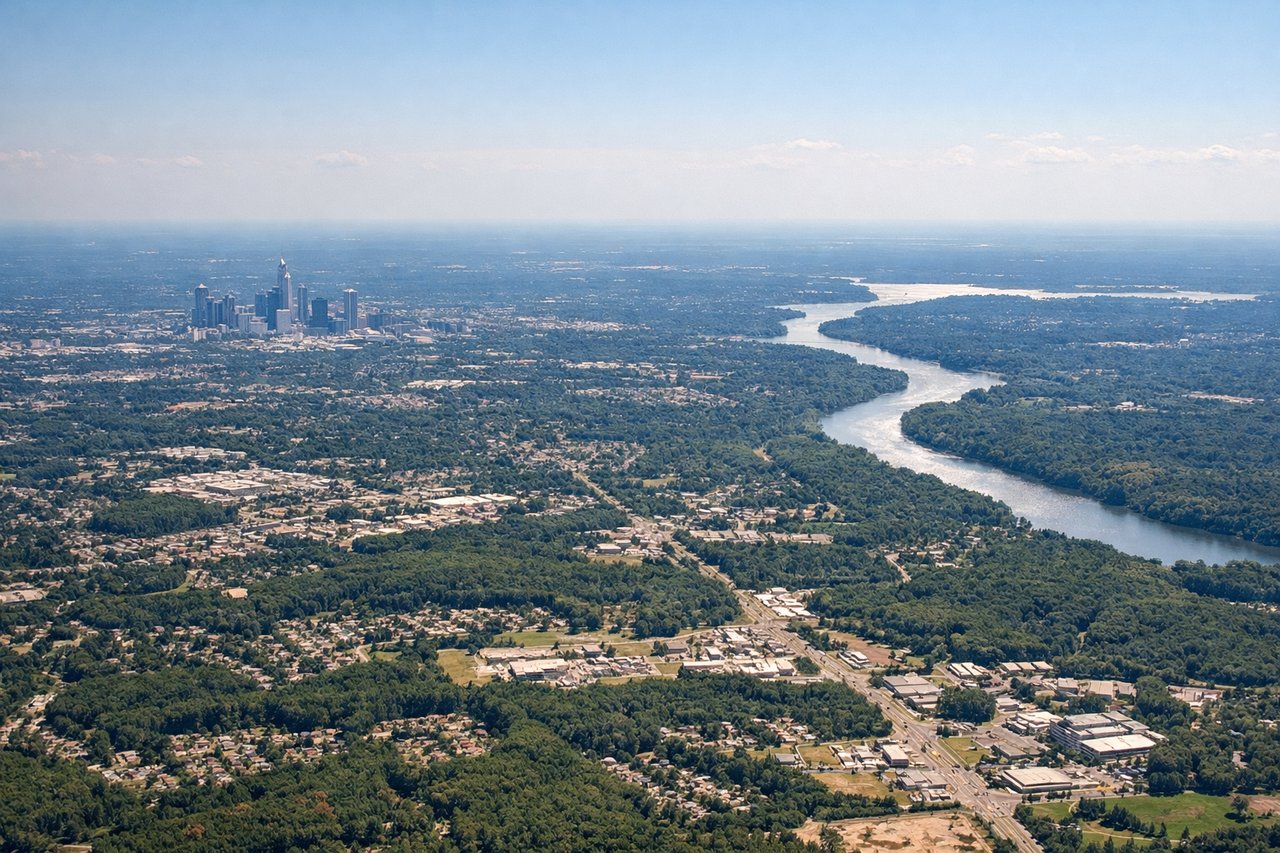
Takeoff from CLT
LEFTDeparting CLT and turning onto the northeasterly heading toward JFK, the left side offers a distant view of the Blue Ridge Mountains and Piedmont foothills to the west, along with a receding glimpse of Charlotte's skyline. The right side mostly shows flat, featureless Piedmont farmland.

Landing at JFK
RIGHTOn approach into JFK, flights are often vectored over Long Island Sound before turning southwest for landing, putting the Manhattan skyline and Jamaica Bay wetlands on the right side of the aircraft. The left side mostly faces open water or the flat Queens/Brooklyn rooftops with less visual interest.
Landmarks on this routeAll landmarks →
Will your flight be in sunlight?
See exactly which side of the plane gets sun and shade at your departure time.
About This Route
Which side of the plane should I sit on flying from Charlotte Douglas International (CLT) to John F Kennedy International (JFK)?
Sit on the Right side of the plane for the best views on flights from Charlotte to New York. While takeoff offers a brief mountain glimpse on the left, the right side's payoff during the JFK approach — Jamaica Bay, the Rockaways, and the Manhattan skyline — makes it the more consistently rewarding side for this route.
What can I see during takeoff from Charlotte Douglas International in Charlotte?
During takeoff from Charlotte Douglas International (CLT), sit on the Left side for the best views. Departing CLT and turning onto the northeasterly heading toward JFK, the left side offers a distant view of the Blue Ridge Mountains and Piedmont foothills to the west, along with a receding glimpse of Charlotte's skyline. The right side mostly shows flat, featureless Piedmont farmland. Notable sights include: Blue Ridge Mountains (distant), South Mountains foothills, Charlotte Uptown skyline, Catawba River valley.
What can I see when landing at John F Kennedy International in New York?
When landing at John F Kennedy International (JFK), sit on the Right side for the best views. On approach into JFK, flights are often vectored over Long Island Sound before turning southwest for landing, putting the Manhattan skyline and Jamaica Bay wetlands on the right side of the aircraft. The left side mostly faces open water or the flat Queens/Brooklyn rooftops with less visual interest. Notable sights include: Manhattan skyline (Empire State Building, One World Trade Center), Jamaica Bay wetlands, Rockaway Peninsula, Long Island coastline.
How long is the flight from Charlotte to New York?
The flight from Charlotte Douglas International (CLT) to John F Kennedy International (JFK) takes 1h 37m.
What does the Charlotte to New York flight path pass over?
The route crosses the Piedmont region of central Virginia near Richmond, then continues over the Chesapeake Bay's northern reaches and the flatlands of the Delmarva Peninsula before approaching the New York coastline.