The right side offers a stronger overall experience: a glimpse of Tulsa on departure, dramatic high-desert and mountain terrain near Albuquerque and Flagstaff during cruise, and the unmistakable Las Vegas Strip on final approach.
Flown TUL to LAS? Did we get it right?
Flight Path
Tulsa to Las Vegas is 1,073 miles (1,727 km), a flight of about 2 hours 45 minutes.
Texas Panhandle plains, Sangre de Cristo foothills near Santa Fe, and the high desert mesas around Flagstaff and the San Francisco Peaks
Great circle distance and headings ›


Phase by phase
Takeoff from TUL
RIGHTDeparting south from TUL on runway 18L, the aircraft banks west toward Las Vegas, giving right-side passengers a brief view of downtown Tulsa and the Arkansas River before leveling onto the westbound track. The left side mostly shows flat farmland with little to distinguish it.
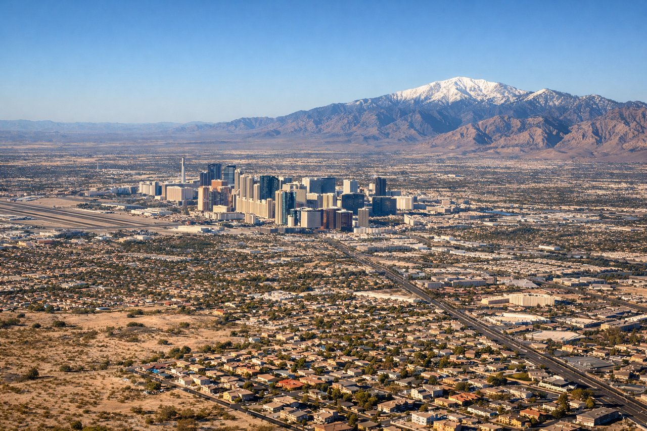
Landing at LAS
RIGHTOn approach to LAS runway 26L/26R, the flight path descends from the east and passengers on the right (north-facing) side get a clear view of the Las Vegas Strip's towers before landing, along with the reddish cliffs of Red Rock Canyon further west. The left side mostly faces empty desert and Henderson suburbs.
Will your flight be in sunlight?
Pick a date and time in the Sun Map to watch the sun move across your whole flight.
About This Route
Which side of the plane should I sit on flying from Tulsa International (TUL) to Mc Carran International (LAS)?
Sit on the Right side of the plane for the best views on flights from Tulsa to Las Vegas. The right side offers a stronger overall experience: a glimpse of Tulsa on departure, dramatic high-desert and mountain terrain near Albuquerque and Flagstaff during cruise, and the unmistakable Las Vegas Strip on final approach.
What can I see during takeoff from Tulsa International in Tulsa?
During takeoff from Tulsa International (TUL), sit on the Right side for the best views. Departing south from TUL on runway 18L, the aircraft banks west toward Las Vegas, giving right-side passengers a brief view of downtown Tulsa and the Arkansas River before leveling onto the westbound track. The left side mostly shows flat farmland with little to distinguish it. Notable sights include: Downtown Tulsa skyline, Arkansas River, Osage Hills in the distance.
What can I see when landing at Mc Carran International in Las Vegas?
When landing at Mc Carran International (LAS), sit on the Right side for the best views. On approach to LAS runway 26L/26R, the flight path descends from the east and passengers on the right (north-facing) side get a clear view of the Las Vegas Strip's towers before landing, along with the reddish cliffs of Red Rock Canyon further west. The left side mostly faces empty desert and Henderson suburbs. Notable sights include: Las Vegas Strip towers, Red Rock Canyon escarpment, Spring Mountains, Lake Mead glimpses.
How long is the flight from Tulsa to Las Vegas?
The flight from Tulsa International (TUL) to Mc Carran International (LAS) takes about 2 hours 45 minutes. The shortest flight path between them is 1,073 miles (1,727 km); winds and air traffic control usually add a few percent.
What does the Tulsa to Las Vegas flight path pass over?
Texas Panhandle plains, Sangre de Cristo foothills near Santa Fe, and the high desert mesas around Flagstaff and the San Francisco Peaks