Chapeco to Atlanta is 4,687 miles (7,543 km), a flight of about 9 hours.
The right side wins at takeoff but the left side delivers the more dramatic payoff — the Atlanta skyline approach is the visual highlight of this route. Over the Amazon basin and Caribbean, both sides are largely ocean and jungle with little to differentiate them, so the landing view tips the balance to left overall.
Flight Path
The flight path crosses the Brazilian Cerrado and Mato Grosso agricultural frontier, then the Amazon basin with its vast river systems including the Tocantins and Araguaia rivers visible as wide brown ribbons through green jungle canopy. Crossing the Caribbean, the islands of the Lesser or Greater Antilles may be visible depending on routing. Over the Gulf of Mexico or Florida peninsula, the shallow turquoise waters of the Bahamas Banks are often strikingly visible before landfall over Florida and the Georgia Piedmont.
Great circle distance and headings ›
.jpeg?width=600)
Phase by phase
Takeoff from XAP
RIGHTChapecó's runway 10/28 means departures heading northeast toward ATL will swing right over the rolling agricultural plateau of western Santa Catarina. The right side gives you a view back over the city grid and the Chapecó River valley cutting through the red-soil farmland below.
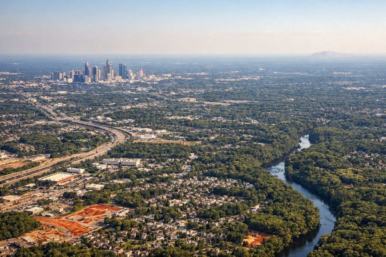
Landing at ATL
LEFTAtlanta's primary arrival corridors from the south bring aircraft in over the Georgia Piedmont. Left-side seats on final approach from the south get a clear view of downtown Atlanta's skyline — the cluster of towers is distinctly visible to the northeast as you descend. Right side faces away from the city toward the suburban sprawl of College Park and East Point.
Landmarks on this routeAll landmarks →
Will your flight be in sunlight?
Pick a date and time in the Sun Map to watch the sun move across your whole flight.
About This Route
Which side of the plane should I sit on flying from Chapeco (XAP) to The William B Hartsfield Atlanta International (ATL)?
Sit on the Left side of the plane for the best views on flights from Chapeco to Atlanta. The right side wins at takeoff but the left side delivers the more dramatic payoff — the Atlanta skyline approach is the visual highlight of this route. Over the Amazon basin and Caribbean, both sides are largely ocean and jungle with little to differentiate them, so the landing view tips the balance to left overall.
What can I see during takeoff from Chapeco in Chapeco?
During takeoff from Chapeco (XAP), sit on the Right side for the best views. Chapecó's runway 10/28 means departures heading northeast toward ATL will swing right over the rolling agricultural plateau of western Santa Catarina. The right side gives you a view back over the city grid and the Chapecó River valley cutting through the red-soil farmland below. Notable sights include: Chapecó River valley, red-soil soy and corn farmland of western Santa Catarina plateau, Chapecó city grid, forested river corridors threading through agricultural land.
What can I see when landing at The William B Hartsfield Atlanta International in Atlanta?
When landing at The William B Hartsfield Atlanta International (ATL), sit on the Left side for the best views. Atlanta's primary arrival corridors from the south bring aircraft in over the Georgia Piedmont. Left-side seats on final approach from the south get a clear view of downtown Atlanta's skyline — the cluster of towers is distinctly visible to the northeast as you descend. Right side faces away from the city toward the suburban sprawl of College Park and East Point. Notable sights include: Downtown Atlanta skyline cluster, Stone Mountain visible to the east as a granite dome rising above the Piedmont, Lake Allatoona to the northwest, Hartsfield-Jackson airport complex itself.
How long is the flight from Chapeco to Atlanta?
The flight from Chapeco (XAP) to The William B Hartsfield Atlanta International (ATL) takes about 9 hours. The shortest flight path between them is 4,687 miles (7,543 km); winds and air traffic control usually add a few percent.
What does the Chapeco to Atlanta flight path pass over?
The flight path crosses the Brazilian Cerrado and Mato Grosso agricultural frontier, then the Amazon basin with its vast river systems including the Tocantins and Araguaia rivers visible as wide brown ribbons through green jungle canopy. Crossing the Caribbean, the islands of the Lesser or Greater Antilles may be visible depending on routing. Over the Gulf of Mexico or Florida peninsula, the shallow turquoise waters of the Bahamas Banks are often strikingly visible before landfall over Florida and the Georgia Piedmont.