Chapeco to Denver is 5,710 miles (9,189 km), a flight of about 11 hours.
Left side wins both ends of the flight. During the long overwater and overland cruise northward through South America and Central America, the left side also tracks closer to the Pacific coast mountain ranges of Colombia and Central America, offering occasional glimpses of the Andes and Sierra Madre. The Front Range arrival view on the left at Denver is one of the most spectacular mountain panoramas available on any US domestic or international approach.
Flight Path
After departing southern Brazil, the route crosses the Brazilian Cerrado and Amazon basin (vast green canopy visible from altitude), then the Colombian Andes and Llanos, the Caribbean coast, Central American isthmus with Pacific and Caribbean coastlines occasionally visible, Gulf of Mexico, and finally the Texas and New Mexico high plains before reaching Colorado
Great circle distance and headings ›

.jpg?width=600)
Phase by phase
Takeoff from XAP
LEFTChapecó's runway typically orients departures toward the northwest. A left-side seat gives views over the rolling agricultural plateau of western Santa Catarina and the Rio Uruguai valley cutting through the landscape below. The patchwork of soy and corn fields across the Planalto Gaúcho is distinctive from low altitude.
Landing at DEN
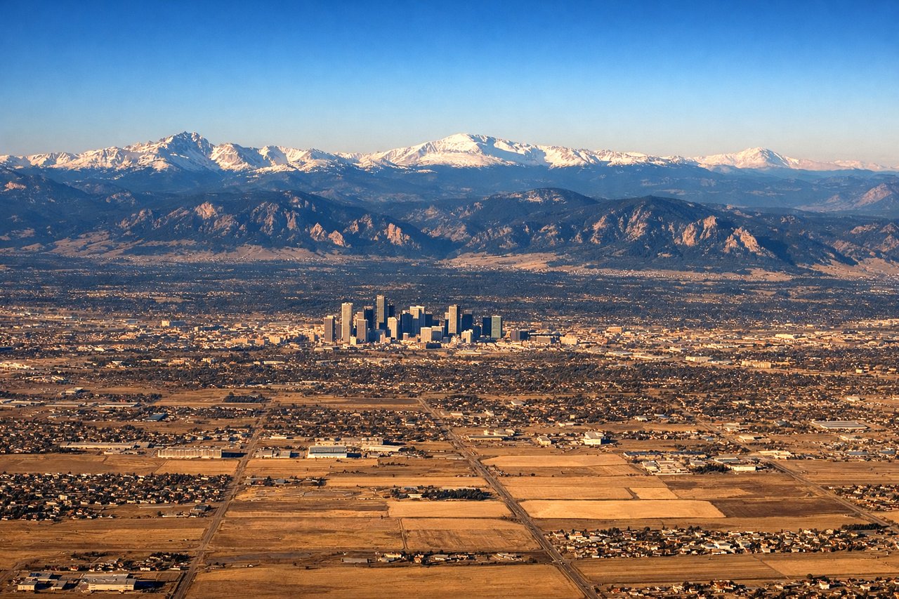
LEFTDenver International sits east of the Rockies, and aircraft typically approach from the east or southeast on runway 16/17 headings. A left-side seat on approach gives a direct broadside view of the entire Front Range — from Pikes Peak in the south to Longs Peak in the north — spread across the western horizon as you descend over the plains. The right side faces flat eastern Colorado with little of visual interest.
Landmarks on this routeAll landmarks →
Will your flight be in sunlight?
Pick a date and time in the Sun Map to watch the sun move across your whole flight.
About This Route
Which side of the plane should I sit on flying from Chapeco (XAP) to Denver International (DEN)?
Sit on the Left side of the plane for the best views on flights from Chapeco to Denver. Left side wins both ends of the flight. During the long overwater and overland cruise northward through South America and Central America, the left side also tracks closer to the Pacific coast mountain ranges of Colombia and Central America, offering occasional glimpses of the Andes and Sierra Madre. The Front Range arrival view on the left at Denver is one of the most spectacular mountain panoramas available on any US domestic or international approach.
What can I see during takeoff from Chapeco in Chapeco?
During takeoff from Chapeco (XAP), sit on the Left side for the best views. Chapecó's runway typically orients departures toward the northwest. A left-side seat gives views over the rolling agricultural plateau of western Santa Catarina and the Rio Uruguai valley cutting through the landscape below. The patchwork of soy and corn fields across the Planalto Gaúcho is distinctive from low altitude. Notable sights include: Rio Uruguai valley, western Santa Catarina agricultural plateau, Chapecó urban grid, rolling Planalto hills.
What can I see when landing at Denver International in Denver?
When landing at Denver International (DEN), sit on the Left side for the best views. Denver International sits east of the Rockies, and aircraft typically approach from the east or southeast on runway 16/17 headings. A left-side seat on approach gives a direct broadside view of the entire Front Range — from Pikes Peak in the south to Longs Peak in the north — spread across the western horizon as you descend over the plains. The right side faces flat eastern Colorado with little of visual interest. Notable sights include: Front Range of the Rocky Mountains, Pikes Peak, Longs Peak, Denver city skyline.
How long is the flight from Chapeco to Denver?
The flight from Chapeco (XAP) to Denver International (DEN) takes about 11 hours. The shortest flight path between them is 5,710 miles (9,189 km); winds and air traffic control usually add a few percent.
What does the Chapeco to Denver flight path pass over?
After departing southern Brazil, the route crosses the Brazilian Cerrado and Amazon basin (vast green canopy visible from altitude), then the Colombian Andes and Llanos, the Caribbean coast, Central American isthmus with Pacific and Caribbean coastlines occasionally visible, Gulf of Mexico, and finally the Texas and New Mexico high plains before reaching Colorado