The left side captures the spectacular Toronto skyline and Lake Ontario on departure, and during the long overland cruise offers views of the Amazon basin and Andean foothills on the western horizon. The right side at landing is strong, but the Toronto departure view is the highlight of the route.
Flight Path
The route tracks south over the eastern United States, crosses the Caribbean near Cuba and Hispaniola, passes over Venezuela and Colombia, then traverses the vast Amazon basin with its river tributaries visible as silver threads through dense green canopy, before crossing into the Brazilian cerrado and the flat Pampas of Argentina. The Andes are visible as a distant snow-capped wall to the west during the South American portion of the flight.
Great circle distance and headings ›
.jpeg?width=600)
_(cropped).jpg?width=600)
Phase by phase
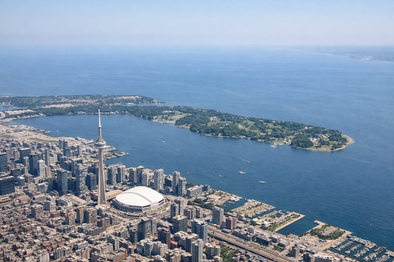
Takeoff from YYZ
LEFTPearson's dominant runway 23 departure takes you southwest, putting the Toronto skyline and Lake Ontario on your left. You get a clear view of downtown Toronto's CN Tower and the waterfront as the aircraft banks south.
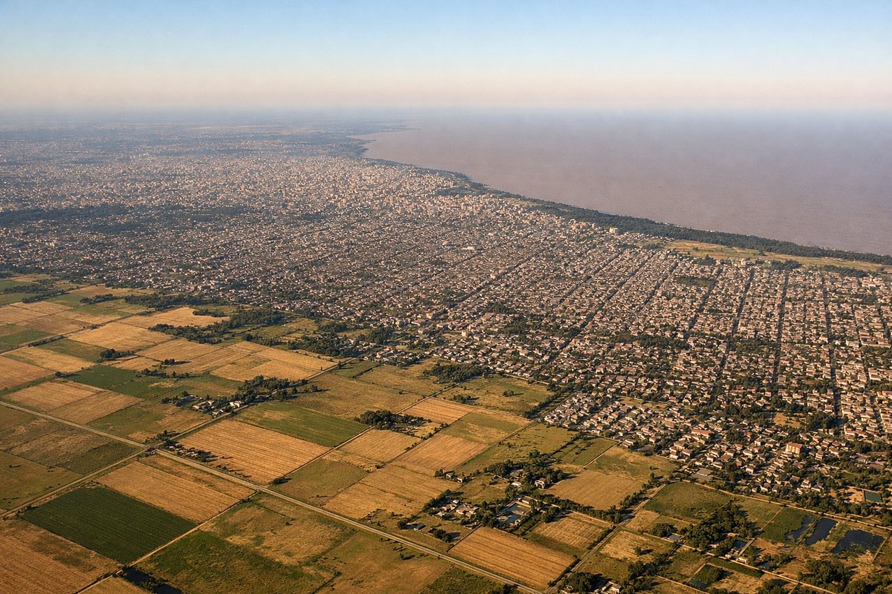
Landing at EZE
RIGHTEzeiza typically uses runway 11 for arrivals from the north, meaning the approach comes from the northwest. The right side gives you the best view of the Rio de la Plata estuary and the Buenos Aires city grid as you descend over the Pampas.
Landmarks on this routeAll landmarks →
Will your flight be in sunlight?
See exactly which side of the plane gets sun and shade at your departure time.
About This Route
Which side of the plane should I sit on flying from Lester B Pearson International (YYZ) to Ezeiza Ministro Pistarini (EZE)?
Sit on the Left side of the plane for the best views on flights from Toronto to Buenos Aires. The left side captures the spectacular Toronto skyline and Lake Ontario on departure, and during the long overland cruise offers views of the Amazon basin and Andean foothills on the western horizon. The right side at landing is strong, but the Toronto departure view is the highlight of the route.
What can I see during takeoff from Lester B Pearson International in Toronto?
During takeoff from Lester B Pearson International (YYZ), sit on the Left side for the best views. Pearson's dominant runway 23 departure takes you southwest, putting the Toronto skyline and Lake Ontario on your left. You get a clear view of downtown Toronto's CN Tower and the waterfront as the aircraft banks south. Notable sights include: CN Tower and downtown Toronto skyline, Lake Ontario shoreline, Toronto Islands, Hamilton Harbour to the west.
What can I see when landing at Ezeiza Ministro Pistarini in Buenos Aires?
When landing at Ezeiza Ministro Pistarini (EZE), sit on the Right side for the best views. Ezeiza typically uses runway 11 for arrivals from the north, meaning the approach comes from the northwest. The right side gives you the best view of the Rio de la Plata estuary and the Buenos Aires city grid as you descend over the Pampas. Notable sights include: Rio de la Plata estuary, Buenos Aires city grid and port district, Pampas grasslands, Riachuelo river winding through the southern suburbs.
How long is the flight from Toronto to Buenos Aires?
The flight from Lester B Pearson International (YYZ) to Ezeiza Ministro Pistarini (EZE) takes Approximately 11 to 12 hours.
What does the Toronto to Buenos Aires flight path pass over?
The route tracks south over the eastern United States, crosses the Caribbean near Cuba and Hispaniola, passes over Venezuela and Colombia, then traverses the vast Amazon basin with its river tributaries visible as silver threads through dense green canopy, before crossing into the Brazilian cerrado and the flat Pampas of Argentina. The Andes are visible as a distant snow-capped wall to the west during the South American portion of the flight.