Left wins at takeoff for the Toronto skyline and Lake Ontario, but right side wins the longer and more spectacular show: over Lake Erie, the southern shore of Lake Michigan near Chicago, the Rockies crossing over Colorado or Utah depending on routing, the Mojave Desert, and the dramatic LAX coastal approach over Santa Monica Bay. Right side carries the flight.
Flight Path
The flight tracks southwest over Lake Erie, then over Indiana and Illinois with Chicago visible to the north, crosses the Mississippi River near St. Louis, continues over the Ozarks and Oklahoma or Kansas depending on routing, crosses the southern Rockies over Colorado or Utah with the Wasatch Range and Colorado Plateau visible, then descends over the Mojave Desert and the San Bernardino Mountains before entering the Los Angeles Basin
Great circle distance and headings ›

.jpg?width=600)
.jpg?width=600)

.jpeg?width=600)

.jpg?width=600)
Phase by phase
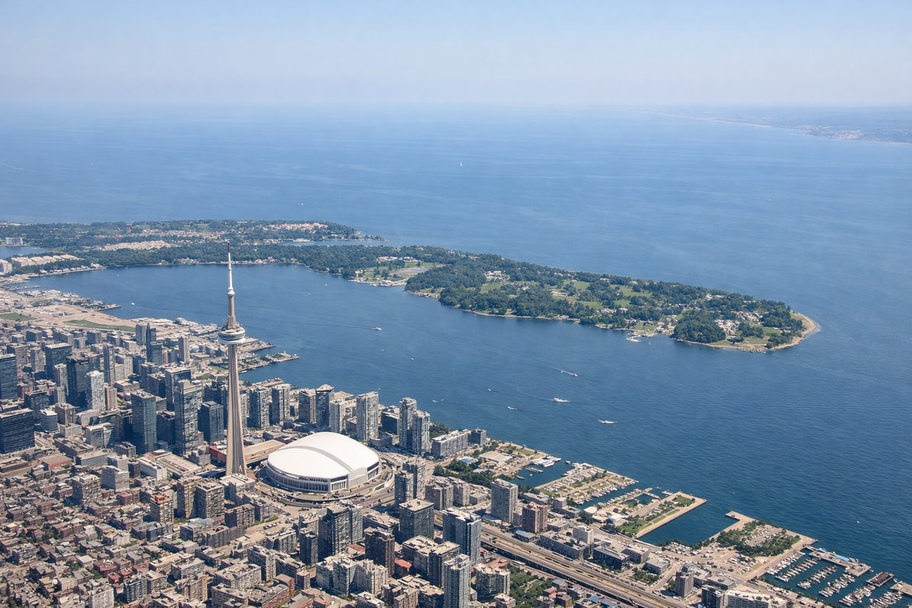
Takeoff from YYZ
LEFTYYZ departures on runway 23 (the most common westbound departure) swing left and south, putting Lake Ontario and the Toronto skyline on the left side. You get a clear view of the CN Tower, downtown core, and the lake stretching east toward Hamilton.

Landing at LAX
RIGHTLAX arrivals on runways 24L/24R approach from the east over the Los Angeles Basin, putting the Santa Monica Mountains, Malibu coastline, and the Pacific Ocean on the right side. The left side faces inland toward the San Gabriel Mountains and the urban sprawl of the basin.
Landmarks on this routeAll landmarks →
Will your flight be in sunlight?
See exactly which side of the plane gets sun and shade at your departure time.
About This Route
Which side of the plane should I sit on flying from Lester B Pearson International (YYZ) to Los Angeles International (LAX)?
Sit on the Right side of the plane for the best views on flights from Toronto to Los Angeles. Left wins at takeoff for the Toronto skyline and Lake Ontario, but right side wins the longer and more spectacular show: over Lake Erie, the southern shore of Lake Michigan near Chicago, the Rockies crossing over Colorado or Utah depending on routing, the Mojave Desert, and the dramatic LAX coastal approach over Santa Monica Bay. Right side carries the flight.
What can I see during takeoff from Lester B Pearson International in Toronto?
During takeoff from Lester B Pearson International (YYZ), sit on the Left side for the best views. YYZ departures on runway 23 (the most common westbound departure) swing left and south, putting Lake Ontario and the Toronto skyline on the left side. You get a clear view of the CN Tower, downtown core, and the lake stretching east toward Hamilton. Notable sights include: CN Tower and downtown Toronto skyline, Lake Ontario shoreline, Hamilton Harbour to the southwest, Niagara Escarpment ridge visible to the south.
What can I see when landing at Los Angeles International in Los Angeles?
When landing at Los Angeles International (LAX), sit on the Right side for the best views. LAX arrivals on runways 24L/24R approach from the east over the Los Angeles Basin, putting the Santa Monica Mountains, Malibu coastline, and the Pacific Ocean on the right side. The left side faces inland toward the San Gabriel Mountains and the urban sprawl of the basin. Notable sights include: Santa Monica Mountains and Malibu coastline, Pacific Ocean and Santa Monica Bay, Venice Beach and Marina del Rey, San Gabriel Mountains visible to the northeast on the left.
How long is the flight from Toronto to Los Angeles?
The flight from Lester B Pearson International (YYZ) to Los Angeles International (LAX) takes Approximately 4 hours 30 minutes to 5 hours.
What does the Toronto to Los Angeles flight path pass over?
The flight tracks southwest over Lake Erie, then over Indiana and Illinois with Chicago visible to the north, crosses the Mississippi River near St. Louis, continues over the Ozarks and Oklahoma or Kansas depending on routing, crosses the southern Rockies over Colorado or Utah with the Wasatch Range and Colorado Plateau visible, then descends over the Mojave Desert and the San Bernardino Mountains before entering the Los Angeles Basin