The left side wins at takeoff for the Toronto skyline and Lake Ontario, but the right side delivers the more dramatic and sustained scenery — the Mojave Desert transition, and the spectacular San Jacinto escarpment on approach into Palm Springs is one of the most dramatic mountain arrivals in North America.
Flown YYZ to PSP? Did we get it right?
Flight Path
Toronto to Palm Springs is 2,080 miles (3,348 km), a flight of about 5 hours 15 minutes.
The flight tracks southwest over Lake Erie, southern Michigan, and northern Indiana before crossing Illinois and Missouri. Over Kansas and Oklahoma the terrain is flat Great Plains. The flight then crosses the Texas Panhandle and New Mexico, where the Sangre de Cristo and Sacramento Mountains are visible. The Mojave Desert begins over Arizona and southeastern California, with the Colorado River crossing visible before the descent into the Coachella Valley.
Great circle distance and headings ›


Phase by phase
Takeoff from YYZ
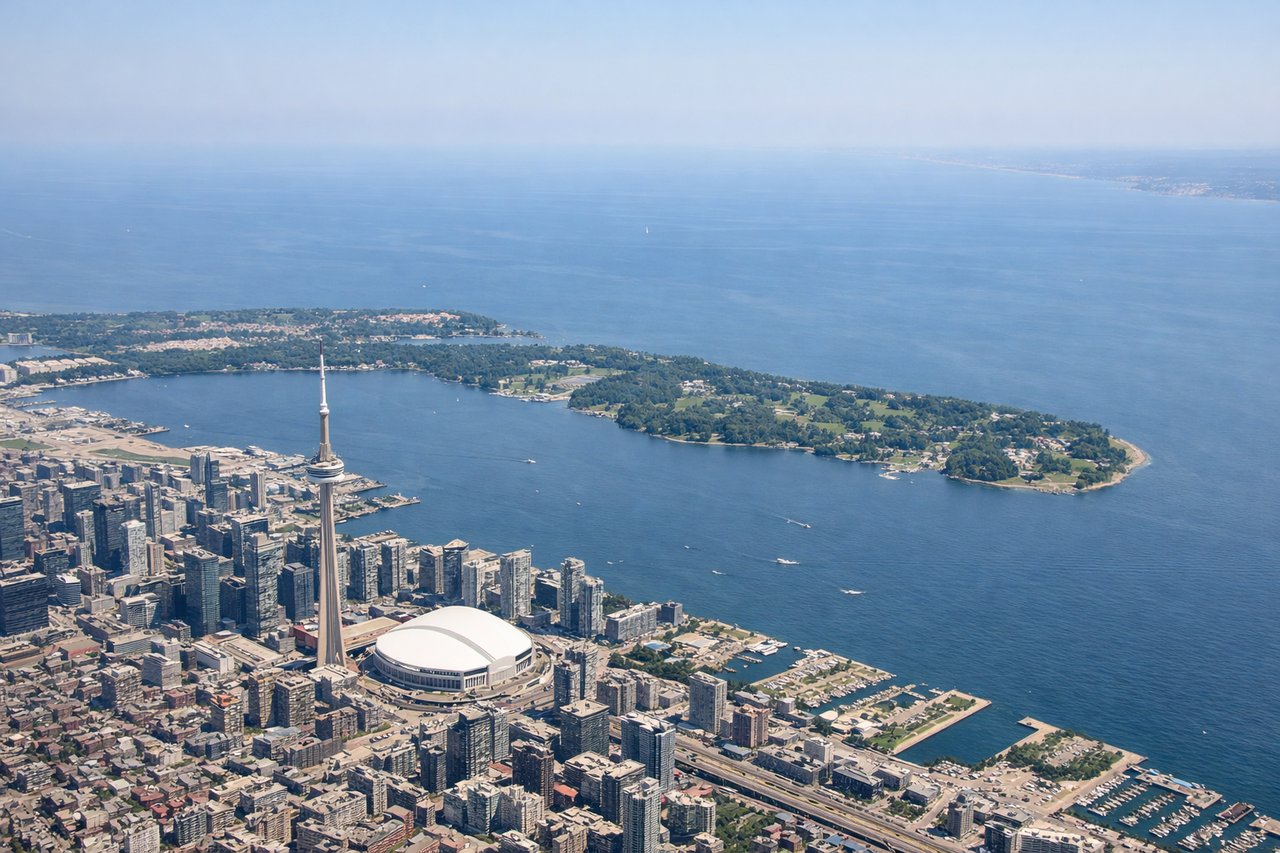
LEFTYYZ departures on runway 23 or 24L/24R head southwest, putting Lake Ontario and the Toronto skyline on the left side. You get a clear view of the CN Tower, downtown core, and the lake stretching east toward Hamilton.
Landing at PSP
RIGHTPSP sits in the Coachella Valley with the San Jacinto Mountains immediately to the southwest. Runway 31 approaches from the southeast, putting the dramatic face of San Jacinto Peak and the Palm Springs Aerial Tramway cliffs on the right side as you descend. The Salton Sea is also visible to the right further back in the approach.
Will your flight be in sunlight?
Pick a date and time in the Sun Map to watch the sun move across your whole flight.
About This Route
Which side of the plane should I sit on flying from Lester B Pearson International (YYZ) to Palm Springs International (PSP)?
Sit on the Right side of the plane for the best views on flights from Toronto to Palm Springs. The left side wins at takeoff for the Toronto skyline and Lake Ontario, but the right side delivers the more dramatic and sustained scenery — the Mojave Desert transition, and the spectacular San Jacinto escarpment on approach into Palm Springs is one of the most dramatic mountain arrivals in North America.
What can I see during takeoff from Lester B Pearson International in Toronto?
During takeoff from Lester B Pearson International (YYZ), sit on the Left side for the best views. YYZ departures on runway 23 or 24L/24R head southwest, putting Lake Ontario and the Toronto skyline on the left side. You get a clear view of the CN Tower, downtown core, and the lake stretching east toward Hamilton. Notable sights include: CN Tower and downtown Toronto skyline, Lake Ontario shoreline, Hamilton Harbour to the west, Pearson airport sprawl receding behind.
What can I see when landing at Palm Springs International in Palm Springs?
When landing at Palm Springs International (PSP), sit on the Right side for the best views. PSP sits in the Coachella Valley with the San Jacinto Mountains immediately to the southwest. Runway 31 approaches from the southeast, putting the dramatic face of San Jacinto Peak and the Palm Springs Aerial Tramway cliffs on the right side as you descend. The Salton Sea is also visible to the right further back in the approach. Notable sights include: San Jacinto Peak and the Santa Rosa Mountains escarpment, Salton Sea to the southeast, Coachella Valley date palm agriculture, Palm Springs urban grid.
How long is the flight from Toronto to Palm Springs?
The flight from Lester B Pearson International (YYZ) to Palm Springs International (PSP) takes about 5 hours 15 minutes. The shortest flight path between them is 2,080 miles (3,348 km); winds and air traffic control usually add a few percent.
What does the Toronto to Palm Springs flight path pass over?
The flight tracks southwest over Lake Erie, southern Michigan, and northern Indiana before crossing Illinois and Missouri. Over Kansas and Oklahoma the terrain is flat Great Plains. The flight then crosses the Texas Panhandle and New Mexico, where the Sangre de Cristo and Sacramento Mountains are visible. The Mojave Desert begins over Arizona and southeastern California, with the Colorado River crossing visible before the descent into the Coachella Valley.