Toronto to Fredericton is 659 miles (1,061 km), a flight of about 2 hours.
While takeoff offers Lake Ontario views on the right, the landing approach provides more dramatic and sustained scenic value with the Saint John River's distinctive meanders and forested landscape. The river valley is the most visually striking feature of this short route.
Flight Path
The flight path crosses the Kawartha Lakes region (Ontario), then transitions over the Canadian Shield landscape of eastern Ontario and western Quebec. The terrain gradually becomes more forested and less urbanized. No major mountain ranges are visible, but the landscape transitions from the Greater Toronto Area's urban sprawl to the boreal and mixed forest zones of central and eastern Canada. The Saint Lawrence River valley lies to the north of the flight path but is not typically visible from cruising altitude on this route.
Great circle distance and headings ›
.jpeg?width=600)
Phase by phase
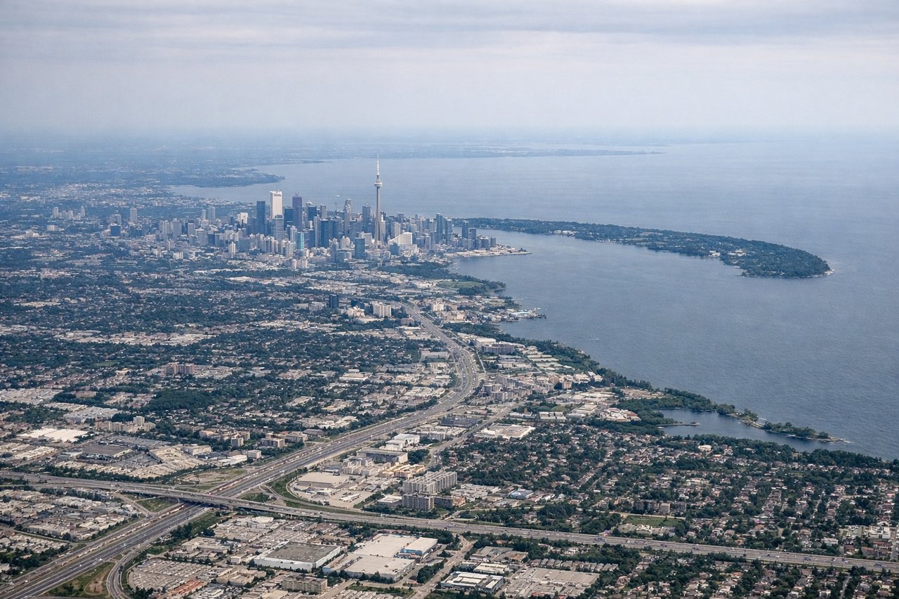
Takeoff from YYZ
RIGHTRight-side seats offer views of Lake Ontario immediately after departure. The aircraft climbs eastward over the lake before turning northeast toward Fredericton, giving right-side passengers an extended view of the shoreline and water.
Landing at YFC
LEFTLeft-side seats provide views of the Saint John River valley and surrounding terrain during the descent into Fredericton. The approach typically comes from the southwest, and left-side passengers see the river's distinctive meanders and the forested landscape of central New Brunswick.
Landmarks on this routeAll landmarks →
Will your flight be in sunlight?
Pick a date and time in the Sun Map to watch the sun move across your whole flight.
About This Route
Which side of the plane should I sit on flying from Lester B Pearson International (YYZ) to Fredericton (YFC)?
Sit on the Left side of the plane for the best views on flights from Toronto to Fredericton. While takeoff offers Lake Ontario views on the right, the landing approach provides more dramatic and sustained scenic value with the Saint John River's distinctive meanders and forested landscape. The river valley is the most visually striking feature of this short route.
What can I see during takeoff from Lester B Pearson International in Toronto?
During takeoff from Lester B Pearson International (YYZ), sit on the Right side for the best views. Right-side seats offer views of Lake Ontario immediately after departure. The aircraft climbs eastward over the lake before turning northeast toward Fredericton, giving right-side passengers an extended view of the shoreline and water. Notable sights include: Lake Ontario (southern shore), Toronto waterfront and harbor, Scarborough Bluffs (eastern lakeshore), Greater Toronto Area urban sprawl.
What can I see when landing at Fredericton in Fredericton?
When landing at Fredericton (YFC), sit on the Left side for the best views. Left-side seats provide views of the Saint John River valley and surrounding terrain during the descent into Fredericton. The approach typically comes from the southwest, and left-side passengers see the river's distinctive meanders and the forested landscape of central New Brunswick. Notable sights include: Saint John River (main valley feature), Fredericton city area, forested uplands of central New Brunswick, river oxbow bends.
How long is the flight from Toronto to Fredericton?
The flight from Lester B Pearson International (YYZ) to Fredericton (YFC) takes about 2 hours. The shortest flight path between them is 659 miles (1,061 km); winds and air traffic control usually add a few percent.
What does the Toronto to Fredericton flight path pass over?
The flight path crosses the Kawartha Lakes region (Ontario), then transitions over the Canadian Shield landscape of eastern Ontario and western Quebec. The terrain gradually becomes more forested and less urbanized. No major mountain ranges are visible, but the landscape transitions from the Greater Toronto Area's urban sprawl to the boreal and mixed forest zones of central and eastern Canada. The Saint Lawrence River valley lies to the north of the flight path but is not typically visible from cruising altitude on this route.