Toronto to Saskatoon is 1,373 miles (2,210 km), a flight of about 2 hours 55 minutes.
The left side edges ahead thanks to the more visually rich Toronto departure with its skyline and lakefront, while the rest of the flight over the Canadian Shield and prairies offers limited scenery on either side.
Flight Path
Canadian Shield lake country of northern Ontario, followed by the flat agricultural plains of Manitoba and Saskatchewan
Great circle distance and headings ›Phase by phase
Takeoff from YYZ
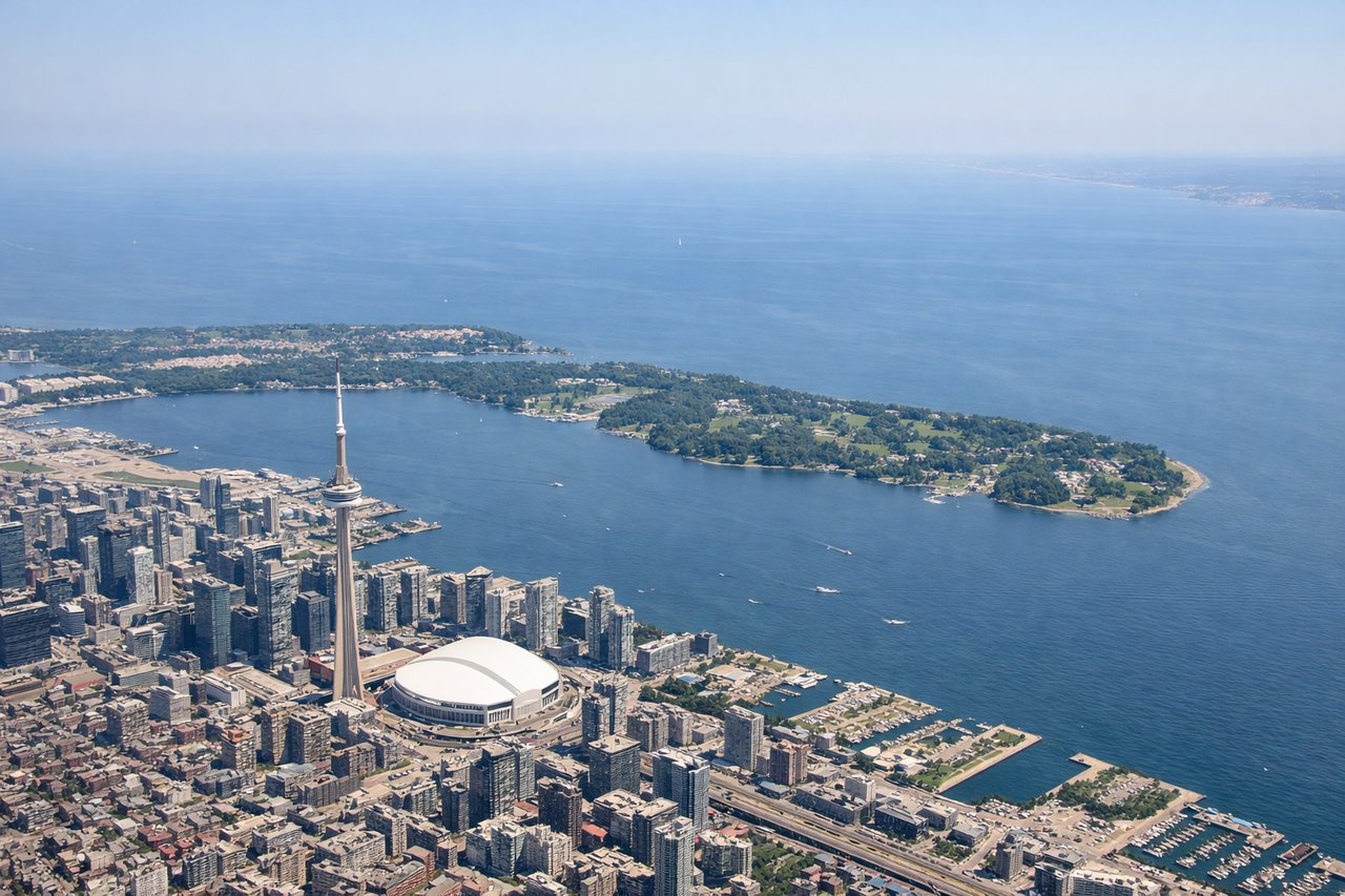
LEFTDeparting YYZ to the west, the initial climb and turn typically bank over Lake Ontario's north shore, giving passengers on the left a last look at the Toronto skyline, the CN Tower, and the lake's shoreline before the aircraft turns onto its westward heading.
Landing at YXE
RIGHTOn approach into YXE from the east on runway 09, the final turn and descent put the South Saskatchewan River and its distinctive bends through the city on the right side, offering the only real visual landmark in an otherwise flat prairie landscape.
Landmarks on this routeAll landmarks →
Will your flight be in sunlight?
Pick a date and time in the Sun Map to watch the sun move across your whole flight.
About This Route
Which side of the plane should I sit on flying from Lester B Pearson International (YYZ) to Saskatoon J G Diefenbaker International (YXE)?
Sit on the Left side of the plane for the best views on flights from Toronto to Saskatoon. The left side edges ahead thanks to the more visually rich Toronto departure with its skyline and lakefront, while the rest of the flight over the Canadian Shield and prairies offers limited scenery on either side.
What can I see during takeoff from Lester B Pearson International in Toronto?
During takeoff from Lester B Pearson International (YYZ), sit on the Left side for the best views. Departing YYZ to the west, the initial climb and turn typically bank over Lake Ontario's north shore, giving passengers on the left a last look at the Toronto skyline, the CN Tower, and the lake's shoreline before the aircraft turns onto its westward heading. Notable sights include: Toronto skyline and CN Tower, Lake Ontario shoreline, Toronto Islands, Port Lands waterfront.
What can I see when landing at Saskatoon J G Diefenbaker International in Saskatoon?
When landing at Saskatoon J G Diefenbaker International (YXE), sit on the Right side for the best views. On approach into YXE from the east on runway 09, the final turn and descent put the South Saskatchewan River and its distinctive bends through the city on the right side, offering the only real visual landmark in an otherwise flat prairie landscape. Notable sights include: South Saskatchewan River bends, University of Saskatchewan campus, Saskatoon bridges, flat prairie farmland grid.
How long is the flight from Toronto to Saskatoon?
The flight from Lester B Pearson International (YYZ) to Saskatoon J G Diefenbaker International (YXE) takes about 2 hours 55 minutes. The shortest flight path between them is 1,373 miles (2,210 km); winds and air traffic control usually add a few percent.
What does the Toronto to Saskatoon flight path pass over?
Canadian Shield lake country of northern Ontario, followed by the flat agricultural plains of Manitoba and Saskatchewan