Toronto to St. John's is 1,319 miles (2,123 km), a flight of about 2 hours 50 minutes.
While the right side wins a nice urban view at takeoff, the left side carries the more consistently interesting scenery through cruise over Quebec's Eastern Townships and the Gulf of St. Lawrence, then delivers a dramatic, close-up coastal view of Signal Hill and the Narrows on final approach into St. John's.
Flight Path
Quebec's Eastern Townships hills, the Gulf of St. Lawrence, Cape Breton Highlands visible to the north, and the boreal lake-studded interior of Newfoundland
Great circle distance and headings ›
.jpeg?width=600)
Phase by phase
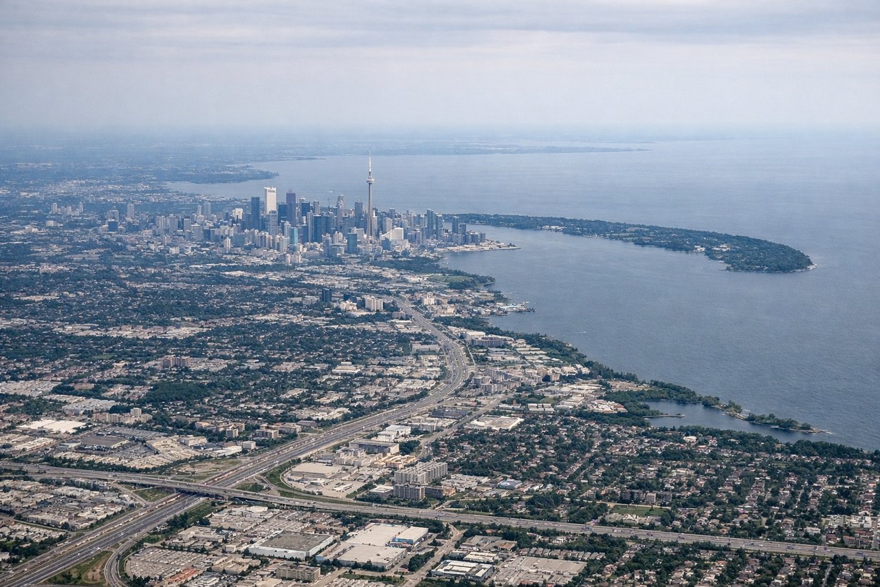
Takeoff from YYZ
RIGHTEastbound departures off Pearson's 05/06 runways bank the aircraft southeast, putting downtown Toronto's skyline, the CN Tower, and Lake Ontario's shoreline squarely on the right side during initial climb.
Landing at YYT
LEFTOn final approach into St. John's, the flight path skirts the Avalon Peninsula's coast before touchdown, giving the left side a clear view of Signal Hill, the Narrows harbour entrance, and the rugged Atlantic cliffs near Cape Spear.
Landmarks on this routeAll landmarks →
Will your flight be in sunlight?
Pick a date and time in the Sun Map to watch the sun move across your whole flight.
About This Route
Which side of the plane should I sit on flying from Lester B Pearson International (YYZ) to St Johns International (YYT)?
Sit on the Left side of the plane for the best views on flights from Toronto to St. John's. While the right side wins a nice urban view at takeoff, the left side carries the more consistently interesting scenery through cruise over Quebec's Eastern Townships and the Gulf of St. Lawrence, then delivers a dramatic, close-up coastal view of Signal Hill and the Narrows on final approach into St. John's.
What can I see during takeoff from Lester B Pearson International in Toronto?
During takeoff from Lester B Pearson International (YYZ), sit on the Right side for the best views. Eastbound departures off Pearson's 05/06 runways bank the aircraft southeast, putting downtown Toronto's skyline, the CN Tower, and Lake Ontario's shoreline squarely on the right side during initial climb. Notable sights include: CN Tower and downtown Toronto skyline, Lake Ontario shoreline, Toronto Islands, Port Lands waterfront.
What can I see when landing at St Johns International in St. John's?
When landing at St Johns International (YYT), sit on the Left side for the best views. On final approach into St. John's, the flight path skirts the Avalon Peninsula's coast before touchdown, giving the left side a clear view of Signal Hill, the Narrows harbour entrance, and the rugged Atlantic cliffs near Cape Spear. Notable sights include: Signal Hill and Cabot Tower, the Narrows (St. John's Harbour entrance), Cape Spear cliffs, Atlantic Ocean coastline.
How long is the flight from Toronto to St. John's?
The flight from Lester B Pearson International (YYZ) to St Johns International (YYT) takes about 2 hours 50 minutes. The shortest flight path between them is 1,319 miles (2,123 km); winds and air traffic control usually add a few percent.
What does the Toronto to St. John's flight path pass over?
Quebec's Eastern Townships hills, the Gulf of St. Lawrence, Cape Breton Highlands visible to the north, and the boreal lake-studded interior of Newfoundland