Zamboanga to Manila is 529 miles (851 km), a flight of about 1 hour 15 minutes.
While takeoff on the right offers coastal scenery, the landing approach on the left provides more dramatic and varied views—Laguna de Bay is a substantial geographic feature, and the contrast between the lake and Metro Manila's dense urban landscape is visually striking. The left side also captures the approach path more directly.
Flight Path
The flight path crosses the Visayan Sea northward from Mindanao. Mid-flight, you'll pass over or near the Panay Strait and potentially see Panay Island's northern coast and the Sibuyan Sea. The route generally follows a northwest trajectory, with the Visayan islands (Panay, Romblon, Marinduque) visible as dark landmasses in the blue water during the middle portion of the flight. The transition from Mindanao's tropical landscape to the central Philippine islands is gradual but noticeable—the terrain becomes more fragmented and island-based as you move north.
Great circle distance and headings ›Phase by phase
Takeoff from ZAM
RIGHTRight-side seats capture the Zamboanga Peninsula's dramatic coastline as you climb northward. You'll see the Basilan Strait and the transition from Mindanao's western coast into open water, with the Sulu Archipelago visible to the southwest.
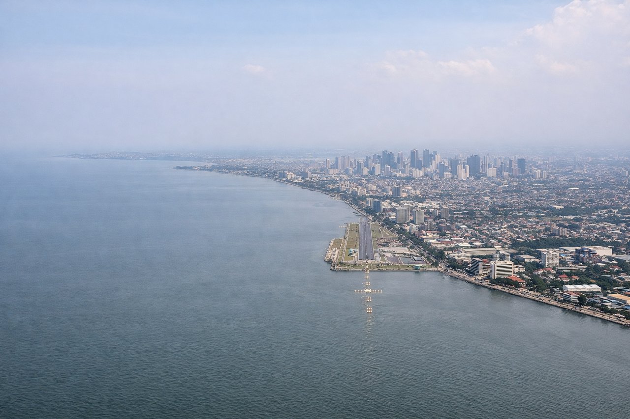
Landing at MNL
LEFTLeft-side seats offer the best views during descent into Manila. You'll see Laguna de Bay (the Philippines' largest freshwater lake) and the sprawling urban landscape of Metro Manila's eastern and central districts as you approach from the south.
Landmarks on this routeAll landmarks →
Will your flight be in sunlight?
Pick a date and time in the Sun Map to watch the sun move across your whole flight.
About This Route
Which side of the plane should I sit on flying from Zamboanga International (ZAM) to Ninoy Aquino International (MNL)?
Sit on the Left side of the plane for the best views on flights from Zamboanga to Manila. While takeoff on the right offers coastal scenery, the landing approach on the left provides more dramatic and varied views—Laguna de Bay is a substantial geographic feature, and the contrast between the lake and Metro Manila's dense urban landscape is visually striking. The left side also captures the approach path more directly.
What can I see during takeoff from Zamboanga International in Zamboanga?
During takeoff from Zamboanga International (ZAM), sit on the Right side for the best views. Right-side seats capture the Zamboanga Peninsula's dramatic coastline as you climb northward. You'll see the Basilan Strait and the transition from Mindanao's western coast into open water, with the Sulu Archipelago visible to the southwest. Notable sights include: Zamboanga Peninsula coastline, Basilan Strait, Sulu Archipelago islands, Mindanao's western shore.
What can I see when landing at Ninoy Aquino International in Manila?
When landing at Ninoy Aquino International (MNL), sit on the Left side for the best views. Left-side seats offer the best views during descent into Manila. You'll see Laguna de Bay (the Philippines' largest freshwater lake) and the sprawling urban landscape of Metro Manila's eastern and central districts as you approach from the south. Notable sights include: Laguna de Bay, Metro Manila urban grid, Sierra Madre mountain range (distant), Pasig River delta.
How long is the flight from Zamboanga to Manila?
The flight from Zamboanga International (ZAM) to Ninoy Aquino International (MNL) takes about 1 hour 15 minutes. The shortest flight path between them is 529 miles (851 km); winds and air traffic control usually add a few percent.
What does the Zamboanga to Manila flight path pass over?
The flight path crosses the Visayan Sea northward from Mindanao. Mid-flight, you'll pass over or near the Panay Strait and potentially see Panay Island's northern coast and the Sibuyan Sea. The route generally follows a northwest trajectory, with the Visayan islands (Panay, Romblon, Marinduque) visible as dark landmasses in the blue water during the middle portion of the flight. The transition from Mindanao's tropical landscape to the central Philippine islands is gradual but noticeable—the terrain becomes more fragmented and island-based as you move north.