Manila to Zamboanga is 529 miles (851 km), a flight of about 1 hour 40 minutes.
The left side strings together the best sequence of the flight: Laguna de Bay and Manila's skyline at takeoff, glimpses of Panay and Negros with Mount Kanlaon's volcanic cone during cruise, and the mountainous Zamboanga Peninsula with Basilan Island on final approach. The right side is dominated by open Sulu Sea water for most of the flight with fewer standout features.
Flight Path
Mindoro island and Mount Halcon, the Sulu Sea, Panay island, and Negros island with the active Mount Kanlaon volcano visible off to the east of the flight path
Great circle distance and headings ›Phase by phase
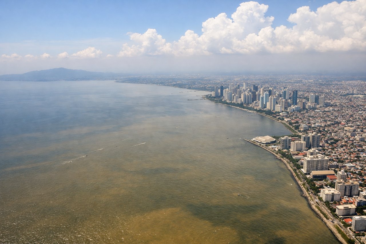
Takeoff from MNL
LEFTClimbing out of NAIA toward the south, left-side windows catch Laguna de Bay's broad shoreline and the Makati/BGC skyline before the volcanic cone of Mount Banahaw appears on the horizon. The right side mostly shows Manila Bay's flat water and the Bataan coastline, which is comparatively featureless.
Landing at ZAM
LEFTOn approach into Zamboanga from the north, the left side faces the mountainous spine of the Zamboanga Peninsula and gives a clear look across the strait to Basilan Island. The right side mostly faces open Sulu Sea water with little to distinguish it until touchdown.
Landmarks on this routeAll landmarks →
Will your flight be in sunlight?
Pick a date and time in the Sun Map to watch the sun move across your whole flight.
About This Route
Which side of the plane should I sit on flying from Ninoy Aquino International (MNL) to Zamboanga International (ZAM)?
Sit on the Left side of the plane for the best views on flights from Manila to Zamboanga. The left side strings together the best sequence of the flight: Laguna de Bay and Manila's skyline at takeoff, glimpses of Panay and Negros with Mount Kanlaon's volcanic cone during cruise, and the mountainous Zamboanga Peninsula with Basilan Island on final approach. The right side is dominated by open Sulu Sea water for most of the flight with fewer standout features.
What can I see during takeoff from Ninoy Aquino International in Manila?
During takeoff from Ninoy Aquino International (MNL), sit on the Left side for the best views. Climbing out of NAIA toward the south, left-side windows catch Laguna de Bay's broad shoreline and the Makati/BGC skyline before the volcanic cone of Mount Banahaw appears on the horizon. The right side mostly shows Manila Bay's flat water and the Bataan coastline, which is comparatively featureless. Notable sights include: Laguna de Bay, Makati/BGC skyline, Mount Banahaw, Taal Volcano (distant).
What can I see when landing at Zamboanga International in Zamboanga?
When landing at Zamboanga International (ZAM), sit on the Left side for the best views. On approach into Zamboanga from the north, the left side faces the mountainous spine of the Zamboanga Peninsula and gives a clear look across the strait to Basilan Island. The right side mostly faces open Sulu Sea water with little to distinguish it until touchdown. Notable sights include: Zamboanga Peninsula mountains, Basilan Island, Moro Gulf coastline, Zamboanga City harbor.
How long is the flight from Manila to Zamboanga?
The flight from Ninoy Aquino International (MNL) to Zamboanga International (ZAM) takes about 1 hour 40 minutes. The shortest flight path between them is 529 miles (851 km); winds and air traffic control usually add a few percent.
What does the Manila to Zamboanga flight path pass over?
Mindoro island and Mount Halcon, the Sulu Sea, Panay island, and Negros island with the active Mount Kanlaon volcano visible off to the east of the flight path