While takeoff offers excellent Manila Bay and volcanic views on the right, the landing approach to Seattle provides the more dramatic and sustained visual experience with Mount Rainier's iconic presence and the Cascade Range dominating the eastern approach. Left-side seats capture this signature Pacific Northwest geography.
Flown MNL to SEA? Did we get it right?
Flight Path
Manila to Seattle is 6,652 miles (10,705 km), a flight of about 11 hours 30 minutes.
The flight crosses the Pacific Ocean northeastward. Notable geographic features along the route include: the Philippine archipelago's northern islands (Luzon Strait visible shortly after takeoff), the vast open Pacific with occasional weather systems, the Aleutian Islands chain (visible from cruising altitude around 10-11 hours into flight, appearing as dark volcanic peaks on the northern horizon if flying the great-circle route), and the North American coastline approaching British Columbia and Washington State. The route typically passes east of Japan and crosses the International Date Line. Cruising altitude provides views of cloud formations and occasional breaks revealing open ocean, but few distinct landmarks for the 6-7 hour mid-ocean portion.
Great circle distance and headings ›


Phase by phase
Takeoff from MNL
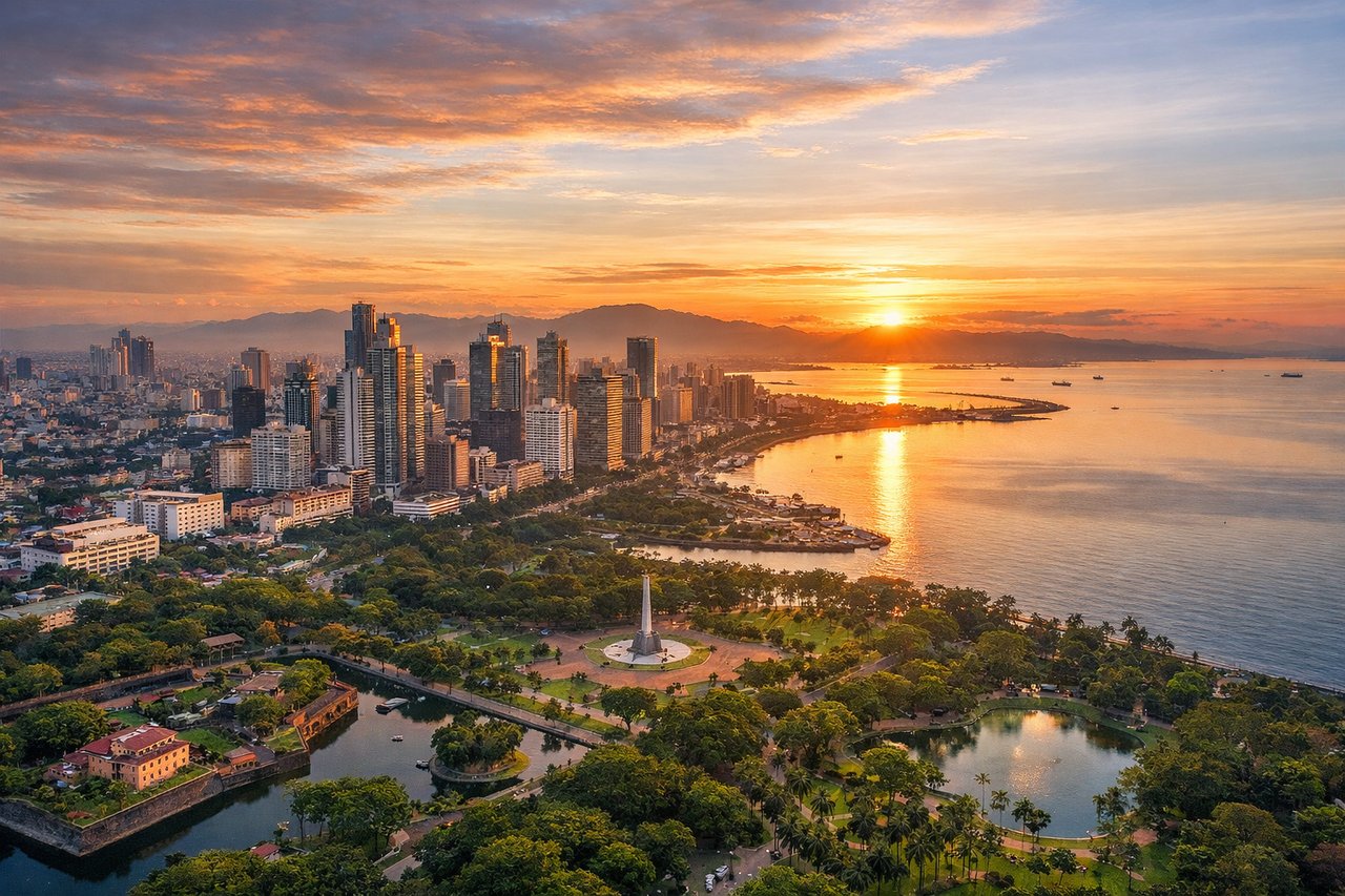
RIGHTMNL typically departs northbound on Runway 24L or 24R. Right-side seats face west toward Manila Bay and the Zambales Mountains, offering immediate views of the bay's western shoreline and volcanic peaks. Left seats face the flat inland plains of Luzon's interior.
Landing at SEA
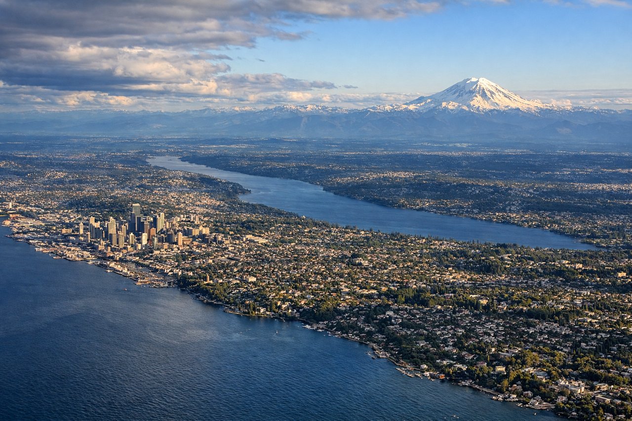
LEFTSEA approaches from the north or northeast, typically landing on Runway 16L or 16R. Left-side seats during descent face east toward the Cascade Range and Mount Rainier, which dominates the eastern skyline. Right seats face Puget Sound and the Olympic Mountains to the west—less dramatic at landing altitude.
Will your flight be in sunlight?
Pick a date and time in the Sun Map to watch the sun move across your whole flight.
About This Route
Which side of the plane should I sit on flying from Ninoy Aquino International (MNL) to Seattle Tacoma International (SEA)?
Sit on the Left side of the plane for the best views on flights from Manila to Seattle. While takeoff offers excellent Manila Bay and volcanic views on the right, the landing approach to Seattle provides the more dramatic and sustained visual experience with Mount Rainier's iconic presence and the Cascade Range dominating the eastern approach. Left-side seats capture this signature Pacific Northwest geography.
What can I see during takeoff from Ninoy Aquino International in Manila?
During takeoff from Ninoy Aquino International (MNL), sit on the Right side for the best views. MNL typically departs northbound on Runway 24L or 24R. Right-side seats face west toward Manila Bay and the Zambales Mountains, offering immediate views of the bay's western shoreline and volcanic peaks. Left seats face the flat inland plains of Luzon's interior. Notable sights include: Manila Bay (immediate view below), Zambales Mountain Range (western horizon), Corregidor Island (small, visible in bay waters), Bataan Peninsula (southern portion of bay).
What can I see when landing at Seattle Tacoma International in Seattle?
When landing at Seattle Tacoma International (SEA), sit on the Left side for the best views. SEA approaches from the north or northeast, typically landing on Runway 16L or 16R. Left-side seats during descent face east toward the Cascade Range and Mount Rainier, which dominates the eastern skyline. Right seats face Puget Sound and the Olympic Mountains to the west—less dramatic at landing altitude. Notable sights include: Mount Rainier (14,411 ft, eastern horizon), Cascade Range (northern and eastern approach), Puget Sound (waters below and left), Lake Washington (visible east of Seattle proper).
How long is the flight from Manila to Seattle?
The flight from Ninoy Aquino International (MNL) to Seattle Tacoma International (SEA) takes about 11 hours 30 minutes. The shortest flight path between them is 6,652 miles (10,705 km); winds and air traffic control usually add a few percent.
What does the Manila to Seattle flight path pass over?
The flight crosses the Pacific Ocean northeastward. Notable geographic features along the route include: the Philippine archipelago's northern islands (Luzon Strait visible shortly after takeoff), the vast open Pacific with occasional weather systems, the Aleutian Islands chain (visible from cruising altitude around 10-11 hours into flight, appearing as dark volcanic peaks on the northern horizon if flying the great-circle route), and the North American coastline approaching British Columbia and Washington State. The route typically passes east of Japan and crosses the International Date Line. Cruising altitude provides views of cloud formations and occasional breaks revealing open ocean, but few distinct landmarks for the 6-7 hour mid-ocean portion.