The left side wins overall because it captures the dramatic Pacific Northwest departure with the Olympic Mountains and Puget Sound, plus likely views of the Alaska Panhandle's glaciated coastline and Aleutian volcanic peaks during the northern great-circle cruise segment, while the right side spends most of the flight over open, featureless Pacific Ocean.
Flown SEA to MNL? Did we get it right?
Flight Path
Seattle to Manila is 6,652 miles (10,705 km), a flight of about 14 hours 45 minutes.
Gulf of Alaska coastline, Aleutian Islands, Kamchatka Peninsula volcanoes, open North Pacific Ocean, Japanese coastline near Honshu before the descent toward Luzon
Great circle distance and headings ›

Phase by phase
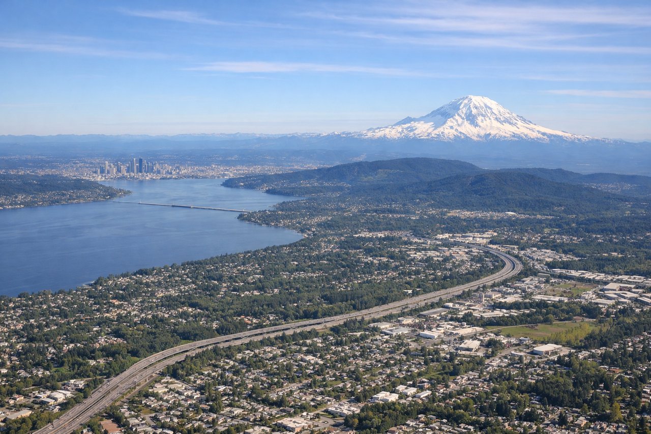
Takeoff from SEA
LEFTDeparting SEA to the north before curving northwest toward the Pacific great circle route, the left (west) side captures the Olympic Mountains, Puget Sound's island-studded waters, and the San Juan Islands receding below. This is a far more dramatic sequence than the flatter eastern foothills view.

Landing at MNL
RIGHTOn approach into MNL from the southwest over Manila Bay, the right side faces east toward the dense high-rise skyline of Metro Manila, including the Pasig River delta and Makati's towers, while the left side mostly sees open bay water.
Will your flight be in sunlight?
Pick a date and time in the Sun Map to watch the sun move across your whole flight.
About This Route
Which side of the plane should I sit on flying from Seattle Tacoma International (SEA) to Ninoy Aquino International (MNL)?
Sit on the Left side of the plane for the best views on flights from Seattle to Manila. The left side wins overall because it captures the dramatic Pacific Northwest departure with the Olympic Mountains and Puget Sound, plus likely views of the Alaska Panhandle's glaciated coastline and Aleutian volcanic peaks during the northern great-circle cruise segment, while the right side spends most of the flight over open, featureless Pacific Ocean.
What can I see during takeoff from Seattle Tacoma International in Seattle?
During takeoff from Seattle Tacoma International (SEA), sit on the Left side for the best views. Departing SEA to the north before curving northwest toward the Pacific great circle route, the left (west) side captures the Olympic Mountains, Puget Sound's island-studded waters, and the San Juan Islands receding below. This is a far more dramatic sequence than the flatter eastern foothills view. Notable sights include: Puget Sound, Olympic Mountains, San Juan Islands, Elliott Bay/downtown Seattle.
What can I see when landing at Ninoy Aquino International in Manila?
When landing at Ninoy Aquino International (MNL), sit on the Right side for the best views. On approach into MNL from the southwest over Manila Bay, the right side faces east toward the dense high-rise skyline of Metro Manila, including the Pasig River delta and Makati's towers, while the left side mostly sees open bay water. Notable sights include: Manila Bay, Metro Manila skyline, Pasig River mouth, Intramuros/Rizal Park area.
How long is the flight from Seattle to Manila?
The flight from Seattle Tacoma International (SEA) to Ninoy Aquino International (MNL) takes about 14 hours 45 minutes. The shortest flight path between them is 6,652 miles (10,705 km); winds and air traffic control usually add a few percent.
What does the Seattle to Manila flight path pass over?
Gulf of Alaska coastline, Aleutian Islands, Kamchatka Peninsula volcanoes, open North Pacific Ocean, Japanese coastline near Honshu before the descent toward Luzon