Zihuatanejo to Mexico City is 201 miles (324 km), a flight of about 1 hour 15 minutes.
While takeoff from ZIH favors the right for coastal views, the landing approach into MEX from the left provides more dramatic and extensive views of Mexico City's geography, the high plateau setting, and surrounding mountain ranges. The landing experience outweighs the brief takeoff advantage.
Flight Path
The flight climbs northeast from the coast over the Sierra Madre del Sur, crossing into the interior plateau. Around midpoint, you'll pass over the state of Guerrero's mountainous interior—the terrain transitions from coastal ranges to the higher Mexican plateau. The Balsas River valley may be visible as a darker linear feature cutting through the mountains. As you approach the Mexico City basin from the west, the terrain rises noticeably into the Trans-Mexican Volcanic Belt, with occasional volcanic peaks visible on clear days. The final descent crosses the high plateau (approximately 7,000 feet elevation) before entering the Mexico City valley.
Great circle distance and headings ›_(cropped).jpg?width=600)


Phase by phase
Takeoff from ZIH
RIGHTZIH typically departs runway 05 (northeast) or 23 (southwest). Right-side seats on a northeast departure offer immediate views of the Pacific coastline and the Zihuatanejo Bay complex as you climb. The terrain rises sharply inland, so the coastal perspective is fleeting and best captured from the right.
Landing at MEX
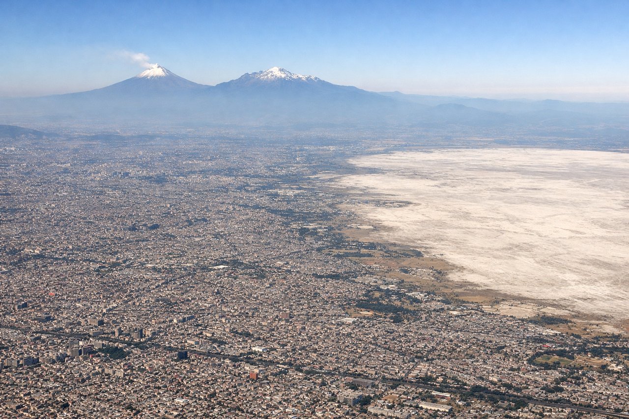
LEFTMEX uses runways 05L/05R and 23L/23R depending on wind. On approach from the west (typical for ZIH arrivals), left-side seats provide superior views of Mexico City's sprawl, the surrounding valley geography, and the approach path over the high plateau. You'll see the city's extent and the valley walls clearly.
Landmarks on this routeAll landmarks →
Will your flight be in sunlight?
Pick a date and time in the Sun Map to watch the sun move across your whole flight.
About This Route
Which side of the plane should I sit on flying from Ixtapa Zihuatanejo International (ZIH) to Licenciado Benito Juarez International (MEX)?
Sit on the Left side of the plane for the best views on flights from Zihuatanejo to Mexico City. While takeoff from ZIH favors the right for coastal views, the landing approach into MEX from the left provides more dramatic and extensive views of Mexico City's geography, the high plateau setting, and surrounding mountain ranges. The landing experience outweighs the brief takeoff advantage.
What can I see during takeoff from Ixtapa Zihuatanejo International in Zihuatanejo?
During takeoff from Ixtapa Zihuatanejo International (ZIH), sit on the Right side for the best views. ZIH typically departs runway 05 (northeast) or 23 (southwest). Right-side seats on a northeast departure offer immediate views of the Pacific coastline and the Zihuatanejo Bay complex as you climb. The terrain rises sharply inland, so the coastal perspective is fleeting and best captured from the right. Notable sights include: Zihuatanejo Bay and town, Pacific Ocean coastline, Sierra Madre del Sur foothills, Playa La Ropa beach.
What can I see when landing at Licenciado Benito Juarez International in Mexico City?
When landing at Licenciado Benito Juarez International (MEX), sit on the Left side for the best views. MEX uses runways 05L/05R and 23L/23R depending on wind. On approach from the west (typical for ZIH arrivals), left-side seats provide superior views of Mexico City's sprawl, the surrounding valley geography, and the approach path over the high plateau. You'll see the city's extent and the valley walls clearly. Notable sights include: Mexico City metropolitan area, Lake Texcoco remnants, Sierra de Guadalupe to the north, Ajusco volcano to the south.
How long is the flight from Zihuatanejo to Mexico City?
The flight from Ixtapa Zihuatanejo International (ZIH) to Licenciado Benito Juarez International (MEX) takes about 1 hour 15 minutes. The shortest flight path between them is 201 miles (324 km); winds and air traffic control usually add a few percent.
What does the Zihuatanejo to Mexico City flight path pass over?
The flight climbs northeast from the coast over the Sierra Madre del Sur, crossing into the interior plateau. Around midpoint, you'll pass over the state of Guerrero's mountainous interior—the terrain transitions from coastal ranges to the higher Mexican plateau. The Balsas River valley may be visible as a darker linear feature cutting through the mountains. As you approach the Mexico City basin from the west, the terrain rises noticeably into the Trans-Mexican Volcanic Belt, with occasional volcanic peaks visible on clear days. The final descent crosses the high plateau (approximately 7,000 feet elevation) before entering the Mexico City valley.