Zihuatanejo to Phoenix is 1,274 miles (2,051 km), a flight of about 3 hours.
While takeoff offers excellent coastal views, the landing approach into Phoenix provides more sustained and dramatic scenery—the transition from pristine Sonoran Desert through the Salt River valley into a major metropolitan area is visually compelling and geographically significant.
Flight Path
The flight path crosses inland over Guerrero state, passing east of the Sierra Madre del Sur range. Passengers may glimpse the Balsas River valley and the high desert plateau of central Mexico. As the aircraft continues northward, the landscape transitions from tropical mountains to increasingly arid terrain. Near the Arizona border, the Sonoran Desert becomes dominant, with occasional mountain ranges visible to the east (Sierra Madre Occidental foothills). The flight typically maintains cruising altitude of 28,000-32,000 feet for most of the journey, making ground features appear small but the overall geography clearly visible on clear days.
Great circle distance and headings ›Phase by phase
Takeoff from ZIH
RIGHTRight-side seats capture the Pacific coastline and the Zihuatanejo Bay immediately after departure. The aircraft climbs northwestward, giving right-side passengers a direct view of the dramatic coastal geography and the Sierra Madre del Sur mountains rising inland.
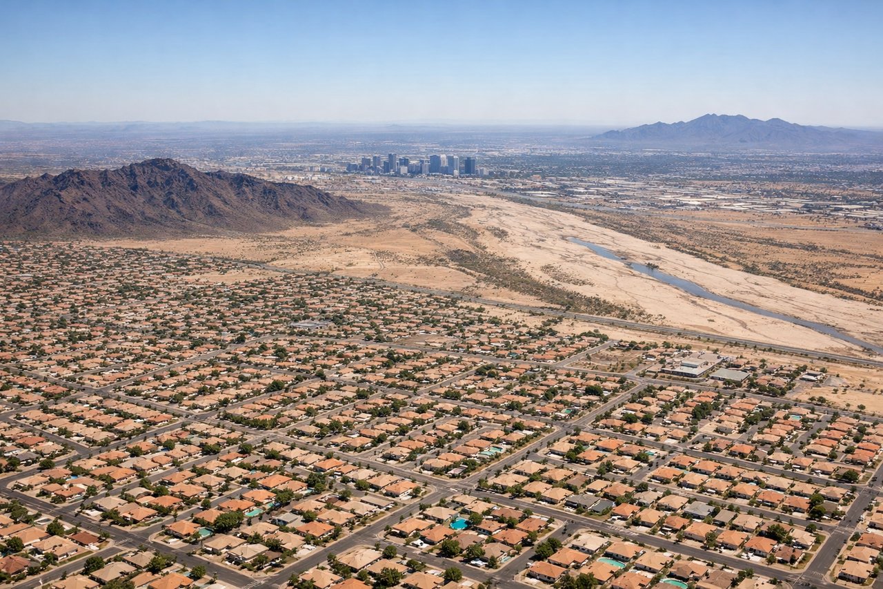
Landing at PHX
LEFTLeft-side seats offer the best views during descent into Phoenix. The aircraft approaches from the southwest, and left-side passengers see the Sonoran Desert landscape, the Salt River valley, and the urban sprawl of the Phoenix metropolitan area as the plane descends toward Sky Harbor.
Will your flight be in sunlight?
Pick a date and time in the Sun Map to watch the sun move across your whole flight.
About This Route
Which side of the plane should I sit on flying from Ixtapa Zihuatanejo International (ZIH) to Phoenix Sky Harbor International (PHX)?
Sit on the Left side of the plane for the best views on flights from Zihuatanejo to Phoenix. While takeoff offers excellent coastal views, the landing approach into Phoenix provides more sustained and dramatic scenery—the transition from pristine Sonoran Desert through the Salt River valley into a major metropolitan area is visually compelling and geographically significant.
What can I see during takeoff from Ixtapa Zihuatanejo International in Zihuatanejo?
During takeoff from Ixtapa Zihuatanejo International (ZIH), sit on the Right side for the best views. Right-side seats capture the Pacific coastline and the Zihuatanejo Bay immediately after departure. The aircraft climbs northwestward, giving right-side passengers a direct view of the dramatic coastal geography and the Sierra Madre del Sur mountains rising inland. Notable sights include: Zihuatanejo Bay (turquoise waters and beach), Pacific Ocean coastline, Sierra Madre del Sur foothills, Ixtapa resort development along the shore.
What can I see when landing at Phoenix Sky Harbor International in Phoenix?
When landing at Phoenix Sky Harbor International (PHX), sit on the Left side for the best views. Left-side seats offer the best views during descent into Phoenix. The aircraft approaches from the southwest, and left-side passengers see the Sonoran Desert landscape, the Salt River valley, and the urban sprawl of the Phoenix metropolitan area as the plane descends toward Sky Harbor. Notable sights include: Sonoran Desert terrain with saguaro cactus patterns, Salt River valley, Phoenix urban grid and downtown skyline, South Mountain Park escarpment.
How long is the flight from Zihuatanejo to Phoenix?
The flight from Ixtapa Zihuatanejo International (ZIH) to Phoenix Sky Harbor International (PHX) takes about 3 hours. The shortest flight path between them is 1,274 miles (2,051 km); winds and air traffic control usually add a few percent.
What does the Zihuatanejo to Phoenix flight path pass over?
The flight path crosses inland over Guerrero state, passing east of the Sierra Madre del Sur range. Passengers may glimpse the Balsas River valley and the high desert plateau of central Mexico. As the aircraft continues northward, the landscape transitions from tropical mountains to increasingly arid terrain. Near the Arizona border, the Sonoran Desert becomes dominant, with occasional mountain ranges visible to the east (Sierra Madre Occidental foothills). The flight typically maintains cruising altitude of 28,000-32,000 feet for most of the journey, making ground features appear small but the overall geography clearly visible on clear days.