Phoenix to Zihuatanejo is 1,274 miles (2,051 km), a flight of about 2 hours 40 minutes.
While left is better at takeoff from PHX, right wins overall because the ZIH landing approach delivers a genuinely spectacular view of the bay and Pacific coast. During the cruise portion heading southeast, the right side also tracks closer to the Gulf of California coastline and the Sierra Madre Occidental as the flight crosses Sonora and Sinaloa.
Flight Path
The flight crosses the Sonoran Desert south of Phoenix, then the Gulf of California coast near Guaymas or Mazatlan depending on routing. The Sierra Madre Occidental runs parallel to the route on the right side through Sinaloa and Nayarit. The flight descends over the coastal tropical lowlands of Guerrero before reaching Zihuatanejo.
Great circle distance and headings ›Phase by phase
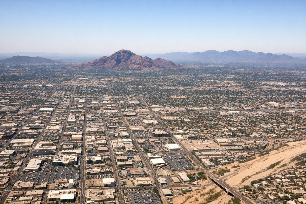
Takeoff from PHX
LEFTPHX primarily uses runways 7/25 and 8/26. On a westbound departure (runway 26), the left side faces south toward South Mountain Park and the Sierra Estrella range. On an eastbound departure (runway 8), the left side looks north over downtown Phoenix and Camelback Mountain. Either way, left gives you the more dramatic terrain.
Landing at ZIH
RIGHTZIH's runway 19 approach comes in from the north heading south, placing the right side toward the Pacific coast, Zihuatanejo Bay, and the distinctive curved shoreline. The bay and the town of Zihuatanejo are clearly visible on the right as the aircraft descends over the coastal hills.
Will your flight be in sunlight?
Pick a date and time in the Sun Map to watch the sun move across your whole flight.
About This Route
Which side of the plane should I sit on flying from Phoenix Sky Harbor International (PHX) to Ixtapa Zihuatanejo International (ZIH)?
Sit on the Right side of the plane for the best views on flights from Phoenix to Zihuatanejo. While left is better at takeoff from PHX, right wins overall because the ZIH landing approach delivers a genuinely spectacular view of the bay and Pacific coast. During the cruise portion heading southeast, the right side also tracks closer to the Gulf of California coastline and the Sierra Madre Occidental as the flight crosses Sonora and Sinaloa.
What can I see during takeoff from Phoenix Sky Harbor International in Phoenix?
During takeoff from Phoenix Sky Harbor International (PHX), sit on the Left side for the best views. PHX primarily uses runways 7/25 and 8/26. On a westbound departure (runway 26), the left side faces south toward South Mountain Park and the Sierra Estrella range. On an eastbound departure (runway 8), the left side looks north over downtown Phoenix and Camelback Mountain. Either way, left gives you the more dramatic terrain. Notable sights include: South Mountain Park and Sierra Estrella range, Camelback Mountain, downtown Phoenix grid, Salt River bed.
What can I see when landing at Ixtapa Zihuatanejo International in Zihuatanejo?
When landing at Ixtapa Zihuatanejo International (ZIH), sit on the Right side for the best views. ZIH's runway 19 approach comes in from the north heading south, placing the right side toward the Pacific coast, Zihuatanejo Bay, and the distinctive curved shoreline. The bay and the town of Zihuatanejo are clearly visible on the right as the aircraft descends over the coastal hills. Notable sights include: Zihuatanejo Bay, Ixtapa resort strip along the coast, Pacific Ocean coastline, coastal Sierra Madre foothills.
How long is the flight from Phoenix to Zihuatanejo?
The flight from Phoenix Sky Harbor International (PHX) to Ixtapa Zihuatanejo International (ZIH) takes about 2 hours 40 minutes. The shortest flight path between them is 1,274 miles (2,051 km); winds and air traffic control usually add a few percent.
What does the Phoenix to Zihuatanejo flight path pass over?
The flight crosses the Sonoran Desert south of Phoenix, then the Gulf of California coast near Guaymas or Mazatlan depending on routing. The Sierra Madre Occidental runs parallel to the route on the right side through Sinaloa and Nayarit. The flight descends over the coastal tropical lowlands of Guerrero before reaching Zihuatanejo.