Left side scores higher due to the dramatic takeoff sequence over the Humboldt County coast and redwood terrain, which provides strong visual interest and variety. While the landing approach on the right side is scenic with downtown San Diego and the bay, the takeoff experience on the left—featuring the rugged northern California coastline, Humboldt Bay, and immediate coastal drama—outweighs the landing advantage. The cruise phase over central California offers moderate scenery on both sides, but the left side's superior departure experience tips the overall balance.
Flown ACV to SAN? Did we get it right?
Flight Path
Arcata/Eureka to San Diego is 686 miles (1,103 km), a flight of about 2 hours 5 minutes.
Big Sur coastline, Santa Lucia Mountains, Monterey Bay, San Luis Obispo County rolling terrain, Santa Maria Valley, Santa Ynez Mountains, Santa Barbara Channel, Channel Islands (distant), Ventura County coastal plain
Great circle distance and headings ›Phase by phase
Takeoff from ACV
LEFTLeft side captures the dramatic Humboldt County coastline and redwood-forested terrain immediately after departure. Runway 32 departures climb northwest over the Pacific, then turn south along the coast, offering immediate views of the rugged northern California shoreline, sea stacks, and coastal bluffs.
Landing at SAN
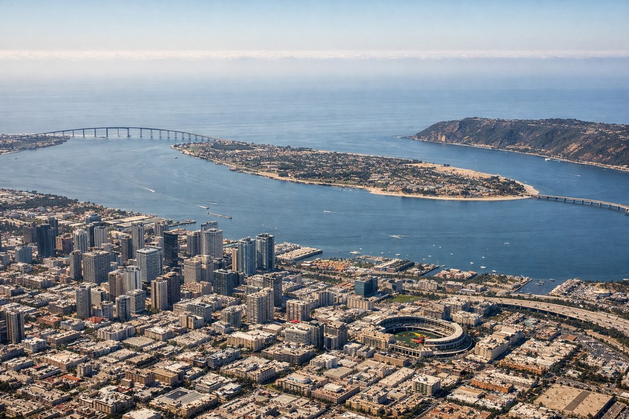
RIGHTRight side provides superior landing approach scenery. Runway 27 arrivals descend from the east over downtown San Diego, Balboa Park, and San Diego Bay. The right side captures the urban skyline, harbor geometry, and the final approach over the bay with clear views of downtown high-rises and the distinctive bay landscape.
Will your flight be in sunlight?
Pick a date and time in the Sun Map to watch the sun move across your whole flight.
About This Route
Which side of the plane should I sit on flying from California Redwood Coast-Humboldt County Airport (ACV) to San Diego International Lindbergh Fld (SAN)?
Sit on the Left side of the plane for the best views on flights from Arcata/Eureka to San Diego. Left side scores higher due to the dramatic takeoff sequence over the Humboldt County coast and redwood terrain, which provides strong visual interest and variety. While the landing approach on the right side is scenic with downtown San Diego and the bay, the takeoff experience on the left—featuring the rugged northern California coastline, Humboldt Bay, and immediate coastal drama—outweighs the landing advantage. The cruise phase over central California offers moderate scenery on both sides, but the left side's superior departure experience tips the overall balance.
What can I see during takeoff from California Redwood Coast-Humboldt County Airport in Arcata/Eureka?
During takeoff from California Redwood Coast-Humboldt County Airport (ACV), sit on the Left side for the best views. Left side captures the dramatic Humboldt County coastline and redwood-forested terrain immediately after departure. Runway 32 departures climb northwest over the Pacific, then turn south along the coast, offering immediate views of the rugged northern California shoreline, sea stacks, and coastal bluffs. Notable sights include: Humboldt Bay, Trinidad Head, coastal redwood forests, Pacific Ocean.
What can I see when landing at San Diego International Lindbergh Fld in San Diego?
When landing at San Diego International Lindbergh Fld (SAN), sit on the Right side for the best views. Right side provides superior landing approach scenery. Runway 27 arrivals descend from the east over downtown San Diego, Balboa Park, and San Diego Bay. The right side captures the urban skyline, harbor geometry, and the final approach over the bay with clear views of downtown high-rises and the distinctive bay landscape. Notable sights include: Downtown San Diego skyline, San Diego Bay, Balboa Park, Coronado Island.
How long is the flight from Arcata/Eureka to San Diego?
The flight from California Redwood Coast-Humboldt County Airport (ACV) to San Diego International Lindbergh Fld (SAN) takes about 2 hours 5 minutes. The shortest flight path between them is 686 miles (1,103 km); winds and air traffic control usually add a few percent.
What does the Arcata/Eureka to San Diego flight path pass over?
Big Sur coastline, Santa Lucia Mountains, Monterey Bay, San Luis Obispo County rolling terrain, Santa Maria Valley, Santa Ynez Mountains, Santa Barbara Channel, Channel Islands (distant), Ventura County coastal plain