The left side captures Izmir's bay at departure and the Sea of Marmara with Istanbul's approach at landing, giving more coastal and urban variety than the right side's largely inland, mountainous but less varied view.
Flight Path
Western Anatolian plains near Balıkesir, the Uludağ mountain range east of Bursa, and the southern shoreline of the Sea of Marmara
Great circle distance and headings ›Phase by phase
Takeoff from ADB
LEFTDeparting ADB northbound, the left side overlooks the Gulf of Izmir and the city's waterfront before the aircraft climbs over the Aegean coastline, giving a strong sense of the bay's shape and the hills ringing Izmir.
Landing at IST
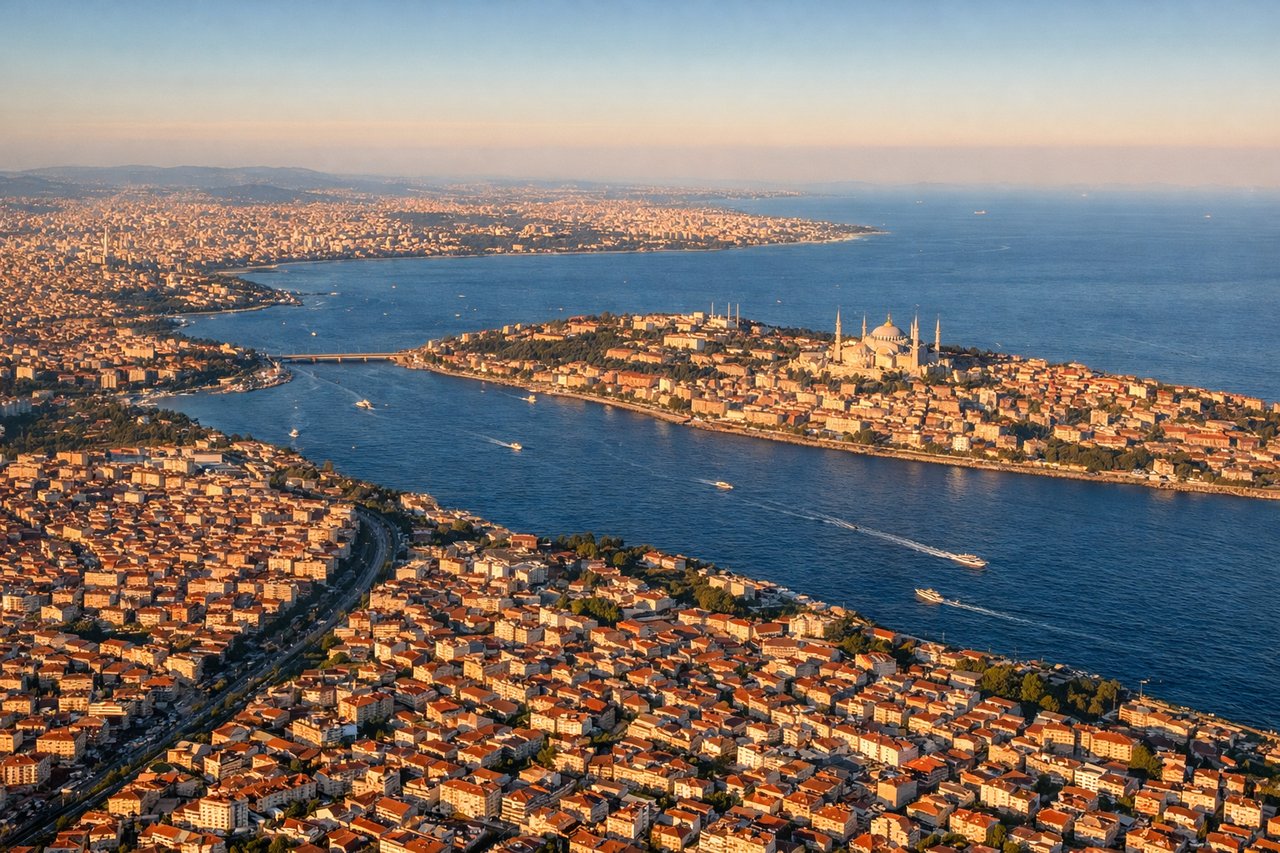
LEFTOn approach into IST from the south, the left side offers views over the Sea of Marmara and its islands before the final turn toward the runways, with glimpses of the Bosphorus entrance and Istanbul's northern suburbs as the plane descends.
Landmarks on this routeAll landmarks →
Will your flight be in sunlight?
See exactly which side of the plane gets sun and shade at your departure time.
About This Route
Which side of the plane should I sit on flying from Adnan Menderes (ADB) to İstanbul Airport (IST)?
Sit on the Left side of the plane for the best views on flights from Izmir to Istanbul. The left side captures Izmir's bay at departure and the Sea of Marmara with Istanbul's approach at landing, giving more coastal and urban variety than the right side's largely inland, mountainous but less varied view.
What can I see during takeoff from Adnan Menderes in Izmir?
During takeoff from Adnan Menderes (ADB), sit on the Left side for the best views. Departing ADB northbound, the left side overlooks the Gulf of Izmir and the city's waterfront before the aircraft climbs over the Aegean coastline, giving a strong sense of the bay's shape and the hills ringing Izmir. Notable sights include: Gulf of Izmir, Izmir city waterfront, Karşıyaka district, Aegean coastline.
What can I see when landing at İstanbul Airport in Istanbul?
When landing at İstanbul Airport (IST), sit on the Left side for the best views. On approach into IST from the south, the left side offers views over the Sea of Marmara and its islands before the final turn toward the runways, with glimpses of the Bosphorus entrance and Istanbul's northern suburbs as the plane descends. Notable sights include: Sea of Marmara, Marmara Island area, Bosphorus mouth, Istanbul suburbs.
How long is the flight from Izmir to Istanbul?
The flight from Adnan Menderes (ADB) to İstanbul Airport (IST) takes 1h 05m.
What does the Izmir to Istanbul flight path pass over?
Western Anatolian plains near Balıkesir, the Uludağ mountain range east of Bursa, and the southern shoreline of the Sea of Marmara