While takeoff favors the right, landing provides the more dramatic and sustained view. The approach into Cartagena offers extended visibility of the historic city, bay system, and coastal geography that makes this route memorable. The left side captures the entire descent sequence with the most distinctive landmarks.
Flown ADZ to CTG? Did we get it right?
Flight Path
San Andres Island to Cartagena is 445 miles (716 km), a flight of about 1 hour 40 minutes.
The flight path crosses the Caribbean Sea southwestward from San Andres toward the Colombian mainland. At midpoint, you'll be over open water with no major landmarks visible—just the Caribbean Sea. The coastline gradually becomes visible as you approach Cartagena, with the Magdalena River delta and coastal swamps appearing before the final approach into the bay.
Great circle distance and headings ›Phase by phase
Takeoff from ADZ
RIGHTSan Andres Island's runway 32 (northwest heading) means right-side seats face the Caribbean Sea and the island's eastern coastline during climb-out. You'll see the shallow turquoise waters and coral reefs that define the island's geography as you depart northwestward.
Landing at CTG
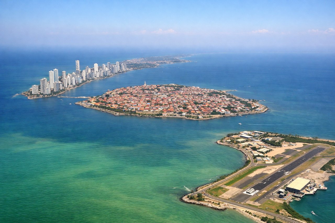
LEFTCartagena's primary runway 32 (northwest approach) means left-side seats face the Caribbean coast and Cartagena's historic walled city during descent. You'll see the distinctive turquoise Cartagena Bay, the city's peninsula, and the surrounding mangrove-lined coastline as you approach from the northwest.
Will your flight be in sunlight?
Pick a date and time in the Sun Map to watch the sun move across your whole flight.
About This Route
Which side of the plane should I sit on flying from Gustavo Rojas Pinilla (ADZ) to Rafael Nunez (CTG)?
Sit on the Left side of the plane for the best views on flights from San Andres Island to Cartagena. While takeoff favors the right, landing provides the more dramatic and sustained view. The approach into Cartagena offers extended visibility of the historic city, bay system, and coastal geography that makes this route memorable. The left side captures the entire descent sequence with the most distinctive landmarks.
What can I see during takeoff from Gustavo Rojas Pinilla in San Andres Island?
During takeoff from Gustavo Rojas Pinilla (ADZ), sit on the Right side for the best views. San Andres Island's runway 32 (northwest heading) means right-side seats face the Caribbean Sea and the island's eastern coastline during climb-out. You'll see the shallow turquoise waters and coral reefs that define the island's geography as you depart northwestward. Notable sights include: Caribbean Sea (turquoise shallow waters), San Andres Island's eastern shore, Providencia Island (visible to the north on clear days), coral reef systems.
What can I see when landing at Rafael Nunez in Cartagena?
When landing at Rafael Nunez (CTG), sit on the Left side for the best views. Cartagena's primary runway 32 (northwest approach) means left-side seats face the Caribbean coast and Cartagena's historic walled city during descent. You'll see the distinctive turquoise Cartagena Bay, the city's peninsula, and the surrounding mangrove-lined coastline as you approach from the northwest. Notable sights include: Cartagena Bay (turquoise waters), Cartagena's walled old city and peninsula, mangrove wetlands to the south, Rosario Islands archipelago.
How long is the flight from San Andres Island to Cartagena?
The flight from Gustavo Rojas Pinilla (ADZ) to Rafael Nunez (CTG) takes about 1 hour 40 minutes. The shortest flight path between them is 445 miles (716 km); winds and air traffic control usually add a few percent.
What does the San Andres Island to Cartagena flight path pass over?
The flight path crosses the Caribbean Sea southwestward from San Andres toward the Colombian mainland. At midpoint, you'll be over open water with no major landmarks visible—just the Caribbean Sea. The coastline gradually becomes visible as you approach Cartagena, with the Magdalena River delta and coastal swamps appearing before the final approach into the bay.