The eastern side delivers the flight's most dramatic and varied scenery: North Island volcanic peaks near Tongariro, the dramatic Kaikoura coast where the mountains meet the sea, the Canterbury Plains and Christchurch, and finally Otago Harbour on approach into Dunedin. The western side offers a fine but more distant view of the Southern Alps, without the same density of close-in coastal and urban features.
Flight Path
Cook Strait crossing, Kaikoura Ranges meeting the Pacific coastline, Canterbury Plains, and the distant snow-capped peaks of the Southern Alps including Aoraki/Mount Cook visible to the west of the flight path
Great circle distance and headings ›Phase by phase
Takeoff from AKL
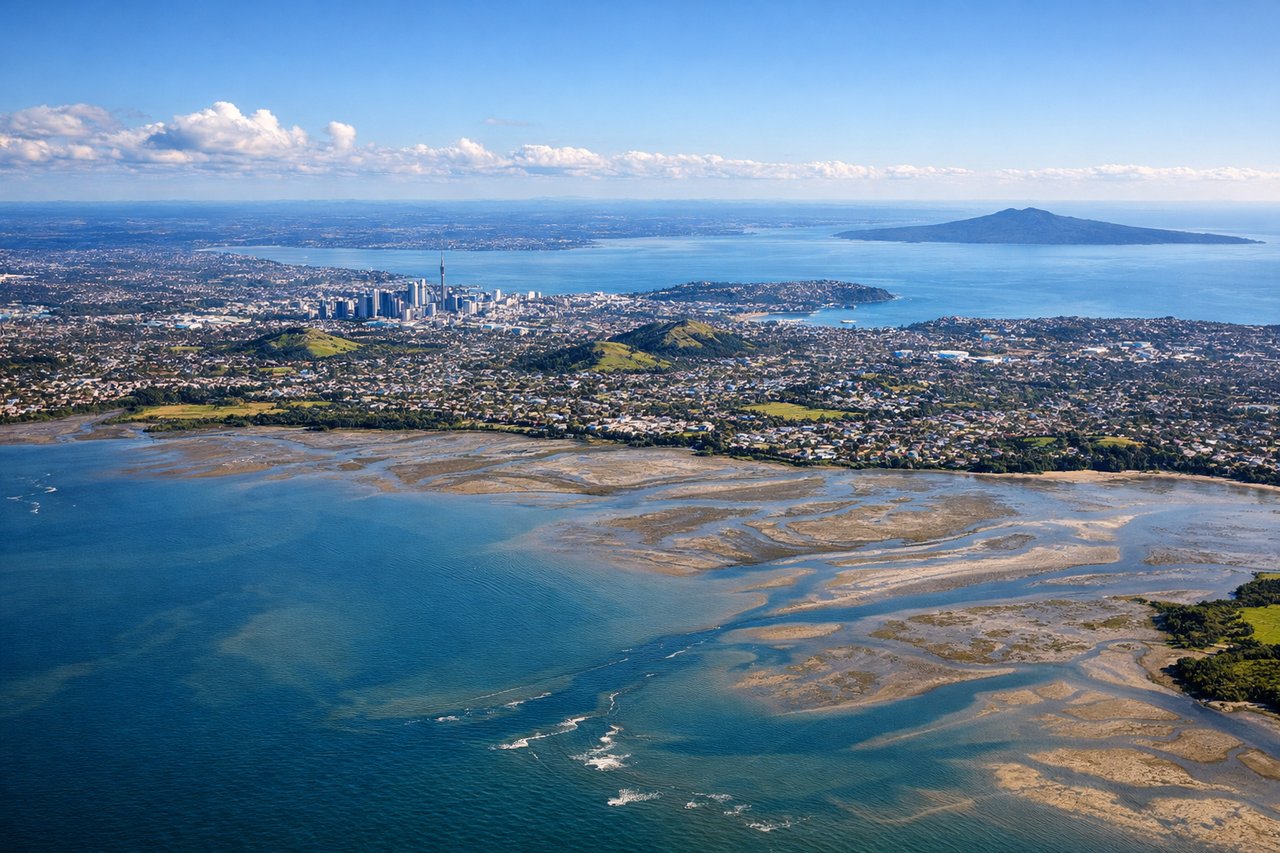
RIGHTDeparting AKL on runway 23L, the climb-out tracks southwest directly over the tidal flats of Manukau Harbour, with the forested ridgeline of the Waitakere Ranges visible beyond on the right. This gives a brief but distinctive harbour-and-hills view before the aircraft settles onto its southbound track.
Landing at DUD
LEFTOn approach into Dunedin's runway 21, the descent path crosses over Otago Harbour and skirts the base of the Otago Peninsula, with Dunedin's compact hillside city visible tucked against the water. It's a rare harbour-city approach that bookends a scenic flight nicely.
Landmarks on this routeAll landmarks →
Will your flight be in sunlight?
See exactly which side of the plane gets sun and shade at your departure time.
About This Route
Which side of the plane should I sit on flying from Auckland International (AKL) to Dunedin (DUD)?
Sit on the Left side of the plane for the best views on flights from Auckland to Dunedin. The eastern side delivers the flight's most dramatic and varied scenery: North Island volcanic peaks near Tongariro, the dramatic Kaikoura coast where the mountains meet the sea, the Canterbury Plains and Christchurch, and finally Otago Harbour on approach into Dunedin. The western side offers a fine but more distant view of the Southern Alps, without the same density of close-in coastal and urban features.
What can I see during takeoff from Auckland International in Auckland?
During takeoff from Auckland International (AKL), sit on the Right side for the best views. Departing AKL on runway 23L, the climb-out tracks southwest directly over the tidal flats of Manukau Harbour, with the forested ridgeline of the Waitakere Ranges visible beyond on the right. This gives a brief but distinctive harbour-and-hills view before the aircraft settles onto its southbound track. Notable sights include: Manukau Harbour tidal flats, Waitakere Ranges, Manukau Heads coastline.
What can I see when landing at Dunedin in Dunedin?
When landing at Dunedin (DUD), sit on the Left side for the best views. On approach into Dunedin's runway 21, the descent path crosses over Otago Harbour and skirts the base of the Otago Peninsula, with Dunedin's compact hillside city visible tucked against the water. It's a rare harbour-city approach that bookends a scenic flight nicely. Notable sights include: Otago Harbour, Otago Peninsula, Dunedin city and hillside suburbs, Taieri Plain.
How long is the flight from Auckland to Dunedin?
The flight from Auckland International (AKL) to Dunedin (DUD) takes 1h 50m.
What does the Auckland to Dunedin flight path pass over?
Cook Strait crossing, Kaikoura Ranges meeting the Pacific coastline, Canterbury Plains, and the distant snow-capped peaks of the Southern Alps including Aoraki/Mount Cook visible to the west of the flight path