The right side delivers the more dramatic and memorable departure view over Manukau Harbour and the Auckland volcanic field, which is genuinely distinctive and photogenic. The Houston arrival on either side is relatively unremarkable flat terrain, so the takeoff experience tips the balance to the right side overall.
Flight Path
The route tracks northeast from Auckland across the South Pacific Ocean, passing north of French Polynesia and the Line Islands. The flight crosses the equator roughly over the central Pacific, then continues over the vast open ocean north of Hawaii before crossing the Mexican coast near the Yucatan Peninsula or entering US airspace over Texas. The entire mid-section of the flight is open ocean with no land visible for roughly 10 to 12 hours. Occasional cloud systems and the curvature of the horizon are the only features. The flight may pass within distant range of the Hawaiian Islands chain depending on the exact routing, but they are rarely close enough to see clearly.
Great circle distance and headings ›

Phase by phase
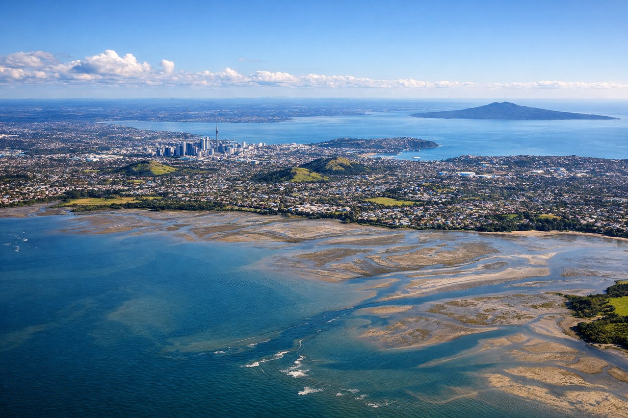
Takeoff from AKL
RIGHTAuckland International typically departs on runway 23L/23R heading southwest, then aircraft turn northward over the Manukau Harbour. Right side passengers get a clear view back over the Manukau Harbour, the Waitakere Ranges, and the Auckland isthmus with its volcanic cones. The left side faces open Tasman Sea with little of interest.
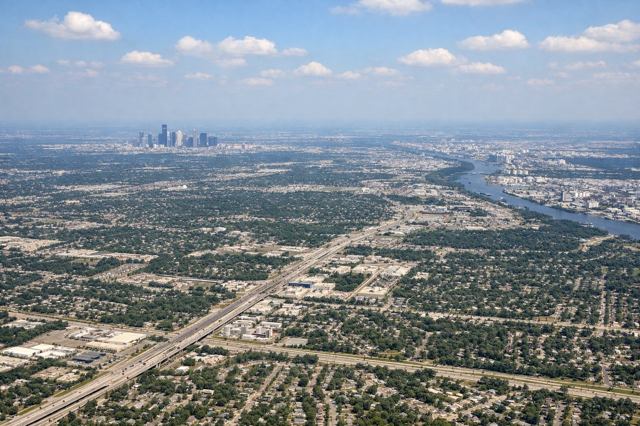
Landing at IAH
LEFTFlights from the southwest typically approach IAH from the south or southeast on runway 26L/26R or 15R, giving left-side passengers views over the Houston Ship Channel, downtown Houston skyline, and the sprawling flat urban grid of the fourth-largest US city. Right side faces suburban sprawl with fewer distinguishing features.
Landmarks on this routeAll landmarks →
Will your flight be in sunlight?
See exactly which side of the plane gets sun and shade at your departure time.
About This Route
Which side of the plane should I sit on flying from Auckland International (AKL) to George Bush Intcntl Houston (IAH)?
Sit on the Right side of the plane for the best views on flights from Auckland to Houston. The right side delivers the more dramatic and memorable departure view over Manukau Harbour and the Auckland volcanic field, which is genuinely distinctive and photogenic. The Houston arrival on either side is relatively unremarkable flat terrain, so the takeoff experience tips the balance to the right side overall.
What can I see during takeoff from Auckland International in Auckland?
During takeoff from Auckland International (AKL), sit on the Right side for the best views. Auckland International typically departs on runway 23L/23R heading southwest, then aircraft turn northward over the Manukau Harbour. Right side passengers get a clear view back over the Manukau Harbour, the Waitakere Ranges, and the Auckland isthmus with its volcanic cones. The left side faces open Tasman Sea with little of interest. Notable sights include: Manukau Harbour, Auckland volcanic field cones (Mangere Mountain, Puketutu Island), Waitakere Ranges, Auckland CBD skyline across the isthmus.
What can I see when landing at George Bush Intcntl Houston in Houston?
When landing at George Bush Intcntl Houston (IAH), sit on the Left side for the best views. Flights from the southwest typically approach IAH from the south or southeast on runway 26L/26R or 15R, giving left-side passengers views over the Houston Ship Channel, downtown Houston skyline, and the sprawling flat urban grid of the fourth-largest US city. Right side faces suburban sprawl with fewer distinguishing features. Notable sights include: Downtown Houston skyline, Houston Ship Channel, Lake Houston to the northeast, Texas Gulf Coast flatlands.
How long is the flight from Auckland to Houston?
The flight from Auckland International (AKL) to George Bush Intcntl Houston (IAH) takes Approximately 17 to 18 hours nonstop.
What does the Auckland to Houston flight path pass over?
The route tracks northeast from Auckland across the South Pacific Ocean, passing north of French Polynesia and the Line Islands. The flight crosses the equator roughly over the central Pacific, then continues over the vast open ocean north of Hawaii before crossing the Mexican coast near the Yucatan Peninsula or entering US airspace over Texas. The entire mid-section of the flight is open ocean with no land visible for roughly 10 to 12 hours. Occasional cloud systems and the curvature of the horizon are the only features. The flight may pass within distant range of the Hawaiian Islands chain depending on the exact routing, but they are rarely close enough to see clearly.