While takeoff offers good views of Auckland's harbours and volcanic landscape, the landing approach into Vancouver provides more dramatic and sustained visual interest with the North Shore Mountains and Burrard Inlet. The left side captures the most distinctive geography of the destination.
Flight Path
The flight crosses the North Pacific Ocean for approximately 8,000 nautical miles. Midpoint views (around 8-9 hours into flight) show open ocean with no visible landmarks. The route typically passes north of Hawaii (not visible from cruise altitude at standard routing). Notable geographic transitions include: departure from New Zealand's North Island volcanic plateau, crossing the Tasman Sea, then the vast Pacific basin, approaching North America near the British Columbia coast with the Cascade Range and Coast Mountains becoming visible during descent into Vancouver.
Great circle distance and headings ›Phase by phase
Takeoff from AKL
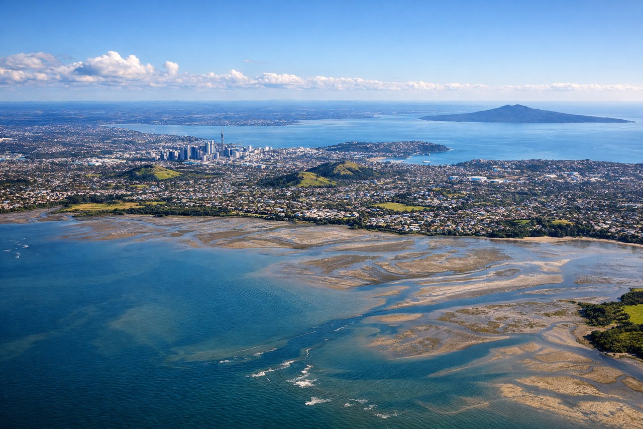
RIGHTAuckland typically departs runway 03L/03R (northbound) or 21L/21R (southbound). Right-side seats offer views of the Hauraki Gulf and Waitemata Harbour during northbound departures, with the city receding behind. Southbound departures show the Manukau Harbour and volcanic cones of the Auckland volcanic field.
Landing at YVR
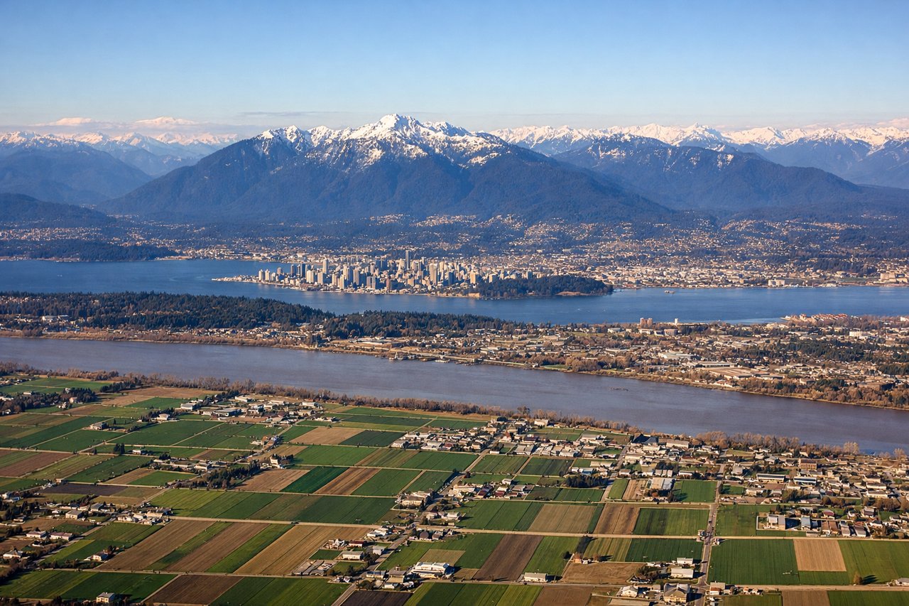
LEFTVancouver typically lands runway 26L/26R (westbound over water) or 08L/08R (eastbound over land). Left-side seats on westbound approaches offer dramatic views of the North Shore Mountains, Burrard Inlet, and the Georgia Strait. Eastbound approaches show the Fraser River valley and suburban sprawl, less visually distinctive.
Landmarks on this routeAll landmarks →
Will your flight be in sunlight?
See exactly which side of the plane gets sun and shade at your departure time.
About This Route
Which side of the plane should I sit on flying from Auckland International (AKL) to Vancouver International (YVR)?
Sit on the Left side of the plane for the best views on flights from Auckland to Vancouver. While takeoff offers good views of Auckland's harbours and volcanic landscape, the landing approach into Vancouver provides more dramatic and sustained visual interest with the North Shore Mountains and Burrard Inlet. The left side captures the most distinctive geography of the destination.
What can I see during takeoff from Auckland International in Auckland?
During takeoff from Auckland International (AKL), sit on the Right side for the best views. Auckland typically departs runway 03L/03R (northbound) or 21L/21R (southbound). Right-side seats offer views of the Hauraki Gulf and Waitemata Harbour during northbound departures, with the city receding behind. Southbound departures show the Manukau Harbour and volcanic cones of the Auckland volcanic field. Notable sights include: Waitemata Harbour, Rangitoto Island (extinct volcano in the gulf), Auckland city skyline, Manukau Harbour.
What can I see when landing at Vancouver International in Vancouver?
When landing at Vancouver International (YVR), sit on the Left side for the best views. Vancouver typically lands runway 26L/26R (westbound over water) or 08L/08R (eastbound over land). Left-side seats on westbound approaches offer dramatic views of the North Shore Mountains, Burrard Inlet, and the Georgia Strait. Eastbound approaches show the Fraser River valley and suburban sprawl, less visually distinctive. Notable sights include: North Shore Mountains (Coast Range), Burrard Inlet, Vancouver city skyline, Strait of Georgia.
How long is the flight from Auckland to Vancouver?
The flight from Auckland International (AKL) to Vancouver International (YVR) takes Approximately 16-17 hours (including typical routing across the Pacific via the great circle path).
What does the Auckland to Vancouver flight path pass over?
The flight crosses the North Pacific Ocean for approximately 8,000 nautical miles. Midpoint views (around 8-9 hours into flight) show open ocean with no visible landmarks. The route typically passes north of Hawaii (not visible from cruise altitude at standard routing). Notable geographic transitions include: departure from New Zealand's North Island volcanic plateau, crossing the Tasman Sea, then the vast Pacific basin, approaching North America near the British Columbia coast with the Cascade Range and Coast Mountains becoming visible during descent into Vancouver.