Amarillo to Denver is 360 miles (579 km), a flight of about 1 hour 15 minutes.
While takeoff offers High Plains views, the landing approach into Denver provides far superior scenery with the dramatic Rocky Mountain Front Range, snow-capped peaks, and the South Platte River valley all visible from the left side during descent.
Flight Path
The flight path crosses the High Plains of the Texas Panhandle and Oklahoma Panhandle, then transitions into the Colorado plains. Notable midpoint features include the Canadian River valley (visible early), the Cimarron River drainage, and the gradual elevation increase toward the Colorado piedmont. The landscape transitions from flat grassland to rolling terrain with increasing pine forest coverage as the aircraft approaches the Front Range foothills. No major bodies of water or dramatic terrain features exist in the true midpoint; the transition is gradual across roughly 200 miles of semi-arid plains and early foothills.
Great circle distance and headings ›Phase by phase
Takeoff from AMA
RIGHTRight-side seats offer views of the Canadian River valley and the High Plains terrain rolling northward toward the Oklahoma Panhandle. The northwesterly departure path from Amarillo reveals the gradual elevation increase toward the Llano Estacado's edge.
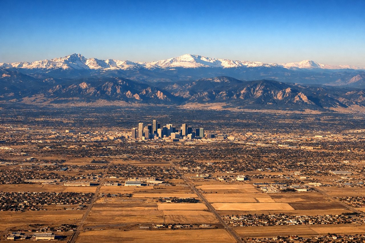
Landing at DEN
LEFTLeft-side seats provide excellent views of the Front Range as the aircraft descends toward Denver. The Rocky Mountains dominate the approach, with the Continental Divide and peaks like Mount Evans and Long's Peak visible on clear days. The South Platte River valley and Denver's urban sprawl are also visible from this side.
Landmarks on this routeAll landmarks →
Will your flight be in sunlight?
Pick a date and time in the Sun Map to watch the sun move across your whole flight.
About This Route
Which side of the plane should I sit on flying from Amarillo International (AMA) to Denver International (DEN)?
Sit on the Left side of the plane for the best views on flights from Amarillo to Denver. While takeoff offers High Plains views, the landing approach into Denver provides far superior scenery with the dramatic Rocky Mountain Front Range, snow-capped peaks, and the South Platte River valley all visible from the left side during descent.
What can I see during takeoff from Amarillo International in Amarillo?
During takeoff from Amarillo International (AMA), sit on the Right side for the best views. Right-side seats offer views of the Canadian River valley and the High Plains terrain rolling northward toward the Oklahoma Panhandle. The northwesterly departure path from Amarillo reveals the gradual elevation increase toward the Llano Estacado's edge. Notable sights include: Canadian River valley, Palo Duro Canyon rim (distant southwest), High Plains plateau, Oklahoma Panhandle grasslands.
What can I see when landing at Denver International in Denver?
When landing at Denver International (DEN), sit on the Left side for the best views. Left-side seats provide excellent views of the Front Range as the aircraft descends toward Denver. The Rocky Mountains dominate the approach, with the Continental Divide and peaks like Mount Evans and Long's Peak visible on clear days. The South Platte River valley and Denver's urban sprawl are also visible from this side. Notable sights include: Rocky Mountain Front Range, South Platte River valley, Denver metropolitan area, Continental Divide peaks.
How long is the flight from Amarillo to Denver?
The flight from Amarillo International (AMA) to Denver International (DEN) takes about 1 hour 15 minutes. The shortest flight path between them is 360 miles (579 km); winds and air traffic control usually add a few percent.
What does the Amarillo to Denver flight path pass over?
The flight path crosses the High Plains of the Texas Panhandle and Oklahoma Panhandle, then transitions into the Colorado plains. Notable midpoint features include the Canadian River valley (visible early), the Cimarron River drainage, and the gradual elevation increase toward the Colorado piedmont. The landscape transitions from flat grassland to rolling terrain with increasing pine forest coverage as the aircraft approaches the Front Range foothills. No major bodies of water or dramatic terrain features exist in the true midpoint; the transition is gradual across roughly 200 miles of semi-arid plains and early foothills.