The takeoff climb from Amman provides more dramatic and geologically distinctive scenery—the Dead Sea and Jordan Valley escarpment are visually striking and unique. The landing approach into Riyadh, while clear, shows primarily urban grid and plateau. Right-side seats capture the more memorable natural features.
Flown AMM to RUH? Did we get it right?
Flight Path
Amman to Riyadh is 801 miles (1,289 km), a flight of about 2 hours 15 minutes.
The flight path crosses the Jordanian plateau and Syrian Desert plateau, passing over sparsely populated steppe terrain with minimal elevation change. The landscape transitions from the western Levantine highlands (visible on departure) through flat, tan desert with scattered wadis and low relief. No major water bodies, mountain ranges, or significant cities lie directly beneath the cruise altitude on this route. The terrain remains predominantly arid plateau throughout the 300-km flight path.
Great circle distance and headings ›Phase by phase
Takeoff from AMM
RIGHTRight-side seats offer views of the Dead Sea depression and the Jordan Valley escarpment as the aircraft climbs southeastward from Amman. The terrain drops dramatically from the Jordanian plateau toward the rift valley, creating distinctive visual relief.
Landing at RUH
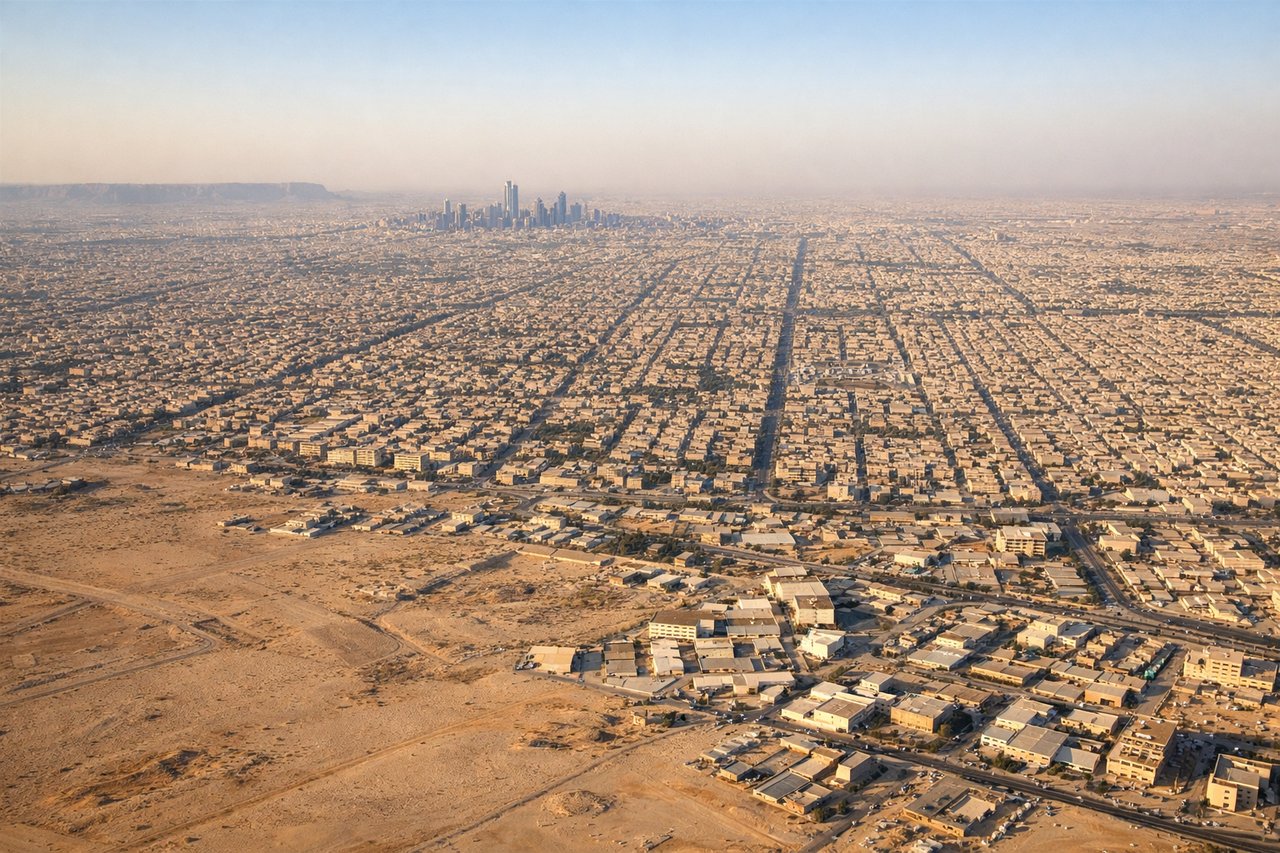
LEFTLeft-side seats provide views of the Tuwaiq Escarpment and Riyadh's urban grid during the descent approach from the northwest. The escarpment's distinctive curved ridge and the city's geometric street layout are prominent visual markers.
Will your flight be in sunlight?
Pick a date and time in the Sun Map to watch the sun move across your whole flight.
About This Route
Which side of the plane should I sit on flying from Queen Alia International (AMM) to King Khaled International (RUH)?
Sit on the Right side of the plane for the best views on flights from Amman to Riyadh. The takeoff climb from Amman provides more dramatic and geologically distinctive scenery—the Dead Sea and Jordan Valley escarpment are visually striking and unique. The landing approach into Riyadh, while clear, shows primarily urban grid and plateau. Right-side seats capture the more memorable natural features.
What can I see during takeoff from Queen Alia International in Amman?
During takeoff from Queen Alia International (AMM), sit on the Right side for the best views. Right-side seats offer views of the Dead Sea depression and the Jordan Valley escarpment as the aircraft climbs southeastward from Amman. The terrain drops dramatically from the Jordanian plateau toward the rift valley, creating distinctive visual relief. Notable sights include: Dead Sea (lowest point on Earth, visible as a narrow blue-grey strip in the valley floor), Jordan Valley escarpment (sharp elevation change along the western edge), Amman city sprawl (receding northward below), Moab plateau (distant eastern highlands).
What can I see when landing at King Khaled International in Riyadh?
When landing at King Khaled International (RUH), sit on the Left side for the best views. Left-side seats provide views of the Tuwaiq Escarpment and Riyadh's urban grid during the descent approach from the northwest. The escarpment's distinctive curved ridge and the city's geometric street layout are prominent visual markers. Notable sights include: Tuwaiq Escarpment (curved limestone ridge bounding Riyadh's western edge), Riyadh city grid (regular street pattern and high-rise clusters), Wadi Hanifah (seasonal watercourse running through the city), Saudi desert plateau (tan, sparsely vegetated terrain surrounding the city).
How long is the flight from Amman to Riyadh?
The flight from Queen Alia International (AMM) to King Khaled International (RUH) takes about 2 hours 15 minutes. The shortest flight path between them is 801 miles (1,289 km); winds and air traffic control usually add a few percent.
What does the Amman to Riyadh flight path pass over?
The flight path crosses the Jordanian plateau and Syrian Desert plateau, passing over sparsely populated steppe terrain with minimal elevation change. The landscape transitions from the western Levantine highlands (visible on departure) through flat, tan desert with scattered wadis and low relief. No major water bodies, mountain ranges, or significant cities lie directly beneath the cruise altitude on this route. The terrain remains predominantly arid plateau throughout the 300-km flight path.