Anchorage to Bethel is 397 miles (640 km), a flight of about 1 hour 10 minutes.
The takeoff view of the Chugach Mountains is more visually distinctive than the landing approach over flat delta terrain. Left seats capture the dramatic mountain escarpment that defines Anchorage's geography.
Flight Path
The flight path crosses the Alaska Range foothills and transitions into the lower Kuskokwim River drainage. The terrain progressively flattens from mountainous terrain near Anchorage to coastal tundra near Bethel. Lake Clark and the Neacola Mountains may be visible to the north on clear days, though they lie slightly north of the direct route. The Tikchik Lakes region (a chain of long, narrow lakes) may be visible to the south depending on exact routing. Most of the midpoint flight occurs over sparsely populated tundra with scattered lakes and rivers.
Great circle distance and headings ›Phase by phase
Takeoff from ANC
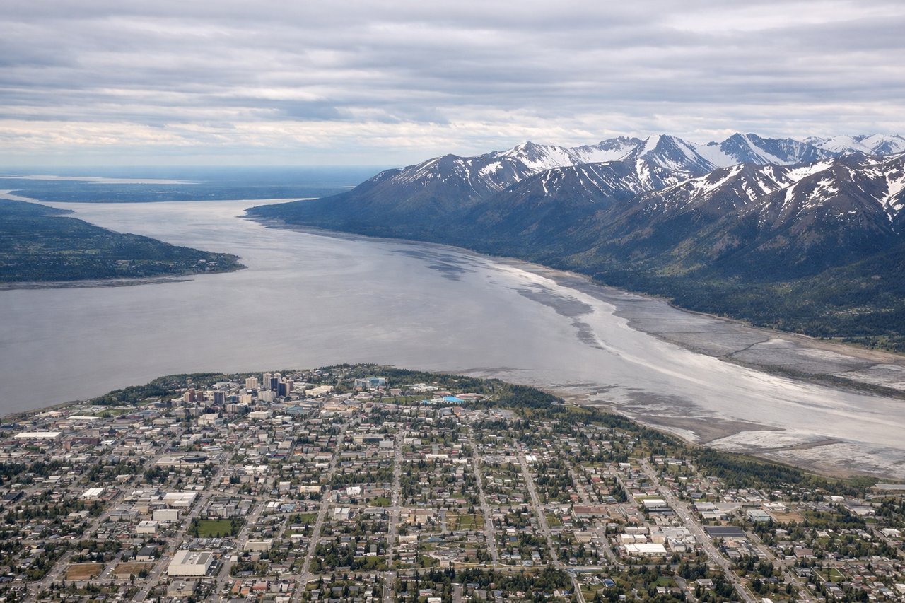
LEFTANC typically departs runways 01L/01R or 07R/07L depending on wind. Left-side seats offer views of the Chugach Mountains immediately east of the airport during initial climb, with the Knik Arm of Cook Inlet visible to the south. Right seats face inland toward less dramatic terrain.
Landing at BET
RIGHTApproaching Bethel from the southeast, right-side seats capture the Kuskokwim River delta and the river itself as it widens toward the Bering Sea. The terrain is low and marshy with visible water channels. Left seats face the tundra interior with fewer distinctive features.
Landmarks on this routeAll landmarks →
Will your flight be in sunlight?
Pick a date and time in the Sun Map to watch the sun move across your whole flight.
About This Route
Which side of the plane should I sit on flying from Ted Stevens Anchorage International (ANC) to Bethel (BET)?
Sit on the Left side of the plane for the best views on flights from Anchorage to Bethel. The takeoff view of the Chugach Mountains is more visually distinctive than the landing approach over flat delta terrain. Left seats capture the dramatic mountain escarpment that defines Anchorage's geography.
What can I see during takeoff from Ted Stevens Anchorage International in Anchorage?
During takeoff from Ted Stevens Anchorage International (ANC), sit on the Left side for the best views. ANC typically departs runways 01L/01R or 07R/07L depending on wind. Left-side seats offer views of the Chugach Mountains immediately east of the airport during initial climb, with the Knik Arm of Cook Inlet visible to the south. Right seats face inland toward less dramatic terrain. Notable sights include: Chugach Mountains (eastern escarpment), Knik Arm (southern water body), Anchorage city grid (directly below during climb), Point Woronzof (western peninsula).
What can I see when landing at Bethel in Bethel?
When landing at Bethel (BET), sit on the Right side for the best views. Approaching Bethel from the southeast, right-side seats capture the Kuskokwim River delta and the river itself as it widens toward the Bering Sea. The terrain is low and marshy with visible water channels. Left seats face the tundra interior with fewer distinctive features. Notable sights include: Kuskokwim River (braided channels in delta), Bering Sea (distant water horizon), Bethel airfield (runway visible on final approach), Coastal tundra (flat, vegetation-patterned landscape).
How long is the flight from Anchorage to Bethel?
The flight from Ted Stevens Anchorage International (ANC) to Bethel (BET) takes about 1 hour 10 minutes. The shortest flight path between them is 397 miles (640 km); winds and air traffic control usually add a few percent.
What does the Anchorage to Bethel flight path pass over?
The flight path crosses the Alaska Range foothills and transitions into the lower Kuskokwim River drainage. The terrain progressively flattens from mountainous terrain near Anchorage to coastal tundra near Bethel. Lake Clark and the Neacola Mountains may be visible to the north on clear days, though they lie slightly north of the direct route. The Tikchik Lakes region (a chain of long, narrow lakes) may be visible to the south depending on exact routing. Most of the midpoint flight occurs over sparsely populated tundra with scattered lakes and rivers.