The takeoff view of the Chugach Mountains is more dramatic and visually distinctive than the landing approach. While the Susquehanna River is notable, the mountainous terrain at Anchorage departure offers superior window-seat geography for the majority of the early flight phase.
Flown ANC to IPT? Did we get it right?
Flight Path
Anchorage to Williamsport is 3,241 miles (5,216 km), a flight of about 5 hours 45 minutes.
This flight crosses the entire North American continent southeast. Notable midpoint geography includes the Alaska Range (visible from higher altitudes during initial climb), the Canadian Rockies and interior British Columbia (if routed through northern corridors), the Great Plains (flat terrain with scattered lakes and river valleys), and the transition into Appalachian terrain as the flight approaches Pennsylvania. The route typically passes over or near the Rocky Mountains, the Great Lakes region, and the Ohio River valley depending on exact routing and wind patterns.
Great circle distance and headings ›


Phase by phase
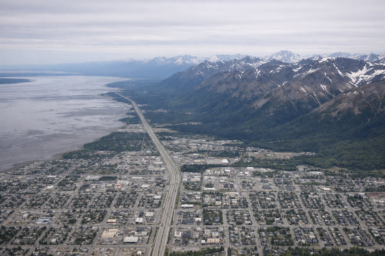
Takeoff from ANC
RIGHTAnchorage typically departs runways 01L/R or 19L/R depending on wind. Right-side seats offer views of the Chugach Mountains immediately east of the airport, which rise dramatically from sea level. The Knik Arm of Cook Inlet spreads west, but the eastern mountains dominate the early climb.
Landing at IPT
LEFTApproach to Williamsport typically uses runways 02 or 20 depending on wind. Left-side seats during descent offer views of the Susquehanna River, which is the dominant geographic feature of the region and runs north-south directly adjacent to the airport. The river's wide channel and islands are clearly visible from altitude.
Will your flight be in sunlight?
Pick a date and time in the Sun Map to watch the sun move across your whole flight.
About This Route
Which side of the plane should I sit on flying from Ted Stevens Anchorage International (ANC) to Williamsport Rgnl (IPT)?
Sit on the Right side of the plane for the best views on flights from Anchorage to Williamsport. The takeoff view of the Chugach Mountains is more dramatic and visually distinctive than the landing approach. While the Susquehanna River is notable, the mountainous terrain at Anchorage departure offers superior window-seat geography for the majority of the early flight phase.
What can I see during takeoff from Ted Stevens Anchorage International in Anchorage?
During takeoff from Ted Stevens Anchorage International (ANC), sit on the Right side for the best views. Anchorage typically departs runways 01L/R or 19L/R depending on wind. Right-side seats offer views of the Chugach Mountains immediately east of the airport, which rise dramatically from sea level. The Knik Arm of Cook Inlet spreads west, but the eastern mountains dominate the early climb. Notable sights include: Chugach Mountains (eastern wall), Knik Arm (western water body), Anchorage city grid (directly below during initial climb), Turnagain Arm (southeastern inlet visible as climb continues).
What can I see when landing at Williamsport Rgnl in Williamsport?
When landing at Williamsport Rgnl (IPT), sit on the Left side for the best views. Approach to Williamsport typically uses runways 02 or 20 depending on wind. Left-side seats during descent offer views of the Susquehanna River, which is the dominant geographic feature of the region and runs north-south directly adjacent to the airport. The river's wide channel and islands are clearly visible from altitude. Notable sights include: Susquehanna River (main channel with visible islands), Lycoming County ridge terrain (rolling Appalachian foothills), Williamsport city center (visible as developed grid), Pennsylvania farmland (patchwork fields in surrounding area).
How long is the flight from Anchorage to Williamsport?
The flight from Ted Stevens Anchorage International (ANC) to Williamsport Rgnl (IPT) takes about 5 hours 45 minutes. The shortest flight path between them is 3,241 miles (5,216 km); winds and air traffic control usually add a few percent.
What does the Anchorage to Williamsport flight path pass over?
This flight crosses the entire North American continent southeast. Notable midpoint geography includes the Alaska Range (visible from higher altitudes during initial climb), the Canadian Rockies and interior British Columbia (if routed through northern corridors), the Great Plains (flat terrain with scattered lakes and river valleys), and the transition into Appalachian terrain as the flight approaches Pennsylvania. The route typically passes over or near the Rocky Mountains, the Great Lakes region, and the Ohio River valley depending on exact routing and wind patterns.