While takeoff offers volcanic scenery, the landing approach provides superior views of the Indian Ocean, Dar's harbor, and coastal geography. The left side captures the most dramatic and varied scenery for this route.
Flight Path
The flight path crosses the Tanzanian plateau and descends toward the coastal plains. Notable midpoint features include the gradual transition from highland terrain (around 1,200-1,500 m elevation) to lowland coastal plains, scattered towns and agricultural areas in the central region, and the Uluguru Mountains visible to the south as the aircraft approaches the coast. The Rufiji River delta becomes visible in the final descent phase as a distinctive braided water system on the coastal plain.
Great circle distance and headings ›


Phase by phase
Takeoff from ARK
RIGHTRight-side seats capture the immediate climb-out view of Mount Mawenzi and the broader Arusha region. The aircraft departs eastward toward Dar es Salaam, so right-side passengers see the volcanic peaks and surrounding plateau terrain as the plane gains altitude.
Landing at DAR
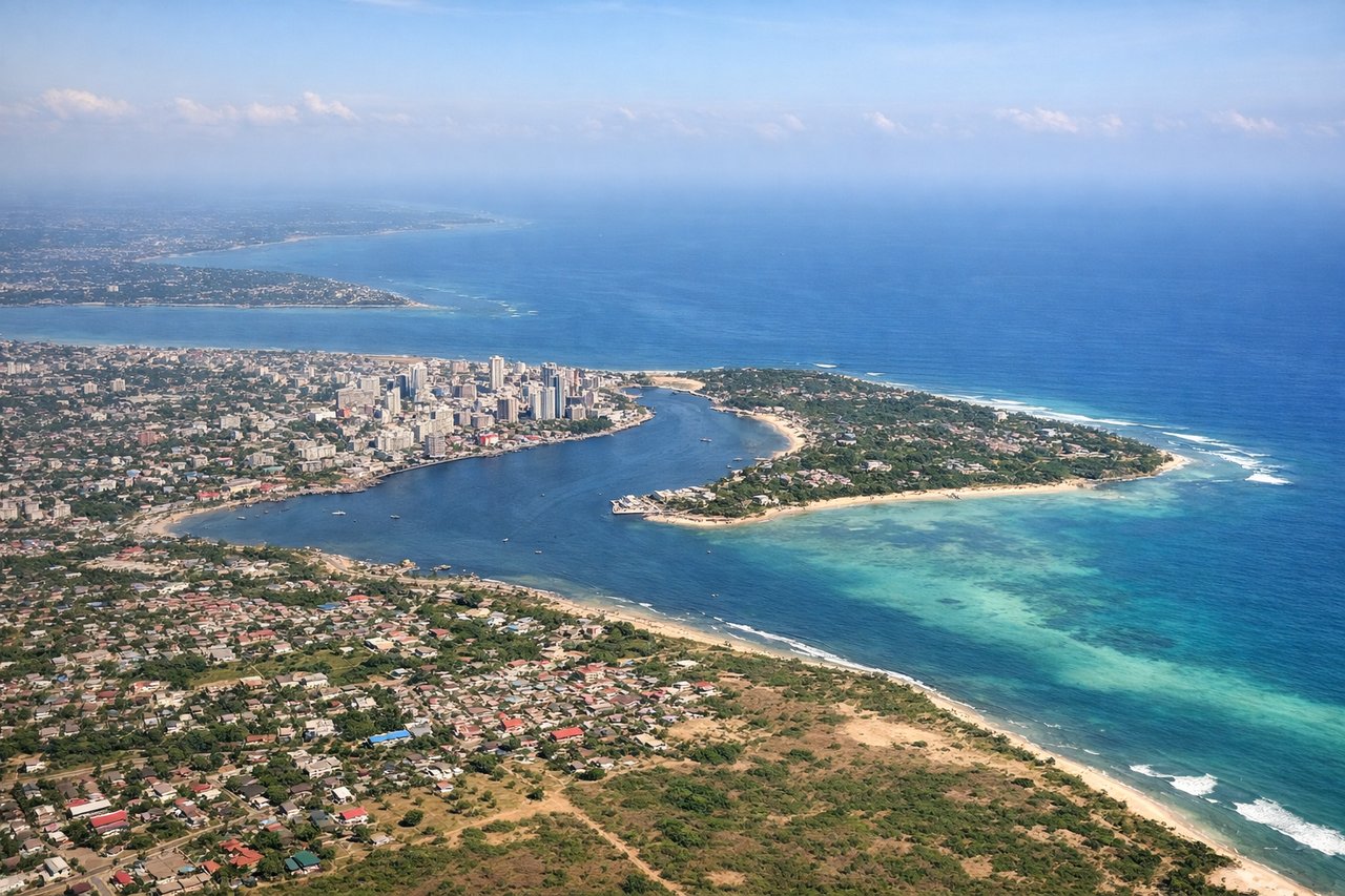
LEFTLeft-side seats provide the best views during descent into Dar es Salaam. The approach path brings the aircraft in from the west over the coastal plains, and left-side passengers see the Indian Ocean coastline, Dar's harbor, and the city's waterfront development as the plane descends toward Julius Nyerere International Airport.
Landmarks on this routeAll landmarks →
Will your flight be in sunlight?
See exactly which side of the plane gets sun and shade at your departure time.
About This Route
Which side of the plane should I sit on flying from Arusha (ARK) to Dar Es Salaam (DAR)?
Sit on the Left side of the plane for the best views on flights from Arusha to Dar Es Salaam. While takeoff offers volcanic scenery, the landing approach provides superior views of the Indian Ocean, Dar's harbor, and coastal geography. The left side captures the most dramatic and varied scenery for this route.
What can I see during takeoff from Arusha in Arusha?
During takeoff from Arusha (ARK), sit on the Right side for the best views. Right-side seats capture the immediate climb-out view of Mount Mawenzi and the broader Arusha region. The aircraft departs eastward toward Dar es Salaam, so right-side passengers see the volcanic peaks and surrounding plateau terrain as the plane gains altitude. Notable sights include: Mount Mawenzi (5,149 m, eastern peak of Kilimanjaro massif), Mount Meru (4,566 m, prominent standalone volcano west of Arusha), Arusha town and surrounding agricultural plateau, Arusha National Park foothills.
What can I see when landing at Dar Es Salaam in Dar Es Salaam?
When landing at Dar Es Salaam (DAR), sit on the Left side for the best views. Left-side seats provide the best views during descent into Dar es Salaam. The approach path brings the aircraft in from the west over the coastal plains, and left-side passengers see the Indian Ocean coastline, Dar's harbor, and the city's waterfront development as the plane descends toward Julius Nyerere International Airport. Notable sights include: Indian Ocean and Dar es Salaam harbor, Zanzibar Channel (visible as the water body separating the mainland from Zanzibar Island to the east), Dar es Salaam city waterfront and port facilities, coastal mangrove forests and sandy beaches.
How long is the flight from Arusha to Dar Es Salaam?
The flight from Arusha (ARK) to Dar Es Salaam (DAR) takes Approximately 1 hour to 1 hour 15 minutes.
What does the Arusha to Dar Es Salaam flight path pass over?
The flight path crosses the Tanzanian plateau and descends toward the coastal plains. Notable midpoint features include the gradual transition from highland terrain (around 1,200-1,500 m elevation) to lowland coastal plains, scattered towns and agricultural areas in the central region, and the Uluguru Mountains visible to the south as the aircraft approaches the coast. The Rufiji River delta becomes visible in the final descent phase as a distinctive braided water system on the coastal plain.