While Athens departure offers moderate coastal and mountain scenery, Perth's approach provides superior visual interest with the Swan River's dramatic meanders, urban skyline, and coastal geography. The full flight is dominated by 14+ hours of open Indian Ocean (scoring maximum 2.0 for ocean-only segments), making the landing experience the decisive factor. Right side captures Perth's arrival drama more effectively than left side captures Athens departure.
Flown ATH to PER? Did we get it right?
Flight Path
Athens to Perth is 7,629 miles (12,278 km), a flight of about 14 hours 25 minutes.
The flight crosses the Arabian Sea, Arabian Peninsula (Oman coast visible on southern routing), Indian Ocean, and approaches Australia over the Timor Sea. No dramatic mountain ranges or island chains are visible during the 14+ hour cruise phase over open ocean. The route typically passes south of the Indian subcontinent and Sri Lanka, then crosses the vast expanse of the Indian Ocean with no significant landmarks visible from cruise altitude until approaching Western Australia's coast near Exmouth Peninsula or further south near the Abrolhos Islands.
Great circle distance and headings ›Phase by phase
Takeoff from ATH
LEFTLeft side captures Athens' coastal geography during departure. Aircraft typically climb northeastward from runway 03L/03R, offering views of the Saronic Gulf, Attica coastline, and the Hymettus and Penteli mountain ranges framing the city. Right side faces inland toward central Greece with less dramatic terrain.
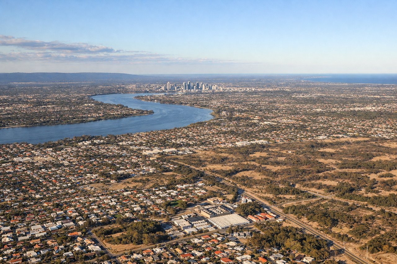
Landing at PER
RIGHTRight side offers superior approach scenery into Perth. Aircraft descending toward runway 21 (typical afternoon operations) approach from the northeast over the Swan River estuary and Indian Ocean. Right-side passengers see the Swan River's distinctive meanders, the city skyline of Perth's central business district, and the coastal geography of the Darling Range foothills. Left side faces open Indian Ocean for most of the descent.
Will your flight be in sunlight?
Pick a date and time in the Sun Map to watch the sun move across your whole flight.
About This Route
Which side of the plane should I sit on flying from Athens International Eleftherios Venizelos (ATH) to Perth International (PER)?
Sit on the Right side of the plane for the best views on flights from Athens to Perth. While Athens departure offers moderate coastal and mountain scenery, Perth's approach provides superior visual interest with the Swan River's dramatic meanders, urban skyline, and coastal geography. The full flight is dominated by 14+ hours of open Indian Ocean (scoring maximum 2.0 for ocean-only segments), making the landing experience the decisive factor. Right side captures Perth's arrival drama more effectively than left side captures Athens departure.
What can I see during takeoff from Athens International Eleftherios Venizelos in Athens?
During takeoff from Athens International Eleftherios Venizelos (ATH), sit on the Left side for the best views. Left side captures Athens' coastal geography during departure. Aircraft typically climb northeastward from runway 03L/03R, offering views of the Saronic Gulf, Attica coastline, and the Hymettus and Penteli mountain ranges framing the city. Right side faces inland toward central Greece with less dramatic terrain. Notable sights include: Saronic Gulf coastline, Hymettus Mountains (southeast of Athens), Penteli Mountains (north), Athens urban sprawl and Piraeus harbor.
What can I see when landing at Perth International in Perth?
When landing at Perth International (PER), sit on the Right side for the best views. Right side offers superior approach scenery into Perth. Aircraft descending toward runway 21 (typical afternoon operations) approach from the northeast over the Swan River estuary and Indian Ocean. Right-side passengers see the Swan River's distinctive meanders, the city skyline of Perth's central business district, and the coastal geography of the Darling Range foothills. Left side faces open Indian Ocean for most of the descent. Notable sights include: Swan River estuary and meanders, Perth central business district skyline, Darling Range foothills, Rottnest Island (visible on clear days during approach).
How long is the flight from Athens to Perth?
The flight from Athens International Eleftherios Venizelos (ATH) to Perth International (PER) takes about 14 hours 25 minutes. The shortest flight path between them is 7,629 miles (12,278 km); winds and air traffic control usually add a few percent.
What does the Athens to Perth flight path pass over?
The flight crosses the Arabian Sea, Arabian Peninsula (Oman coast visible on southern routing), Indian Ocean, and approaches Australia over the Timor Sea. No dramatic mountain ranges or island chains are visible during the 14+ hour cruise phase over open ocean. The route typically passes south of the Indian subcontinent and Sri Lanka, then crosses the vast expanse of the Indian Ocean with no significant landmarks visible from cruise altitude until approaching Western Australia's coast near Exmouth Peninsula or further south near the Abrolhos Islands.