Atlanta to Savannah is 214 miles (345 km), a flight of about 1 hour 5 minutes.
While the takeoff side offers a brief glimpse of Stone Mountain, the landing side into Savannah delivers a longer, richer sequence of river, historic city, and marsh-to-coast scenery, giving the right side the edge over the full flight.
Flight Path
Middle Georgia's Piedmont-to-coastal-plain transition near Macon, forested farmland, and the Ocmulgee and Oconee River valleys beneath the flight path.
Great circle distance and headings ›Phase by phase
Takeoff from ATL
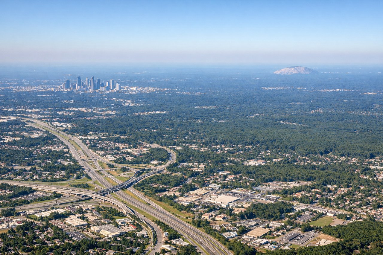
LEFTDeparting ATL eastbound puts Stone Mountain's distinctive granite dome, about 20 miles northeast of the airport, in view on the left side during initial climb. The right side over this same period shows only Atlanta's southern suburbs and flat Piedmont terrain.
Landing at SAV
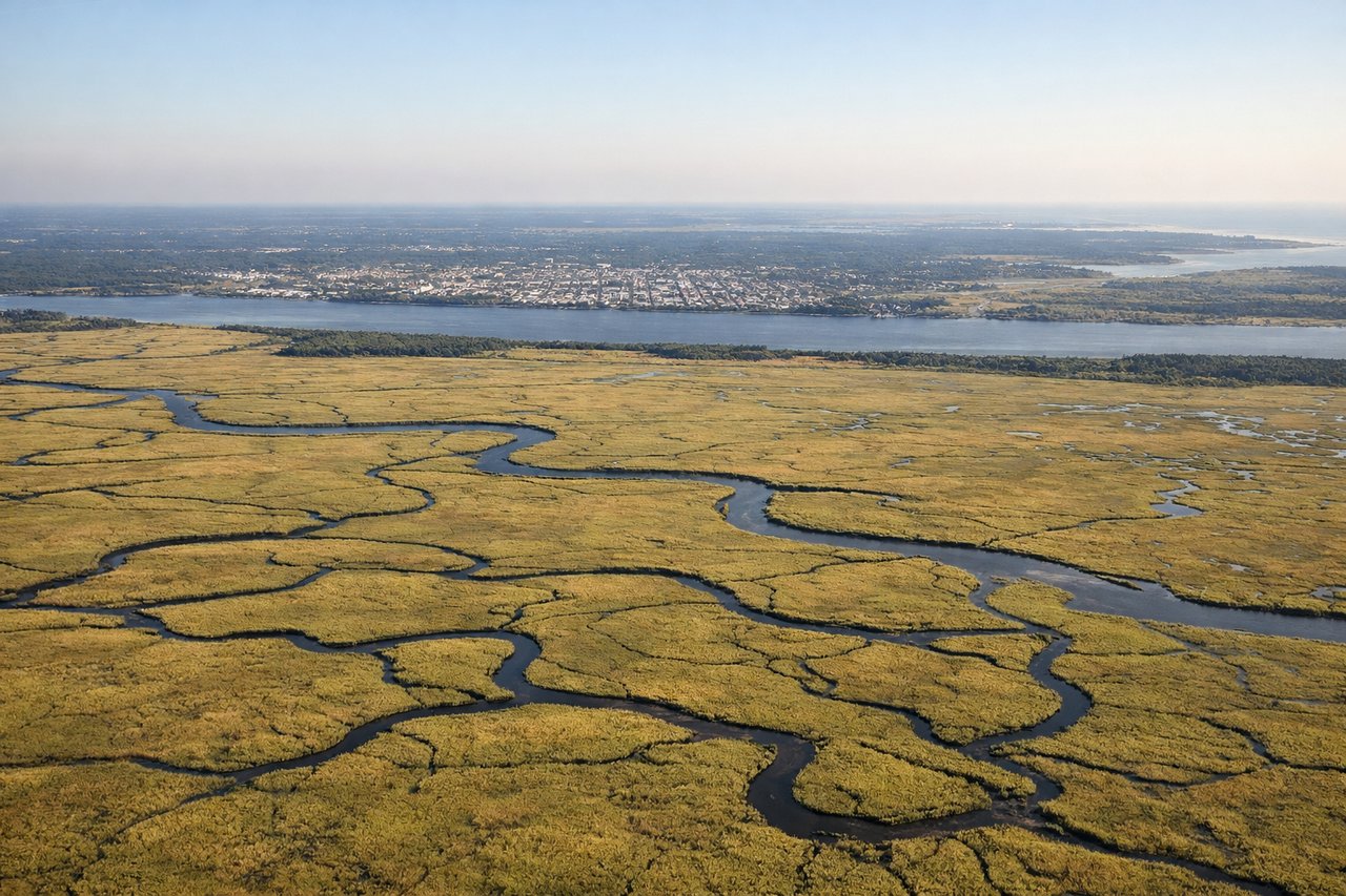
RIGHTOn the approach into Savannah, the flight path passes just north of the historic downtown, giving right-side passengers a view of the Savannah River, the old city grid, and the salt marshes that stretch toward the Atlantic coast. The left side during this same descent shows only inland farmland and pine forest.
Landmarks on this routeAll landmarks →
Will your flight be in sunlight?
Pick a date and time in the Sun Map to watch the sun move across your whole flight.
About This Route
Which side of the plane should I sit on flying from The William B Hartsfield Atlanta International (ATL) to Savannah Hilton Head International (SAV)?
Sit on the Right side of the plane for the best views on flights from Atlanta to Savannah. While the takeoff side offers a brief glimpse of Stone Mountain, the landing side into Savannah delivers a longer, richer sequence of river, historic city, and marsh-to-coast scenery, giving the right side the edge over the full flight.
What can I see during takeoff from The William B Hartsfield Atlanta International in Atlanta?
During takeoff from The William B Hartsfield Atlanta International (ATL), sit on the Left side for the best views. Departing ATL eastbound puts Stone Mountain's distinctive granite dome, about 20 miles northeast of the airport, in view on the left side during initial climb. The right side over this same period shows only Atlanta's southern suburbs and flat Piedmont terrain. Notable sights include: Stone Mountain granite dome, Atlanta suburban sprawl, Piedmont rolling hills.
What can I see when landing at Savannah Hilton Head International in Savannah?
When landing at Savannah Hilton Head International (SAV), sit on the Right side for the best views. On the approach into Savannah, the flight path passes just north of the historic downtown, giving right-side passengers a view of the Savannah River, the old city grid, and the salt marshes that stretch toward the Atlantic coast. The left side during this same descent shows only inland farmland and pine forest. Notable sights include: Savannah River, historic downtown Savannah waterfront, coastal salt marshes, Savannah port cranes.
How long is the flight from Atlanta to Savannah?
The flight from The William B Hartsfield Atlanta International (ATL) to Savannah Hilton Head International (SAV) takes about 1 hour 5 minutes. The shortest flight path between them is 214 miles (345 km); winds and air traffic control usually add a few percent.
What does the Atlanta to Savannah flight path pass over?
Middle Georgia's Piedmont-to-coastal-plain transition near Macon, forested farmland, and the Ocmulgee and Oconee River valleys beneath the flight path.