Oranjestad to Bogota is 608 miles (979 km), a flight of about 1 hour 55 minutes.
While takeoff offers Caribbean views, the landing approach into Bogota provides the most dramatic and sustained visual experience. The Andes cordillera during descent is geographically significant and visually commanding, making left-side seats the better overall choice for this route.
Flight Path
The flight path crosses the Caribbean, then tracks southwest over the Maracaibo Basin and Venezuelan lowlands. You'll pass east of Lake Maracaibo (visible from altitude as a large inland water body). The landscape transitions from coastal plains to the foothills of the Andes as you approach Colombian airspace. The Cordillera Occidental (Western Range) becomes visible on the left around 90 minutes into flight. The final hour shows progressive elevation gain as you approach the high plateau where Bogota sits at 2,640 meters.
Great circle distance and headings ›
.jpg?width=600)
Phase by phase
Takeoff from AUA
RIGHTAruba's runway 10/28 typically uses 10 for departures heading northeast. Right-side seats face the Caribbean Sea and the Venezuelan coast across the horizon. You'll see the island's southern coastline recede while tracking toward the South American mainland.
Landing at BOG
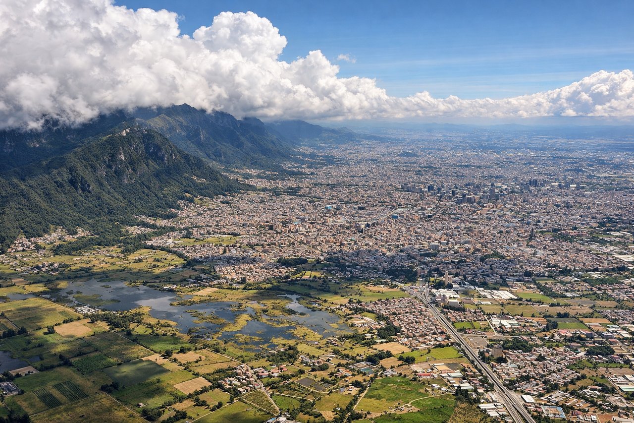
LEFTBogota's primary runway is 10L/28R; approach typically uses 10L from the north. Left-side seats face west and southwest, giving views of the Andes' eastern cordillera as you descend into the valley. The mountain wall is dramatic and unmissable during final approach.
Landmarks on this routeAll landmarks →
Will your flight be in sunlight?
Pick a date and time in the Sun Map to watch the sun move across your whole flight.
About This Route
Which side of the plane should I sit on flying from Reina Beatrix International (AUA) to Eldorado International (BOG)?
Sit on the Left side of the plane for the best views on flights from Oranjestad to Bogota. While takeoff offers Caribbean views, the landing approach into Bogota provides the most dramatic and sustained visual experience. The Andes cordillera during descent is geographically significant and visually commanding, making left-side seats the better overall choice for this route.
What can I see during takeoff from Reina Beatrix International in Oranjestad?
During takeoff from Reina Beatrix International (AUA), sit on the Right side for the best views. Aruba's runway 10/28 typically uses 10 for departures heading northeast. Right-side seats face the Caribbean Sea and the Venezuelan coast across the horizon. You'll see the island's southern coastline recede while tracking toward the South American mainland. Notable sights include: Caribbean Sea (immediate), Aruba's southern shore and Oranjestad district, Paraguaná Peninsula (Venezuela, distant on horizon), Coro region coastline.
What can I see when landing at Eldorado International in Bogota?
When landing at Eldorado International (BOG), sit on the Left side for the best views. Bogota's primary runway is 10L/28R; approach typically uses 10L from the north. Left-side seats face west and southwest, giving views of the Andes' eastern cordillera as you descend into the valley. The mountain wall is dramatic and unmissable during final approach. Notable sights include: Cordillera Oriental (Eastern Range of Colombian Andes), Bogota's urban sprawl across the high plateau, Monserrate peak (east of city center), Tequendama Falls region (south).
How long is the flight from Oranjestad to Bogota?
The flight from Reina Beatrix International (AUA) to Eldorado International (BOG) takes about 1 hour 55 minutes. The shortest flight path between them is 608 miles (979 km); winds and air traffic control usually add a few percent.
What does the Oranjestad to Bogota flight path pass over?
The flight path crosses the Caribbean, then tracks southwest over the Maracaibo Basin and Venezuelan lowlands. You'll pass east of Lake Maracaibo (visible from altitude as a large inland water body). The landscape transitions from coastal plains to the foothills of the Andes as you approach Colombian airspace. The Cordillera Occidental (Western Range) becomes visible on the left around 90 minutes into flight. The final hour shows progressive elevation gain as you approach the high plateau where Bogota sits at 2,640 meters.