Bogota to Oranjestad is 608 miles (979 km), a flight of about 1 hour 55 minutes.
The takeoff climb-out from Bogotá offers more dramatic and sustained scenery with the Cordillera Oriental mountains. While the landing approach over the Caribbean is scenic, the takeoff provides greater visual variety and more distinctive geological features.
Flight Path
The flight path crosses the Caribbean Sea northwest of Venezuela. Notable features include the Maracaibo Basin region (visible as you pass west of the Paraguaná Peninsula), the open Caribbean waters with occasional cloud formations, and the gradual transition from the mountainous Colombian interior to the flat, arid northern coast of South America. Curaçao and Bonaire islands may be visible to the south during clear conditions in the mid-flight phase.
Great circle distance and headings ›.jpg?width=600)

Phase by phase
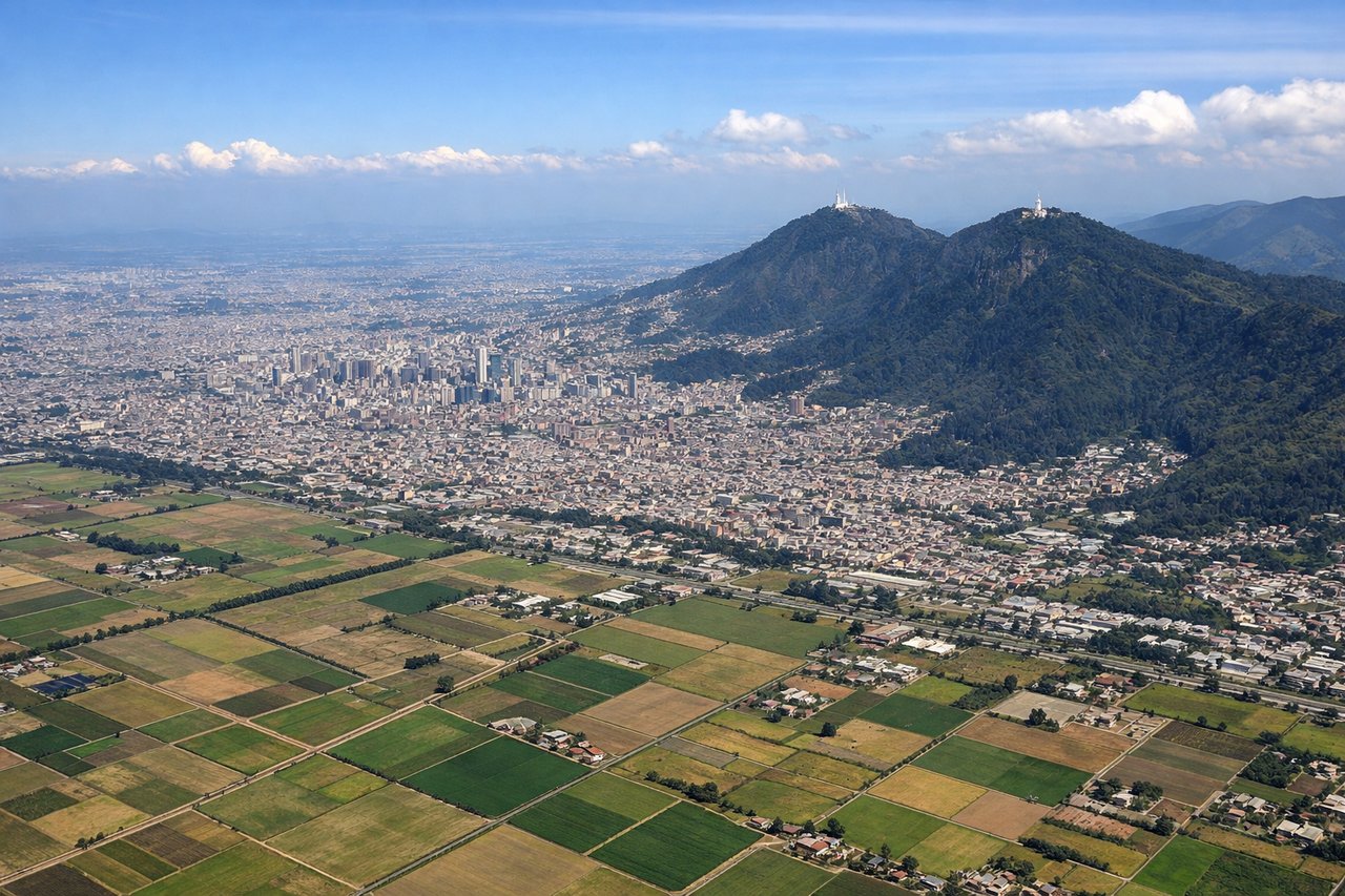
Takeoff from BOG
RIGHTRight-side seats offer views of the Cordillera Oriental (Eastern Range) of the Colombian Andes as the aircraft climbs northwestward from Bogotá. The mountains dominate the eastern horizon during initial climb-out and provide dramatic relief against the high-altitude plateau.
Landing at AUA
LEFTLeft-side seats provide unobstructed views of the Caribbean Sea and the northern coast of South America as the aircraft descends toward Aruba from the southeast. The turquoise waters and the contrast between ocean and the arid landscape of the Paraguaná Peninsula (Venezuela) are striking during final approach.
Landmarks on this routeAll landmarks →
Will your flight be in sunlight?
Pick a date and time in the Sun Map to watch the sun move across your whole flight.
About This Route
Which side of the plane should I sit on flying from Eldorado International (BOG) to Reina Beatrix International (AUA)?
Sit on the Right side of the plane for the best views on flights from Bogota to Oranjestad. The takeoff climb-out from Bogotá offers more dramatic and sustained scenery with the Cordillera Oriental mountains. While the landing approach over the Caribbean is scenic, the takeoff provides greater visual variety and more distinctive geological features.
What can I see during takeoff from Eldorado International in Bogota?
During takeoff from Eldorado International (BOG), sit on the Right side for the best views. Right-side seats offer views of the Cordillera Oriental (Eastern Range) of the Colombian Andes as the aircraft climbs northwestward from Bogotá. The mountains dominate the eastern horizon during initial climb-out and provide dramatic relief against the high-altitude plateau. Notable sights include: Cordillera Oriental (Eastern Range of Colombian Andes), Bogotá city sprawl receding below, Sabana de Bogotá (high plateau), Monserrate peak visible to the east.
What can I see when landing at Reina Beatrix International in Oranjestad?
When landing at Reina Beatrix International (AUA), sit on the Left side for the best views. Left-side seats provide unobstructed views of the Caribbean Sea and the northern coast of South America as the aircraft descends toward Aruba from the southeast. The turquoise waters and the contrast between ocean and the arid landscape of the Paraguaná Peninsula (Venezuela) are striking during final approach. Notable sights include: Caribbean Sea (turquoise waters), Paraguaná Peninsula (Venezuela, arid lowlands), Aruba's flat terrain and distinctive shape, Curaçao visible to the south on clear days.
How long is the flight from Bogota to Oranjestad?
The flight from Eldorado International (BOG) to Reina Beatrix International (AUA) takes about 1 hour 55 minutes. The shortest flight path between them is 608 miles (979 km); winds and air traffic control usually add a few percent.
What does the Bogota to Oranjestad flight path pass over?
The flight path crosses the Caribbean Sea northwest of Venezuela. Notable features include the Maracaibo Basin region (visible as you pass west of the Paraguaná Peninsula), the open Caribbean waters with occasional cloud formations, and the gradual transition from the mountainous Colombian interior to the flat, arid northern coast of South America. Curaçao and Bonaire islands may be visible to the south during clear conditions in the mid-flight phase.