While the left seat wins at takeoff for the Austin cityscape, the right seat delivers the more dramatic payoff on arrival with the Atlanta skyline and Stone Mountain on approach. For the cruise portion heading northeast, the right side also tracks closer to the Mississippi-Alabama border terrain and the Talladega National Forest ridgelines in Alabama, making it the better overall seat for the full journey.
Flight Path
The flight tracks northeast across East Texas, crossing the Sabine River into Louisiana briefly or clipping the northwest corner, then across Mississippi and Alabama. Visible features include the pine forests of East Texas and western Louisiana, the broad Mississippi River crossing near Vicksburg or Jackson MS area, the red clay farmland and pine forests of central Alabama, and the Talladega National Forest ridgelines in east-central Alabama before descending into the Georgia Piedmont.
Great circle distance and headings ›
.jpeg?width=600)
Phase by phase
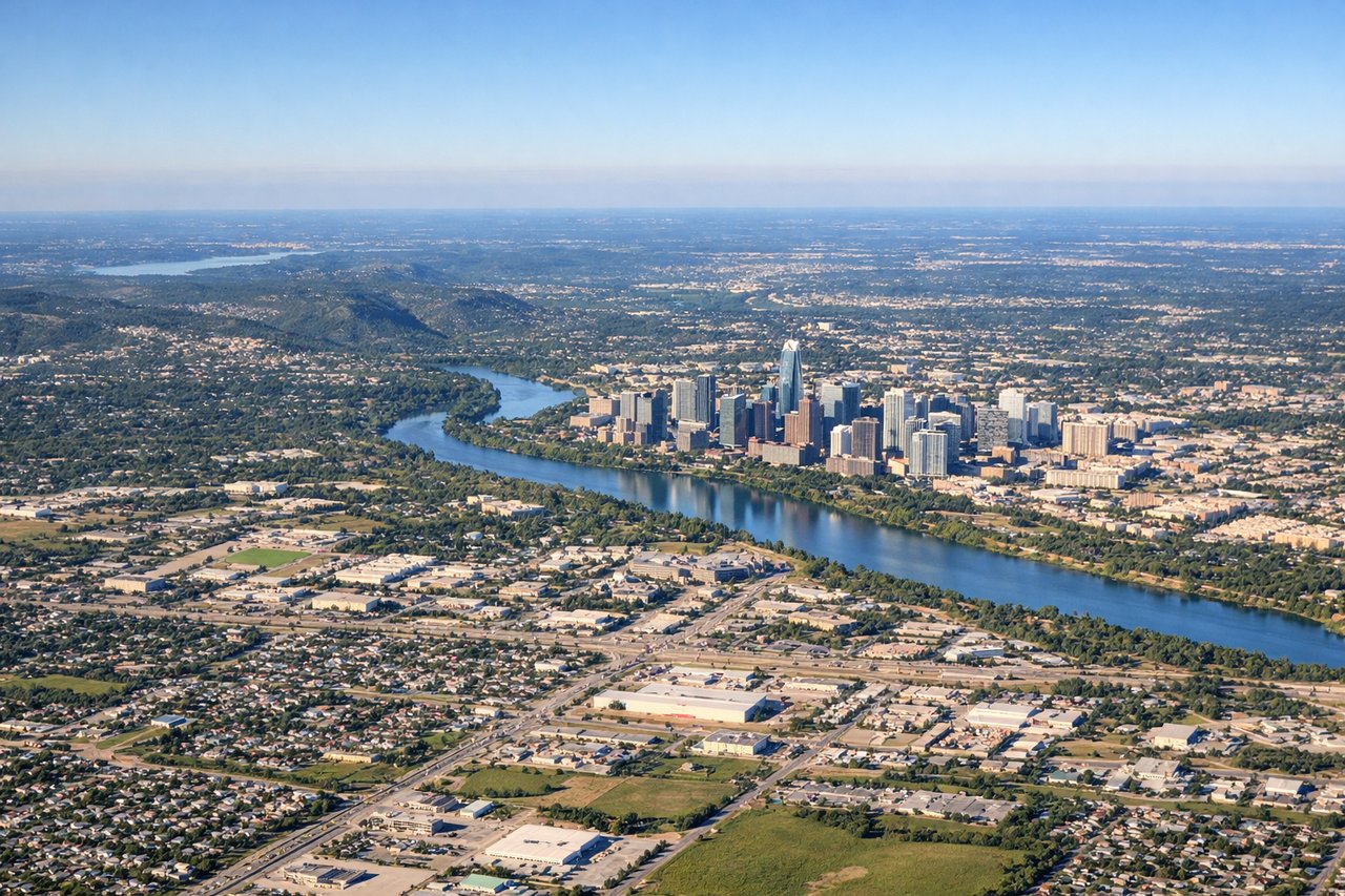
Takeoff from AUS
LEFTABIA typically departs eastbound on runway 17L/35R or 17R/35L. On a northeast-bound departure toward Atlanta, a left-side seat gives you a view back over downtown Austin, the Colorado River, and Lady Bird Lake as the aircraft climbs and turns northeast. The right side faces largely undeveloped scrubland southeast of the airport.

Landing at ATL
RIGHTAtlanta Hartsfield-Jackson typically uses its parallel runways oriented roughly 09L/27R and 10/28, with arrivals commonly from the west or northwest. Approaching from the west-southwest on a standard approach, the right side of the aircraft faces north, giving views over downtown Atlanta, Midtown, and the broader metro grid. The left side looks south toward less distinctive suburban sprawl.
Landmarks on this routeAll landmarks →
Will your flight be in sunlight?
See exactly which side of the plane gets sun and shade at your departure time.
About This Route
Which side of the plane should I sit on flying from Austin Bergstrom International (AUS) to The William B Hartsfield Atlanta International (ATL)?
Sit on the Right side of the plane for the best views on flights from Austin to Atlanta. While the left seat wins at takeoff for the Austin cityscape, the right seat delivers the more dramatic payoff on arrival with the Atlanta skyline and Stone Mountain on approach. For the cruise portion heading northeast, the right side also tracks closer to the Mississippi-Alabama border terrain and the Talladega National Forest ridgelines in Alabama, making it the better overall seat for the full journey.
What can I see during takeoff from Austin Bergstrom International in Austin?
During takeoff from Austin Bergstrom International (AUS), sit on the Left side for the best views. ABIA typically departs eastbound on runway 17L/35R or 17R/35L. On a northeast-bound departure toward Atlanta, a left-side seat gives you a view back over downtown Austin, the Colorado River, and Lady Bird Lake as the aircraft climbs and turns northeast. The right side faces largely undeveloped scrubland southeast of the airport. Notable sights include: Lady Bird Lake and the Colorado River bends, downtown Austin skyline, Lake Walter E. Long to the northeast, Texas Hill Country terrain to the west receding into the distance.
What can I see when landing at The William B Hartsfield Atlanta International in Atlanta?
When landing at The William B Hartsfield Atlanta International (ATL), sit on the Right side for the best views. Atlanta Hartsfield-Jackson typically uses its parallel runways oriented roughly 09L/27R and 10/28, with arrivals commonly from the west or northwest. Approaching from the west-southwest on a standard approach, the right side of the aircraft faces north, giving views over downtown Atlanta, Midtown, and the broader metro grid. The left side looks south toward less distinctive suburban sprawl. Notable sights include: Downtown Atlanta skyline and Midtown high-rises, Stone Mountain visible to the northeast as a distinctive granite dome, Lake Allatoona to the northwest, the broad Chattahoochee River corridor.
How long is the flight from Austin to Atlanta?
The flight from Austin Bergstrom International (AUS) to The William B Hartsfield Atlanta International (ATL) takes Approximately 2 hours 10 minutes.
What does the Austin to Atlanta flight path pass over?
The flight tracks northeast across East Texas, crossing the Sabine River into Louisiana briefly or clipping the northwest corner, then across Mississippi and Alabama. Visible features include the pine forests of East Texas and western Louisiana, the broad Mississippi River crossing near Vicksburg or Jackson MS area, the red clay farmland and pine forests of central Alabama, and the Talladega National Forest ridgelines in east-central Alabama before descending into the Georgia Piedmont.