The right side wins both the departure and arrival sequences: Atlanta's skyline on takeoff and Austin's skyline plus Lake Travis and the Hill Country on landing. The left side offers comparatively flat, featureless farmland throughout most of the flight.
Flight Path
The route crosses the Mississippi River near Vicksburg, then passes over the Piney Woods of northern Louisiana and East Texas before flattening into the Texas Blackland Prairie approaching Austin.
Great circle distance and headings ›.jpeg?width=600)

Phase by phase

Takeoff from ATL
RIGHTATL sits just south of downtown Atlanta, so a westbound departure puts the city's skyline and the wooded Piedmont hills off the right (north) side as the aircraft climbs out. The left side mostly shows suburban sprawl with no distinctive landmarks.
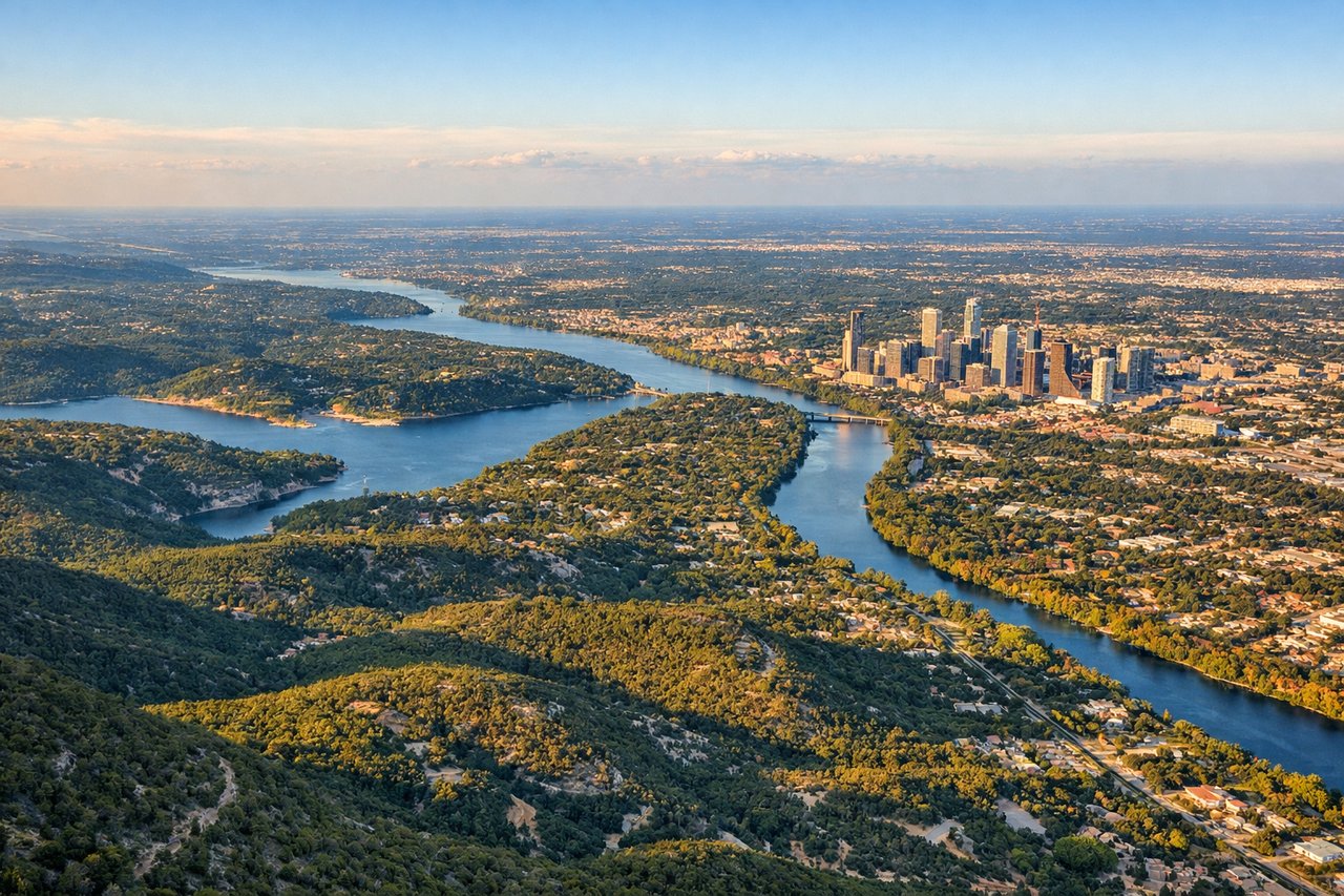
Landing at AUS
RIGHTArrivals into AUS from the northeast typically get vectored for a southbound approach to runway 18, putting Lake Travis, the Texas Hill Country, and downtown Austin's skyline on the right (west) side of the cabin during descent. The left side shows only flat farmland east of the city.
Landmarks on this routeAll landmarks →
Will your flight be in sunlight?
See exactly which side of the plane gets sun and shade at your departure time.
About This Route
Which side of the plane should I sit on flying from The William B Hartsfield Atlanta International (ATL) to Austin Bergstrom International (AUS)?
Sit on the Right side of the plane for the best views on flights from Atlanta to Austin. The right side wins both the departure and arrival sequences: Atlanta's skyline on takeoff and Austin's skyline plus Lake Travis and the Hill Country on landing. The left side offers comparatively flat, featureless farmland throughout most of the flight.
What can I see during takeoff from The William B Hartsfield Atlanta International in Atlanta?
During takeoff from The William B Hartsfield Atlanta International (ATL), sit on the Right side for the best views. ATL sits just south of downtown Atlanta, so a westbound departure puts the city's skyline and the wooded Piedmont hills off the right (north) side as the aircraft climbs out. The left side mostly shows suburban sprawl with no distinctive landmarks. Notable sights include: Downtown Atlanta skyline, Hartsfield-Jackson's runway complex, Chattahoochee River, Piedmont foothills.
What can I see when landing at Austin Bergstrom International in Austin?
When landing at Austin Bergstrom International (AUS), sit on the Right side for the best views. Arrivals into AUS from the northeast typically get vectored for a southbound approach to runway 18, putting Lake Travis, the Texas Hill Country, and downtown Austin's skyline on the right (west) side of the cabin during descent. The left side shows only flat farmland east of the city. Notable sights include: Lake Travis, Texas Hill Country, Austin downtown skyline, Colorado River.
How long is the flight from Atlanta to Austin?
The flight from The William B Hartsfield Atlanta International (ATL) to Austin Bergstrom International (AUS) takes 2h 15m.
What does the Atlanta to Austin flight path pass over?
The route crosses the Mississippi River near Vicksburg, then passes over the Piney Woods of northern Louisiana and East Texas before flattening into the Texas Blackland Prairie approaching Austin.