While takeoff offers coastal and delta views, the landing approach provides more dramatic and sustained scenery. The Cordillera Oriental's mountain ridges, valleys, and the high-altitude plateau surrounding Bogota create more visually distinctive features than the relatively flat coastal terrain at departure.
Flown BAQ to BOG? Did we get it right?
Flight Path
Barranquilla to Bogota is 430 miles (692 km), a flight of about 1 hour 15 minutes.
The flight path crosses the Magdalena River valley inland, passing over transitional terrain between coastal lowlands and the foothills of the Cordillera Oriental. At cruise altitude (around 25,000 feet), passengers may glimpse the Sierra Nevada de Santa Marta to the east-northeast during early climb, and the gradual rise of Andean foothills becomes visible as the aircraft approaches Bogota's high plateau region. The terrain transitions from flat alluvial plains to increasingly rugged mountainous topography with visible river valleys and ridge systems.
Great circle distance and headings ›

Phase by phase
Takeoff from BAQ
RIGHTRight-side seats capture the Caribbean coastline and Magdalena River delta as the aircraft climbs southwestward from Barranquilla. The river's distinctive braided channels and coastal wetlands are prominent during the initial climb phase.
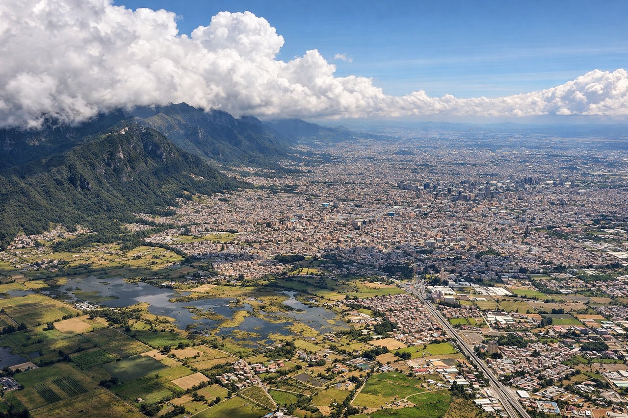
Landing at BOG
LEFTLeft-side seats provide excellent views of the Cordillera Oriental (Eastern Range) of the Colombian Andes as the aircraft descends into Bogota from the north. The mountain ridges and valleys become increasingly prominent during final approach, with the high plateau visible before landing.
Will your flight be in sunlight?
Pick a date and time in the Sun Map to watch the sun move across your whole flight.
About This Route
Which side of the plane should I sit on flying from Ernesto Cortissoz (BAQ) to Eldorado International (BOG)?
Sit on the Left side of the plane for the best views on flights from Barranquilla to Bogota. While takeoff offers coastal and delta views, the landing approach provides more dramatic and sustained scenery. The Cordillera Oriental's mountain ridges, valleys, and the high-altitude plateau surrounding Bogota create more visually distinctive features than the relatively flat coastal terrain at departure.
What can I see during takeoff from Ernesto Cortissoz in Barranquilla?
During takeoff from Ernesto Cortissoz (BAQ), sit on the Right side for the best views. Right-side seats capture the Caribbean coastline and Magdalena River delta as the aircraft climbs southwestward from Barranquilla. The river's distinctive braided channels and coastal wetlands are prominent during the initial climb phase. Notable sights include: Magdalena River delta with multiple channels, Caribbean Sea coastline, Barranquilla city grid, mangrove wetland systems.
What can I see when landing at Eldorado International in Bogota?
When landing at Eldorado International (BOG), sit on the Left side for the best views. Left-side seats provide excellent views of the Cordillera Oriental (Eastern Range) of the Colombian Andes as the aircraft descends into Bogota from the north. The mountain ridges and valleys become increasingly prominent during final approach, with the high plateau visible before landing. Notable sights include: Cordillera Oriental mountain range, Bogota's high-altitude plateau (2,640 m), Río Magdalena valley system, agricultural terraced valleys.
How long is the flight from Barranquilla to Bogota?
The flight from Ernesto Cortissoz (BAQ) to Eldorado International (BOG) takes about 1 hour 15 minutes. The shortest flight path between them is 430 miles (692 km); winds and air traffic control usually add a few percent.
What does the Barranquilla to Bogota flight path pass over?
The flight path crosses the Magdalena River valley inland, passing over transitional terrain between coastal lowlands and the foothills of the Cordillera Oriental. At cruise altitude (around 25,000 feet), passengers may glimpse the Sierra Nevada de Santa Marta to the east-northeast during early climb, and the gradual rise of Andean foothills becomes visible as the aircraft approaches Bogota's high plateau region. The terrain transitions from flat alluvial plains to increasingly rugged mountainous topography with visible river valleys and ridge systems.