Bacolod to Manila is 291 miles (468 km), a flight of about 1 hour 15 minutes.
While the takeoff favors the right side with Mt. Kanlaon's volcanic profile, the left side wins overall because the Manila approach delivers a much stronger visual payoff — Taal Volcano's crater lake followed by the sweeping Manila Bay and city skyline, a more memorable sequence than the cruise-phase views on either side.
Flight Path
The route crosses the Sibuyan Sea and passes near Romblon and Marinduque islands before tracking along the Verde Island Passage toward the Batangas coast and Manila Bay.
Great circle distance and headings ›Phase by phase
Takeoff from BCD
RIGHTDeparting Bacolod, the right (east) side offers a good look at Negros Island's central mountain spine, dominated by Mt. Kanlaon volcano, as the aircraft climbs away from the coast. The left side mostly shows the flat Guimaras Strait and open water toward Panay.
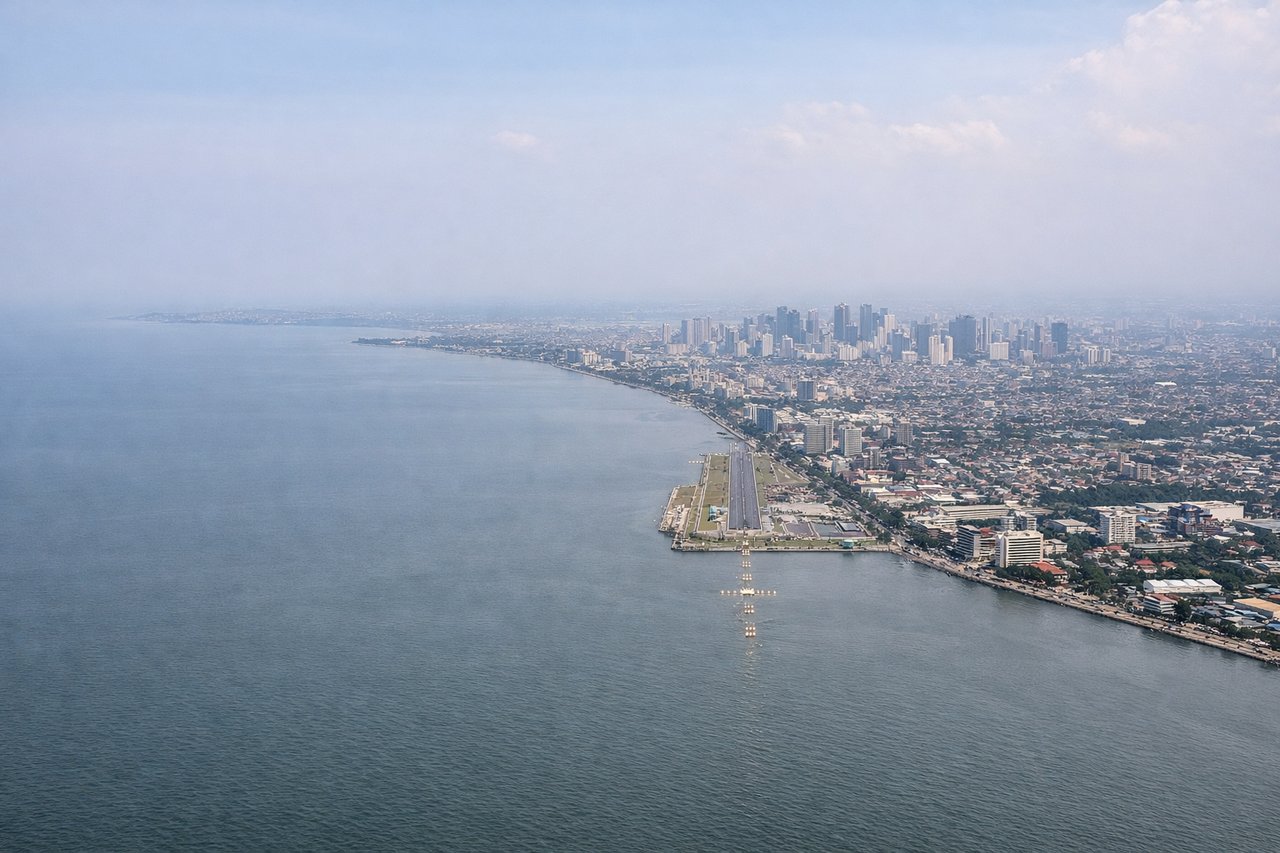
Landing at MNL
LEFTOn approach into Manila from the south, the left (west) side reveals Taal Volcano's crater lake near Batangas and then the wide sweep of Manila Bay with the city skyline as the plane lines up for landing. The right side mostly shows the flatter, less distinctive terrain of Laguna and Rizal provinces.
Landmarks on this routeAll landmarks →
Will your flight be in sunlight?
Pick a date and time in the Sun Map to watch the sun move across your whole flight.
About This Route
Which side of the plane should I sit on flying from Bacolod-Silay International Airport (BCD) to Ninoy Aquino International (MNL)?
Sit on the Left side of the plane for the best views on flights from Bacolod to Manila. While the takeoff favors the right side with Mt. Kanlaon's volcanic profile, the left side wins overall because the Manila approach delivers a much stronger visual payoff — Taal Volcano's crater lake followed by the sweeping Manila Bay and city skyline, a more memorable sequence than the cruise-phase views on either side.
What can I see during takeoff from Bacolod-Silay International Airport in Bacolod?
During takeoff from Bacolod-Silay International Airport (BCD), sit on the Right side for the best views. Departing Bacolod, the right (east) side offers a good look at Negros Island's central mountain spine, dominated by Mt. Kanlaon volcano, as the aircraft climbs away from the coast. The left side mostly shows the flat Guimaras Strait and open water toward Panay. Notable sights include: Mt. Kanlaon volcano, Negros Occidental mountain range, Guimaras Strait, Bacolod coastline.
What can I see when landing at Ninoy Aquino International in Manila?
When landing at Ninoy Aquino International (MNL), sit on the Left side for the best views. On approach into Manila from the south, the left (west) side reveals Taal Volcano's crater lake near Batangas and then the wide sweep of Manila Bay with the city skyline as the plane lines up for landing. The right side mostly shows the flatter, less distinctive terrain of Laguna and Rizal provinces. Notable sights include: Taal Volcano and crater lake, Manila Bay, Bataan Peninsula silhouette, Manila skyline.
How long is the flight from Bacolod to Manila?
The flight from Bacolod-Silay International Airport (BCD) to Ninoy Aquino International (MNL) takes about 1 hour 15 minutes. The shortest flight path between them is 291 miles (468 km); winds and air traffic control usually add a few percent.
What does the Bacolod to Manila flight path pass over?
The route crosses the Sibuyan Sea and passes near Romblon and Marinduque islands before tracking along the Verde Island Passage toward the Batangas coast and Manila Bay.