Bacolod to Kuala Lumpur is 1,563 miles (2,515 km), a flight of about 3 hours 40 minutes.
Takeoff offers more dramatic and varied geography (straits, multiple islands, open sea). Landing is dominated by urban sprawl with limited natural features. Right side captures the more geographically interesting departure sequence.
Flight Path
The flight path crosses the Sulu Sea and Celebes Sea. Midway, you'll pass east of Mindanao (Philippines) and west of Brunei. The Sulu Archipelago's scattered islands may be visible on clear days around the 1-hour mark. As you approach Malaysian airspace, the Sarawak coast becomes visible, with the Rajang River delta and coastal mangrove areas appearing before the final descent into the Klang Valley.
Great circle distance and headings ›Phase by phase
Takeoff from BCD
RIGHTBacolod typically departs to the north or northeast. Right-side seats offer views of Guimaras Strait and the northern coastline of Panay Island as you climb out, with the Visayan Sea spreading eastward.
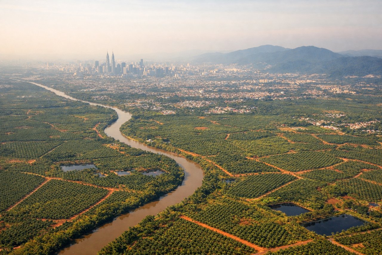
Landing at KUL
LEFTKuala Lumpur International typically uses runways aligned roughly north-south (02/20). Left-side seats during descent from the north offer views of the Klang Valley, Petronas Twin Towers area, and the approach over Selangor's coastal plains and wetlands before touchdown.
Will your flight be in sunlight?
Pick a date and time in the Sun Map to watch the sun move across your whole flight.
About This Route
Which side of the plane should I sit on flying from Bacolod-Silay International Airport (BCD) to Kuala Lumpur International (KUL)?
Sit on the Right side of the plane for the best views on flights from Bacolod to Kuala Lumpur. Takeoff offers more dramatic and varied geography (straits, multiple islands, open sea). Landing is dominated by urban sprawl with limited natural features. Right side captures the more geographically interesting departure sequence.
What can I see during takeoff from Bacolod-Silay International Airport in Bacolod?
During takeoff from Bacolod-Silay International Airport (BCD), sit on the Right side for the best views. Bacolod typically departs to the north or northeast. Right-side seats offer views of Guimaras Strait and the northern coastline of Panay Island as you climb out, with the Visayan Sea spreading eastward. Notable sights include: Guimaras Island (directly below during initial climb), Panay Island's northern coast, Visayan Sea, Negros Oriental coastline to the east.
What can I see when landing at Kuala Lumpur International in Kuala Lumpur?
When landing at Kuala Lumpur International (KUL), sit on the Left side for the best views. Kuala Lumpur International typically uses runways aligned roughly north-south (02/20). Left-side seats during descent from the north offer views of the Klang Valley, Petronas Twin Towers area, and the approach over Selangor's coastal plains and wetlands before touchdown. Notable sights include: Klang Valley urban sprawl, Petronas Twin Towers and Kuala Lumpur skyline, Selangor coastal plains and mangrove areas, Langat River delta.
How long is the flight from Bacolod to Kuala Lumpur?
The flight from Bacolod-Silay International Airport (BCD) to Kuala Lumpur International (KUL) takes about 3 hours 40 minutes. The shortest flight path between them is 1,563 miles (2,515 km); winds and air traffic control usually add a few percent.
What does the Bacolod to Kuala Lumpur flight path pass over?
The flight path crosses the Sulu Sea and Celebes Sea. Midway, you'll pass east of Mindanao (Philippines) and west of Brunei. The Sulu Archipelago's scattered islands may be visible on clear days around the 1-hour mark. As you approach Malaysian airspace, the Sarawak coast becomes visible, with the Rajang River delta and coastal mangrove areas appearing before the final descent into the Klang Valley.