Banjarmasin to Denpasar is 368 miles (592 km), a flight of about 1 hour 15 minutes.
Left-side seats capture the most dramatic geography: the Barito delta during departure and Mount Agung during approach. The landing view of Bali's volcanic landscape is more visually distinctive than the takeoff delta views.
Flight Path
The flight path crosses the Java Sea heading southeast. At midpoint (roughly 50 nm southeast of Banjarmasin), the aircraft passes over open water with no significant landmarks. The Flores Sea and scattered small islands of the Sunda Strait region lie to the south but remain below typical cruise altitude visibility. As the aircraft approaches Bali from the north, the Lombok Strait becomes visible, with Lombok's mountainous profile appearing on the eastern horizon before descent begins.
Great circle distance and headings ›Phase by phase
Takeoff from BDJ
RIGHTBanjarmasin typically departs to the northeast (runway 03/21 primary). Right-side seats offer views of the Barito River delta and its extensive network of waterways as the aircraft climbs. The left side faces inland toward less distinctive terrain.
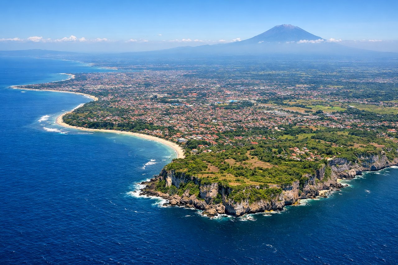
Landing at DPS
LEFTBali typically lands on runway 09/27 (east-west orientation). Left-side seats during approach from the north offer views of Mount Agung (3,142 m), Bali's dominant volcanic peak, and the island's northern coastline. Right-side views face the Indian Ocean.
Landmarks on this routeAll landmarks →
Will your flight be in sunlight?
Pick a date and time in the Sun Map to watch the sun move across your whole flight.
About This Route
Which side of the plane should I sit on flying from Syamsudin Noor International Airport (BDJ) to Denpasar I Gusti Ngurah Rai International Airport (DPS)?
Sit on the Left side of the plane for the best views on flights from Banjarmasin to Denpasar. Left-side seats capture the most dramatic geography: the Barito delta during departure and Mount Agung during approach. The landing view of Bali's volcanic landscape is more visually distinctive than the takeoff delta views.
What can I see during takeoff from Syamsudin Noor International Airport in Banjarmasin?
During takeoff from Syamsudin Noor International Airport (BDJ), sit on the Right side for the best views. Banjarmasin typically departs to the northeast (runway 03/21 primary). Right-side seats offer views of the Barito River delta and its extensive network of waterways as the aircraft climbs. The left side faces inland toward less distinctive terrain. Notable sights include: Barito River delta with its braided channels and tidal flats, Banjarmasin city sprawl along the river, Martapura River confluence, coastal mangrove wetlands to the east.
What can I see when landing at Denpasar I Gusti Ngurah Rai International Airport in Denpasar?
When landing at Denpasar I Gusti Ngurah Rai International Airport (DPS), sit on the Left side for the best views. Bali typically lands on runway 09/27 (east-west orientation). Left-side seats during approach from the north offer views of Mount Agung (3,142 m), Bali's dominant volcanic peak, and the island's northern coastline. Right-side views face the Indian Ocean. Notable sights include: Mount Agung volcanic peak, Bali's northern coastline with black sand beaches, Lombok Strait between Bali and Lombok island, Denpasar city and airport surroundings.
How long is the flight from Banjarmasin to Denpasar?
The flight from Syamsudin Noor International Airport (BDJ) to Denpasar I Gusti Ngurah Rai International Airport (DPS) takes about 1 hour 15 minutes. The shortest flight path between them is 368 miles (592 km); winds and air traffic control usually add a few percent.
What does the Banjarmasin to Denpasar flight path pass over?
The flight path crosses the Java Sea heading southeast. At midpoint (roughly 50 nm southeast of Banjarmasin), the aircraft passes over open water with no significant landmarks. The Flores Sea and scattered small islands of the Sunda Strait region lie to the south but remain below typical cruise altitude visibility. As the aircraft approaches Bali from the north, the Lombok Strait becomes visible, with Lombok's mountainous profile appearing on the eastern horizon before descent begins.