Windsor Locks to Minneapolis is 1,048 miles (1,686 km), a flight of about 2 hours 45 minutes.
The right side offers the more consistent scenery across the flight: New England foothills at departure, glimpses of the Great Lakes region (Lake Erie's eastern tip and the Lake Michigan crossing) during cruise, and a strong finish with the Minneapolis skyline and Mississippi River on approach. The left side stays comparatively featureless, mostly flat farmland and suburban haze.
Flight Path
The flight path crosses over western New York near Buffalo and the eastern edge of Lake Erie, continues across southern Michigan, and crosses Lake Michigan between the Michigan and Wisconsin shorelines before flattening out over Wisconsin farmland en route to Minnesota.
Great circle distance and headings ›.jpeg?width=600)


Phase by phase

Takeoff from BDL
RIGHTClimbing out of BDL toward the west, the right side faces north over the rolling Litchfield Hills and Berkshire foothills straddling the Connecticut-Massachusetts line, with the Connecticut River valley visible below. The left side mostly shows the flatter Hartford basin and quickly fades into haze-toned suburban sprawl.
Landing at MSP
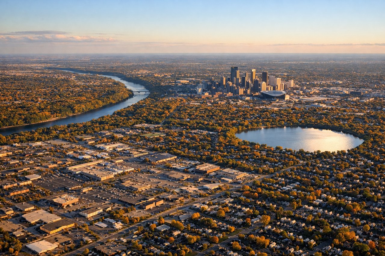
RIGHTArrivals from the east typically land on MSP's northwest-facing runways, curving in from the southeast with downtown Minneapolis, the Mississippi River, and the Chain of Lakes visible off the right side of the aircraft. The left side during this turn mostly shows suburban St. Paul and flat farmland with no distinct landmarks.
Landmarks on this routeAll landmarks →
Will your flight be in sunlight?
Pick a date and time in the Sun Map to watch the sun move across your whole flight.
About This Route
Which side of the plane should I sit on flying from Bradley International (BDL) to Minneapolis St Paul International (MSP)?
Sit on the Right side of the plane for the best views on flights from Windsor Locks to Minneapolis. The right side offers the more consistent scenery across the flight: New England foothills at departure, glimpses of the Great Lakes region (Lake Erie's eastern tip and the Lake Michigan crossing) during cruise, and a strong finish with the Minneapolis skyline and Mississippi River on approach. The left side stays comparatively featureless, mostly flat farmland and suburban haze.
What can I see during takeoff from Bradley International in Windsor Locks?
During takeoff from Bradley International (BDL), sit on the Right side for the best views. Climbing out of BDL toward the west, the right side faces north over the rolling Litchfield Hills and Berkshire foothills straddling the Connecticut-Massachusetts line, with the Connecticut River valley visible below. The left side mostly shows the flatter Hartford basin and quickly fades into haze-toned suburban sprawl. Notable sights include: Berkshire/Litchfield foothills, Connecticut River valley, Farmington River valley farmland.
What can I see when landing at Minneapolis St Paul International in Minneapolis?
When landing at Minneapolis St Paul International (MSP), sit on the Right side for the best views. Arrivals from the east typically land on MSP's northwest-facing runways, curving in from the southeast with downtown Minneapolis, the Mississippi River, and the Chain of Lakes visible off the right side of the aircraft. The left side during this turn mostly shows suburban St. Paul and flat farmland with no distinct landmarks. Notable sights include: Downtown Minneapolis skyline, Mississippi River bends, Lake Calhoun/Bde Maka Ska, Fort Snelling confluence.
How long is the flight from Windsor Locks to Minneapolis?
The flight from Bradley International (BDL) to Minneapolis St Paul International (MSP) takes about 2 hours 45 minutes. The shortest flight path between them is 1,048 miles (1,686 km); winds and air traffic control usually add a few percent.
What does the Windsor Locks to Minneapolis flight path pass over?
The flight path crosses over western New York near Buffalo and the eastern edge of Lake Erie, continues across southern Michigan, and crosses Lake Michigan between the Michigan and Wisconsin shorelines before flattening out over Wisconsin farmland en route to Minnesota.