Minneapolis to Windsor Locks is 1,048 miles (1,686 km), a flight of about 3 hours 15 minutes.
Right-side seats provide superior views at both ends: Mississippi River and Minneapolis urban geography on departure, and the Connecticut River valley during approach. The midpoint offers less dramatic scenery, making the endpoints decisive.
Flight Path
The flight path crosses the Appalachian foothills of Pennsylvania and New York. Notable features include the Finger Lakes region (visible as elongated north-south water bodies if flying over central New York), the Mohawk River valley, and the transition from Midwest agricultural land to New England's mixed forest and farmland. Lake Ontario may be visible to the north on clear days. The terrain gradually increases in elevation and becomes more forested as the aircraft approaches New England.
Great circle distance and headings ›

.jpeg?width=600)
Phase by phase
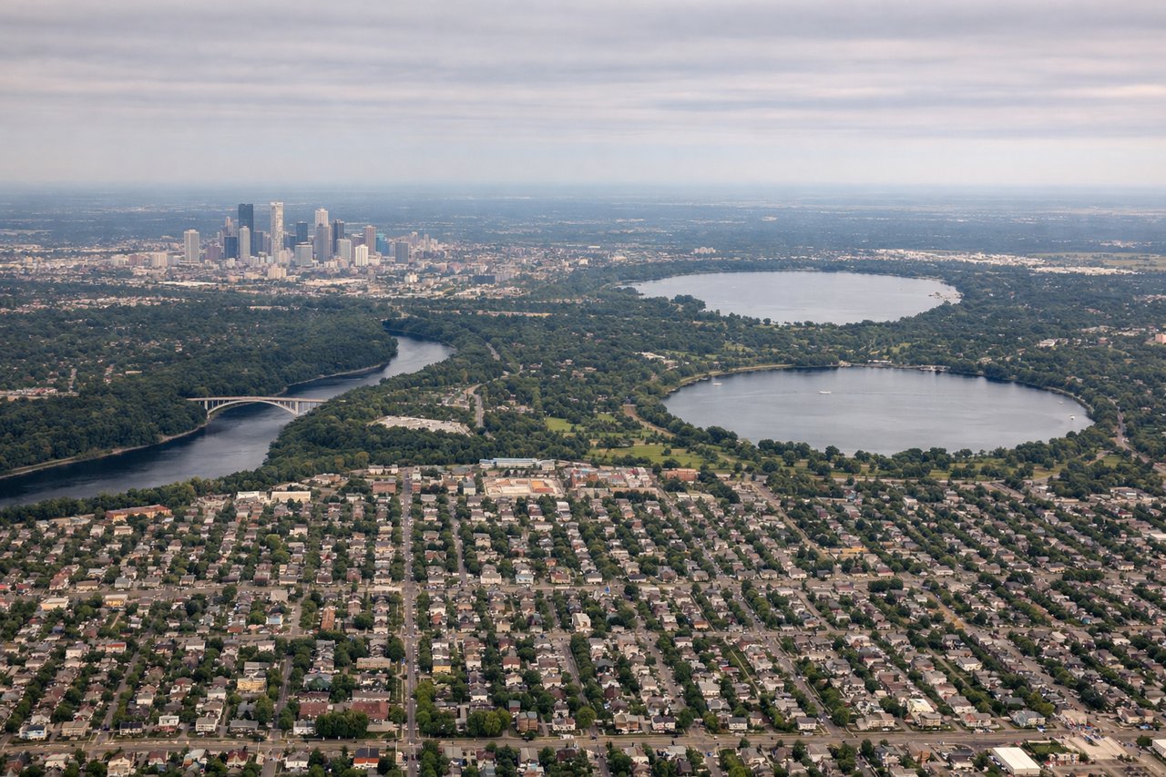
Takeoff from MSP
RIGHTRight-side seats capture the Mississippi River valley and urban Minneapolis sprawl during northeastward climb. MSP typically departs runways 30L/30R or 12L/12R; northeast departures show the river's distinctive meanders and the city grid expanding eastward.
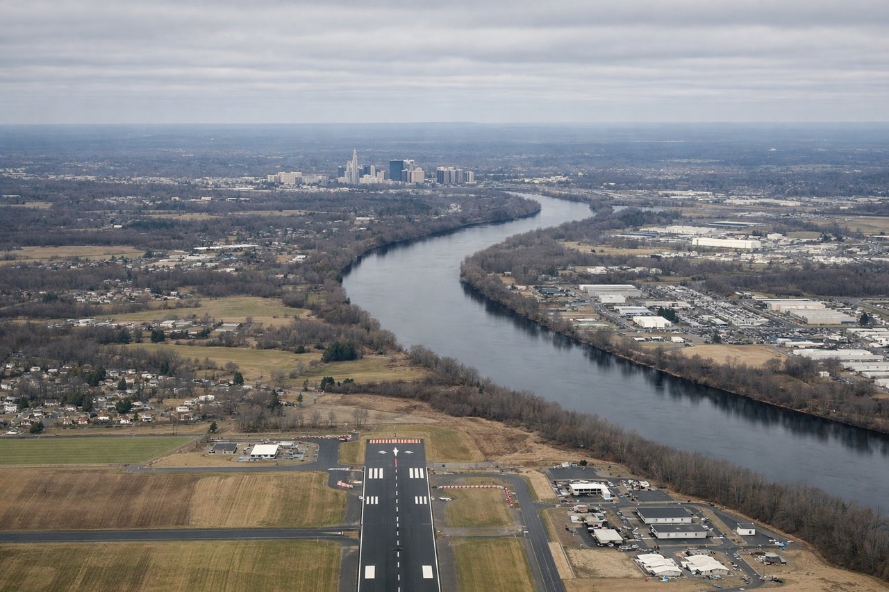
Landing at BDL
LEFTLeft-side seats offer views of Connecticut River valley and New England terrain during descent into Bradley. BDL typically lands runways 06/24; westbound approaches show the Connecticut River, Hartford's urban core, and the transition from farmland to developed areas.
Landmarks on this routeAll landmarks →
Will your flight be in sunlight?
Pick a date and time in the Sun Map to watch the sun move across your whole flight.
About This Route
Which side of the plane should I sit on flying from Minneapolis St Paul International (MSP) to Bradley International (BDL)?
Sit on the Right side of the plane for the best views on flights from Minneapolis to Windsor Locks. Right-side seats provide superior views at both ends: Mississippi River and Minneapolis urban geography on departure, and the Connecticut River valley during approach. The midpoint offers less dramatic scenery, making the endpoints decisive.
What can I see during takeoff from Minneapolis St Paul International in Minneapolis?
During takeoff from Minneapolis St Paul International (MSP), sit on the Right side for the best views. Right-side seats capture the Mississippi River valley and urban Minneapolis sprawl during northeastward climb. MSP typically departs runways 30L/30R or 12L/12R; northeast departures show the river's distinctive meanders and the city grid expanding eastward. Notable sights include: Mississippi River (immediate foreground, flowing south), Minneapolis downtown skyline (west/left), St. Paul across the river (east), suburban sprawl extending to horizon.
What can I see when landing at Bradley International in Windsor Locks?
When landing at Bradley International (BDL), sit on the Left side for the best views. Left-side seats offer views of Connecticut River valley and New England terrain during descent into Bradley. BDL typically lands runways 06/24; westbound approaches show the Connecticut River, Hartford's urban core, and the transition from farmland to developed areas. Notable sights include: Connecticut River (flowing south through the frame), Hartford skyline (southwest), farmland and forest patchwork (north and east), Bradley airport runways (final approach).
How long is the flight from Minneapolis to Windsor Locks?
The flight from Minneapolis St Paul International (MSP) to Bradley International (BDL) takes about 3 hours 15 minutes. The shortest flight path between them is 1,048 miles (1,686 km); winds and air traffic control usually add a few percent.
What does the Minneapolis to Windsor Locks flight path pass over?
The flight path crosses the Appalachian foothills of Pennsylvania and New York. Notable features include the Finger Lakes region (visible as elongated north-south water bodies if flying over central New York), the Mohawk River valley, and the transition from Midwest agricultural land to New England's mixed forest and farmland. Lake Ontario may be visible to the north on clear days. The terrain gradually increases in elevation and becomes more forested as the aircraft approaches New England.