Belem to Rio De Janeiro is 1,530 miles (2,462 km), a flight of about 2 hours 45 minutes.
While takeoff offers Amazon estuary views, the landing approach into Santos Dumont provides more dramatic and iconic geography. Guanabara Bay, Sugarloaf Mountain, and Corcovado create a more visually compelling experience than the estuary's subtle patterns.
Flight Path
The flight path travels south-southwest across the Brazilian coast. Notable features include the Tocantins River mouth (visible around 45 minutes out), the transition from equatorial várzea forest to tropical Atlantic Forest as latitude increases, the Parnaíba River delta region, and the gradual appearance of the Brazilian Highlands (Serra da Mantiqueira) on the western horizon during the final hour of flight. The coastline remains visible intermittently to the east, with the Atlantic Ocean providing a consistent reference point throughout the journey.
Great circle distance and headings ›Phase by phase
Takeoff from BEL
RIGHTRight-side seats capture the Amazon River estuary's intricate channel system and tidal flats as the aircraft climbs southwestward. The river's braided patterns and surrounding várzea forest are distinctive from altitude during the initial climb.
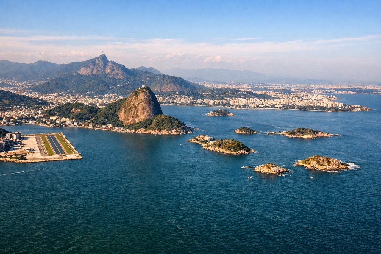
Landing at SDU
LEFTLeft-side seats on descent into Santos Dumont provide excellent views of Guanabara Bay's distinctive geography and Rio's iconic coastal landmarks. The bay's shape, surrounding mountains, and the approach path over water offer superior visual interest compared to the right side.
Landmarks on this routeAll landmarks →
Will your flight be in sunlight?
Pick a date and time in the Sun Map to watch the sun move across your whole flight.
About This Route
Which side of the plane should I sit on flying from Val De Caes (BEL) to Santos Dumont (SDU)?
Sit on the Left side of the plane for the best views on flights from Belem to Rio De Janeiro. While takeoff offers Amazon estuary views, the landing approach into Santos Dumont provides more dramatic and iconic geography. Guanabara Bay, Sugarloaf Mountain, and Corcovado create a more visually compelling experience than the estuary's subtle patterns.
What can I see during takeoff from Val De Caes in Belem?
During takeoff from Val De Caes (BEL), sit on the Right side for the best views. Right-side seats capture the Amazon River estuary's intricate channel system and tidal flats as the aircraft climbs southwestward. The river's braided patterns and surrounding várzea forest are distinctive from altitude during the initial climb. Notable sights include: Amazon River estuary with multiple channels and islands, Guajará Bay to the west, várzea wetland forest canopy, Belém city grid along the eastern riverbank.
What can I see when landing at Santos Dumont in Rio De Janeiro?
When landing at Santos Dumont (SDU), sit on the Left side for the best views. Left-side seats on descent into Santos Dumont provide excellent views of Guanabara Bay's distinctive geography and Rio's iconic coastal landmarks. The bay's shape, surrounding mountains, and the approach path over water offer superior visual interest compared to the right side. Notable sights include: Guanabara Bay with its complex shoreline and islands, Sugarloaf Mountain (Pão de Açúcar) and the Corcovado massif, Niterói across the bay to the north, Christ the Redeemer statue location on Corcovado peak.
How long is the flight from Belem to Rio De Janeiro?
The flight from Val De Caes (BEL) to Santos Dumont (SDU) takes about 2 hours 45 minutes. The shortest flight path between them is 1,530 miles (2,462 km); winds and air traffic control usually add a few percent.
What does the Belem to Rio De Janeiro flight path pass over?
The flight path travels south-southwest across the Brazilian coast. Notable features include the Tocantins River mouth (visible around 45 minutes out), the transition from equatorial várzea forest to tropical Atlantic Forest as latitude increases, the Parnaíba River delta region, and the gradual appearance of the Brazilian Highlands (Serra da Mantiqueira) on the western horizon during the final hour of flight. The coastline remains visible intermittently to the east, with the Atlantic Ocean providing a consistent reference point throughout the journey.