Berlin to Seattle is 5,065 miles (8,152 km), a flight of about 10 hours 15 minutes.
While the takeoff offers Berlin's urban and lake scenery, the landing approach provides the most dramatic and visually distinctive views: Mount Rainier and the Cascade Range are far more striking than the flat Brandenburg landscape. Right side seats capture the climax of the journey.
Flight Path
Over the North Atlantic, you'll cross the Arctic Circle region and pass near Greenland's ice sheet (visible as a massive white expanse if weather permits). Over Canada, the flight path typically crosses the Canadian Shield and boreal forests of northern Canada, then descends over the Rocky Mountains in British Columbia before reaching the Pacific Northwest. The Rockies and interior British Columbia's mountain ranges offer significant scenery during the final 2-3 hours of approach.
Great circle distance and headings ›


.jpg?width=600)

Phase by phase
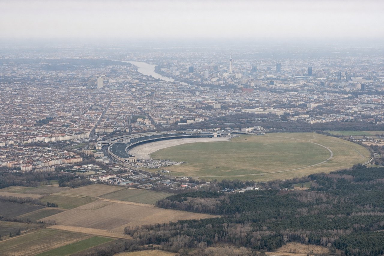
Takeoff from BER
LEFTLeft side offers views of Berlin's urban sprawl and the Spree River winding through the city during initial climb. You'll see the distinctive pattern of lakes dotting the Brandenburg region as you gain altitude northwestward.
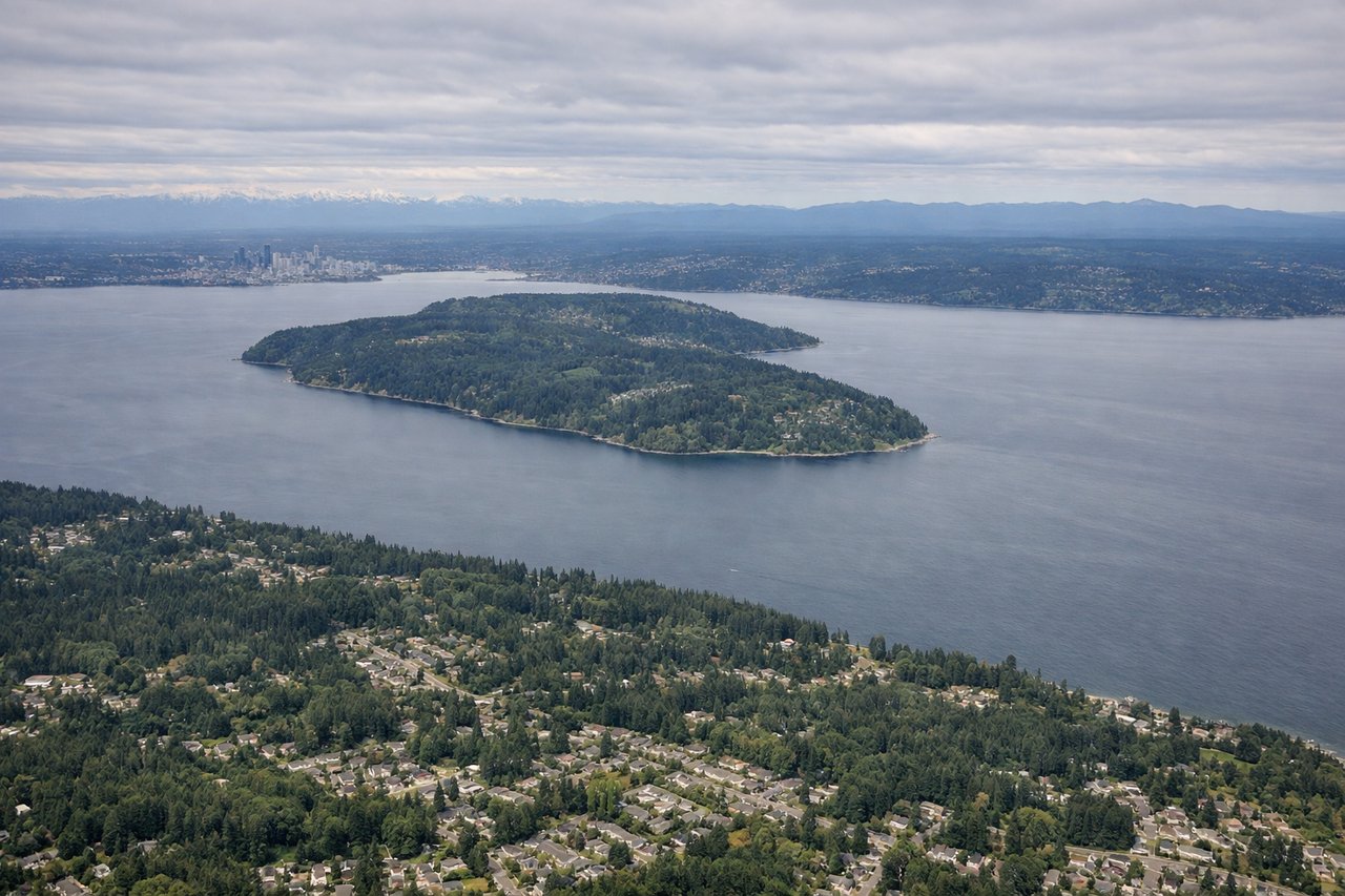
Landing at SEA
RIGHTRight side provides excellent views of the Cascade Range and Mount Rainier during descent into Seattle. As you approach from the east, the dramatic volcanic peak dominates the landscape, and you'll see the Puget Sound opening up with the Olympic Mountains visible across the water to the west.
Landmarks on this routeAll landmarks →
Will your flight be in sunlight?
Pick a date and time in the Sun Map to watch the sun move across your whole flight.
About This Route
Which side of the plane should I sit on flying from Berlin Brandenburg (BER) to Seattle Tacoma International (SEA)?
Sit on the Right side of the plane for the best views on flights from Berlin to Seattle. While the takeoff offers Berlin's urban and lake scenery, the landing approach provides the most dramatic and visually distinctive views: Mount Rainier and the Cascade Range are far more striking than the flat Brandenburg landscape. Right side seats capture the climax of the journey.
What can I see during takeoff from Berlin Brandenburg in Berlin?
During takeoff from Berlin Brandenburg (BER), sit on the Left side for the best views. Left side offers views of Berlin's urban sprawl and the Spree River winding through the city during initial climb. You'll see the distinctive pattern of lakes dotting the Brandenburg region as you gain altitude northwestward. Notable sights include: Spree River (central Berlin), Müggelsee (largest lake in Brandenburg, southeast), Tegeler See (northwest of city center), Brandenburg's glacial lake chain extending north.
What can I see when landing at Seattle Tacoma International in Seattle?
When landing at Seattle Tacoma International (SEA), sit on the Right side for the best views. Right side provides excellent views of the Cascade Range and Mount Rainier during descent into Seattle. As you approach from the east, the dramatic volcanic peak dominates the landscape, and you'll see the Puget Sound opening up with the Olympic Mountains visible across the water to the west. Notable sights include: Mount Rainier (14,410 ft, prominent volcanic cone), Cascade Range (extending north-south), Puget Sound (major inlet), Olympic Mountains (western shore, across the sound).
How long is the flight from Berlin to Seattle?
The flight from Berlin Brandenburg (BER) to Seattle Tacoma International (SEA) takes about 10 hours 15 minutes. The shortest flight path between them is 5,065 miles (8,152 km); winds and air traffic control usually add a few percent.
What does the Berlin to Seattle flight path pass over?
Over the North Atlantic, you'll cross the Arctic Circle region and pass near Greenland's ice sheet (visible as a massive white expanse if weather permits). Over Canada, the flight path typically crosses the Canadian Shield and boreal forests of northern Canada, then descends over the Rocky Mountains in British Columbia before reaching the Pacific Northwest. The Rockies and interior British Columbia's mountain ranges offer significant scenery during the final 2-3 hours of approach.