Seattle to Los Angeles is 960 miles (1,545 km), a flight of about 2 hours 40 minutes.
Right side wins both ends of the flight. During the cruise over Oregon and Northern California you also get better views of the Cascade volcanoes including Mount Jefferson and Mount Shasta on the right side as the route tracks south, making it the clear choice for the full journey.
Flight Path
The route tracks roughly south-southwest over the Oregon Cascades, passing Mount Jefferson and the Three Sisters volcanic cluster visible to the left on the right side of the aircraft. Over Northern California, Mount Shasta (14,179 ft) is a standout landmark on the right side, highly visible from cruise altitude. The Sacramento Valley appears as a broad flat agricultural plain. The route then crosses over the Tehachapi Mountains before descending into the LA Basin.
Great circle distance and headings ›


.jpg?width=600)
Phase by phase
Takeoff from BFI
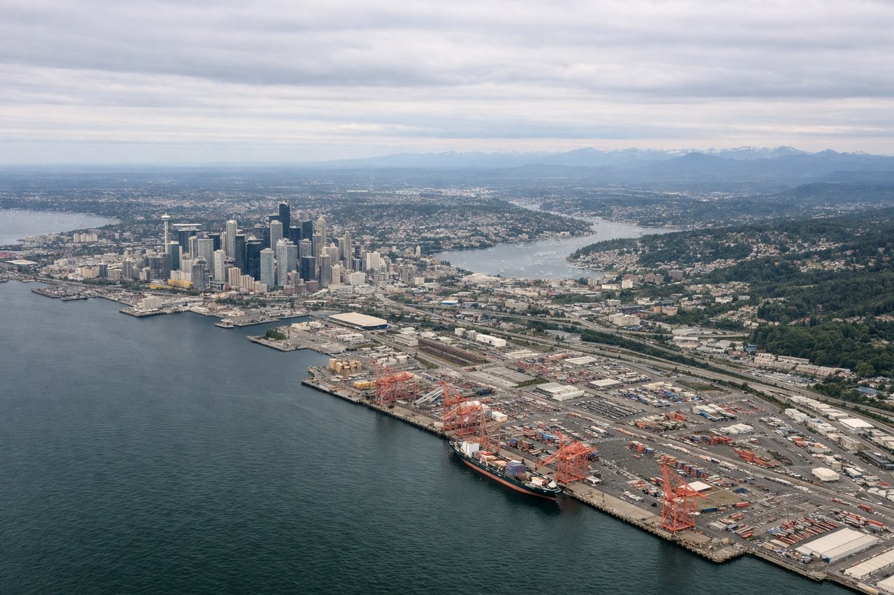
RIGHTBFI's primary departure runway 13R sends aircraft southeast, then the route curves south. The right side faces east toward the Cascade Range, giving a clear view of Mount Rainier dominating the skyline. You also get a good look back at Lake Washington and the Seattle urban grid.

Landing at LAX
RIGHTLAX's primary arrival runways 24L/24R bring aircraft in from the east heading west. The right side faces north, giving views of the Santa Monica Mountains, the Los Angeles Basin sprawl, and the coastline as you descend over Inglewood. The left side faces south toward less distinctive terrain.
Landmarks on this routeAll landmarks →
Will your flight be in sunlight?
Pick a date and time in the Sun Map to watch the sun move across your whole flight.
About This Route
Which side of the plane should I sit on flying from Boeing Fld King Co International (BFI) to Los Angeles International (LAX)?
Sit on the Right side of the plane for the best views on flights from Seattle to Los Angeles. Right side wins both ends of the flight. During the cruise over Oregon and Northern California you also get better views of the Cascade volcanoes including Mount Jefferson and Mount Shasta on the right side as the route tracks south, making it the clear choice for the full journey.
What can I see during takeoff from Boeing Fld King Co International in Seattle?
During takeoff from Boeing Fld King Co International (BFI), sit on the Right side for the best views. BFI's primary departure runway 13R sends aircraft southeast, then the route curves south. The right side faces east toward the Cascade Range, giving a clear view of Mount Rainier dominating the skyline. You also get a good look back at Lake Washington and the Seattle urban grid. Notable sights include: Mount Rainier (14,411 ft, unmistakable snow cone to the southeast), Lake Washington (large freshwater lake immediately east of Seattle), the Seattle downtown skyline receding to the northwest, Elliott Bay and Puget Sound to the west visible briefly on climb-out.
What can I see when landing at Los Angeles International in Los Angeles?
When landing at Los Angeles International (LAX), sit on the Right side for the best views. LAX's primary arrival runways 24L/24R bring aircraft in from the east heading west. The right side faces north, giving views of the Santa Monica Mountains, the Los Angeles Basin sprawl, and the coastline as you descend over Inglewood. The left side faces south toward less distinctive terrain. Notable sights include: Los Angeles Basin urban grid (one of the largest continuous urban areas visible from altitude), Santa Monica Mountains running east-west north of the city, the Pacific Ocean coastline and Santa Monica Bay on final approach, downtown Los Angeles skyline visible to the northeast during descent.
How long is the flight from Seattle to Los Angeles?
The flight from Boeing Fld King Co International (BFI) to Los Angeles International (LAX) takes about 2 hours 40 minutes. The shortest flight path between them is 960 miles (1,545 km); winds and air traffic control usually add a few percent.
What does the Seattle to Los Angeles flight path pass over?
The route tracks roughly south-southwest over the Oregon Cascades, passing Mount Jefferson and the Three Sisters volcanic cluster visible to the left on the right side of the aircraft. Over Northern California, Mount Shasta (14,179 ft) is a standout landmark on the right side, highly visible from cruise altitude. The Sacramento Valley appears as a broad flat agricultural plain. The route then crosses over the Tehachapi Mountains before descending into the LA Basin.