Right side wins both ends of the flight. At takeoff you get the full sweep of Barbados and the Caribbean, and on approach into SeaTac you get downtown Seattle, Elliott Bay, and the Olympic Mountains. The left side offers little of comparable interest at either end.
Flown BGI to SEA? Did we get it right?
Flight Path
Bridgetown to Seattle is 4,292 miles (6,908 km), a flight of about 8 hours 35 minutes.
The flight tracks northwest over the Caribbean Sea, crosses Cuba or the Gulf of Mexico depending on routing, then overflies the southeastern United States. The mid-flight portion crosses the Great Plains — largely featureless at altitude — before the Rockies appear in the distance over Colorado or Utah. The Cascade Range becomes visible in the final hour, with volcanic peaks including Mount Rainier and Mount Adams identifiable on clear days from either side of the aircraft.
Great circle distance and headings ›


Phase by phase
Takeoff from BGI
RIGHTGrantley Adams typically departs on runway 09 (eastward) or 27 (westward). On a northbound routing to SEA, aircraft generally climb out heading northwest. The right side gives you the best view of the Barbados west coast, the calm Caribbean Sea, and the island's southern parishes before the island falls away behind you.
Landing at SEA
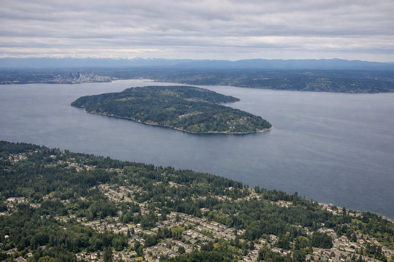
RIGHTSeaTac primarily uses runways 16L/16R for southward landings, meaning the approach comes from the north over the Seattle metro area. The right side on final approach gives a clear view of downtown Seattle, Elliott Bay, and the Olympic Mountains across Puget Sound to the west.
Will your flight be in sunlight?
Pick a date and time in the Sun Map to watch the sun move across your whole flight.
About This Route
Which side of the plane should I sit on flying from Grantley Adams International (BGI) to Seattle Tacoma International (SEA)?
Sit on the Right side of the plane for the best views on flights from Bridgetown to Seattle. Right side wins both ends of the flight. At takeoff you get the full sweep of Barbados and the Caribbean, and on approach into SeaTac you get downtown Seattle, Elliott Bay, and the Olympic Mountains. The left side offers little of comparable interest at either end.
What can I see during takeoff from Grantley Adams International in Bridgetown?
During takeoff from Grantley Adams International (BGI), sit on the Right side for the best views. Grantley Adams typically departs on runway 09 (eastward) or 27 (westward). On a northbound routing to SEA, aircraft generally climb out heading northwest. The right side gives you the best view of the Barbados west coast, the calm Caribbean Sea, and the island's southern parishes before the island falls away behind you. Notable sights include: Carlisle Bay and Bridgetown Harbour, the west coast platinum coast beaches, the island's flat coral limestone interior, and the deep blue Caribbean Sea stretching toward the Windward Islands.
What can I see when landing at Seattle Tacoma International in Seattle?
When landing at Seattle Tacoma International (SEA), sit on the Right side for the best views. SeaTac primarily uses runways 16L/16R for southward landings, meaning the approach comes from the north over the Seattle metro area. The right side on final approach gives a clear view of downtown Seattle, Elliott Bay, and the Olympic Mountains across Puget Sound to the west. Notable sights include: Downtown Seattle skyline and Elliott Bay, Puget Sound and the Kitsap Peninsula, the Olympic Mountains on the western horizon, and Lake Washington to the east.
How long is the flight from Bridgetown to Seattle?
The flight from Grantley Adams International (BGI) to Seattle Tacoma International (SEA) takes about 8 hours 35 minutes. The shortest flight path between them is 4,292 miles (6,908 km); winds and air traffic control usually add a few percent.
What does the Bridgetown to Seattle flight path pass over?
The flight tracks northwest over the Caribbean Sea, crosses Cuba or the Gulf of Mexico depending on routing, then overflies the southeastern United States. The mid-flight portion crosses the Great Plains — largely featureless at altitude — before the Rockies appear in the distance over Colorado or Utah. The Cascade Range becomes visible in the final hour, with volcanic peaks including Mount Rainier and Mount Adams identifiable on clear days from either side of the aircraft.