The westbound departure from Billings offers superior scenic value with immediate views of the Beartooth and Absaroka Mountains during climb-out. While the Boston landing provides some Appalachian foothills views, the takeoff scenery is more dramatic and distinctive. Left-side seats capture the best of both segments.
Flown BIL to BOS? Did we get it right?
Flight Path
Billings to Boston is 1,861 miles (2,994 km), a flight of about 4 hours 35 minutes.
The flight path crosses the Great Plains of Wyoming and Nebraska, then transitions into the Mississippi River valley near Iowa/Illinois. Notable features include the Black Hills (distant view to the north around South Dakota), the Missouri River valley, and the transition from high plains to agricultural heartland. The Mississippi River becomes visible as the aircraft approaches Illinois and Wisconsin. Further east, the Appalachian foothills emerge as the aircraft descends into New England airspace.
Great circle distance and headings ›

Phase by phase
Takeoff from BIL
LEFTLeft side offers immediate views of the Beartooth Mountains and Absaroka Range to the south and southeast as the aircraft climbs out. The right side faces open prairie with minimal visual interest during the initial climb.
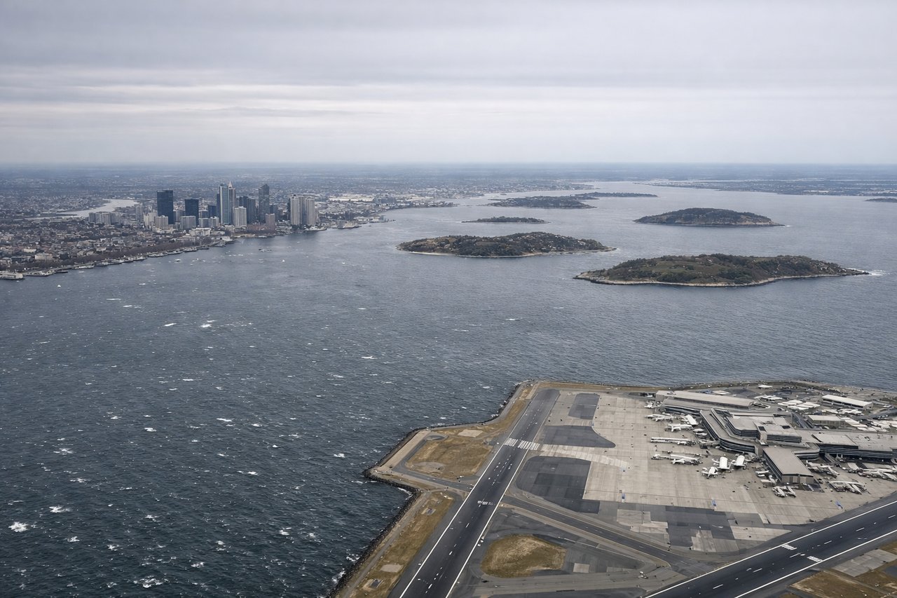
Landing at BOS
RIGHTRight side provides views of the Appalachian foothills and the Connecticut River valley as the aircraft descends into New England. The left side faces the Atlantic Ocean and offers less distinctive terrain during final approach into Boston.
Will your flight be in sunlight?
Pick a date and time in the Sun Map to watch the sun move across your whole flight.
About This Route
Which side of the plane should I sit on flying from Billings Logan International Airport (BIL) to General Edward Lawrence Logan International (BOS)?
Sit on the Left side of the plane for the best views on flights from Billings to Boston. The westbound departure from Billings offers superior scenic value with immediate views of the Beartooth and Absaroka Mountains during climb-out. While the Boston landing provides some Appalachian foothills views, the takeoff scenery is more dramatic and distinctive. Left-side seats capture the best of both segments.
What can I see during takeoff from Billings Logan International Airport in Billings?
During takeoff from Billings Logan International Airport (BIL), sit on the Left side for the best views. Left side offers immediate views of the Beartooth Mountains and Absaroka Range to the south and southeast as the aircraft climbs out. The right side faces open prairie with minimal visual interest during the initial climb. Notable sights include: Beartooth Mountains (south), Absaroka Range (southeast), Yellowstone Plateau (distant south), Billings urban area (below).
What can I see when landing at General Edward Lawrence Logan International in Boston?
When landing at General Edward Lawrence Logan International (BOS), sit on the Right side for the best views. Right side provides views of the Appalachian foothills and the Connecticut River valley as the aircraft descends into New England. The left side faces the Atlantic Ocean and offers less distinctive terrain during final approach into Boston. Notable sights include: Connecticut River valley (below), Appalachian foothills (right and south), Boston Harbor (left), Atlantic coastline (left).
How long is the flight from Billings to Boston?
The flight from Billings Logan International Airport (BIL) to General Edward Lawrence Logan International (BOS) takes about 4 hours 35 minutes. The shortest flight path between them is 1,861 miles (2,994 km); winds and air traffic control usually add a few percent.
What does the Billings to Boston flight path pass over?
The flight path crosses the Great Plains of Wyoming and Nebraska, then transitions into the Mississippi River valley near Iowa/Illinois. Notable features include the Black Hills (distant view to the north around South Dakota), the Missouri River valley, and the transition from high plains to agricultural heartland. The Mississippi River becomes visible as the aircraft approaches Illinois and Wisconsin. Further east, the Appalachian foothills emerge as the aircraft descends into New England airspace.