While the takeoff offers excellent mountain scenery on the left, the landing approach on the right provides more visually striking coastal and harbor views. The Charleston arrival is the more memorable segment of this flight.
Flown BJC to CHS? Did we get it right?
Flight Path
Denver to Charleston is 1,471 miles (2,367 km), a flight of about 3 hours 15 minutes.
The flight path crosses the Appalachian foothills of eastern Tennessee and western North Carolina, including views of the Blue Ridge Mountains and Smoky Mountains ridgelines. The Tennessee Valley and Chattanooga area appear in the middle portion of the flight. As the aircraft descends toward the coastal plain, the terrain flattens dramatically over Georgia and South Carolina, with the transition from piedmont to coastal lowlands becoming visible around 30 minutes before landing.
Great circle distance and headings ›

Phase by phase
Takeoff from BJC
LEFTDeparting eastbound from BJC, the left side offers immediate views of the Front Range and the high peaks of the Rocky Mountains. The right side faces the Denver metro area and plains, which are less visually distinctive.
Landing at CHS
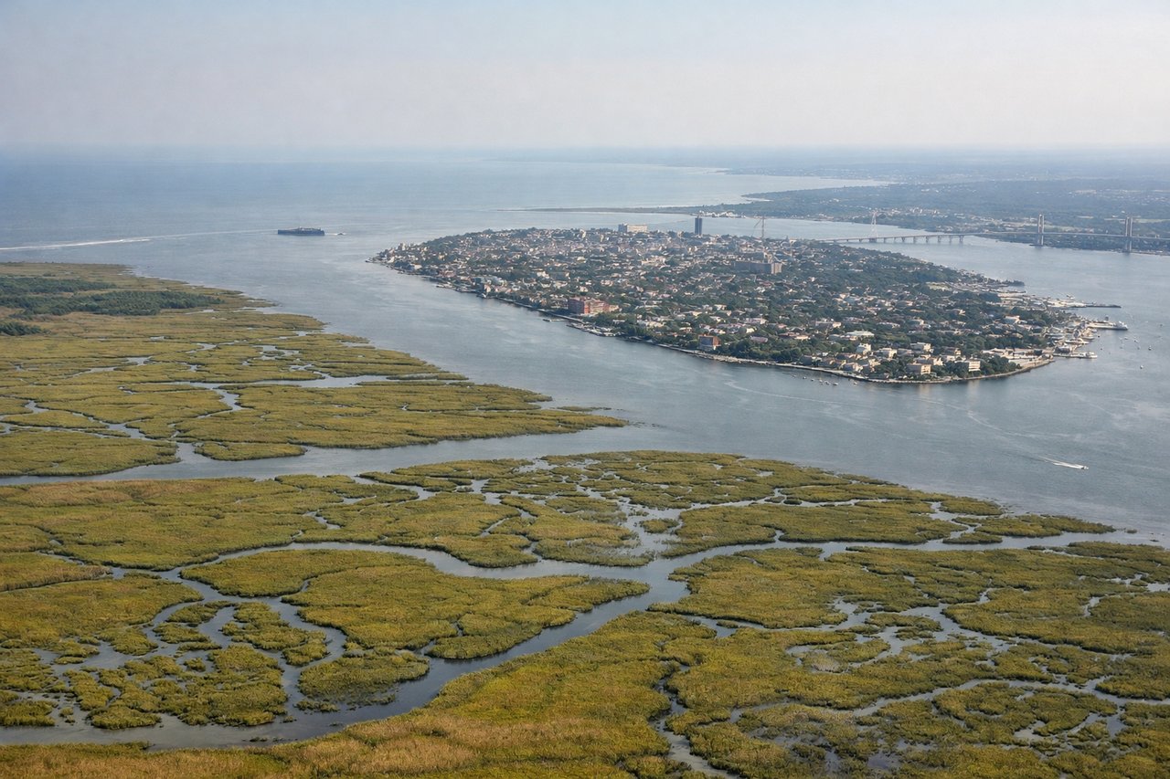
RIGHTApproaching CHS from the west, the right side provides views of the Charleston harbor, the Ashley River, and the Atlantic coastline. The left side faces inland terrain with fewer distinctive features during final descent.
Will your flight be in sunlight?
Pick a date and time in the Sun Map to watch the sun move across your whole flight.
About This Route
Which side of the plane should I sit on flying from Rocky Mountain Metropolitan Airport (BJC) to Charleston Afb International (CHS)?
Sit on the Right side of the plane for the best views on flights from Denver to Charleston. While the takeoff offers excellent mountain scenery on the left, the landing approach on the right provides more visually striking coastal and harbor views. The Charleston arrival is the more memorable segment of this flight.
What can I see during takeoff from Rocky Mountain Metropolitan Airport in Denver?
During takeoff from Rocky Mountain Metropolitan Airport (BJC), sit on the Left side for the best views. Departing eastbound from BJC, the left side offers immediate views of the Front Range and the high peaks of the Rocky Mountains. The right side faces the Denver metro area and plains, which are less visually distinctive. Notable sights include: Front Range peaks (including Mount Evans and Mount Bierstadt), South Platte River valley, Denver metropolitan sprawl.
What can I see when landing at Charleston Afb International in Charleston?
When landing at Charleston Afb International (CHS), sit on the Right side for the best views. Approaching CHS from the west, the right side provides views of the Charleston harbor, the Ashley River, and the Atlantic coastline. The left side faces inland terrain with fewer distinctive features during final descent. Notable sights include: Charleston Harbor, Ashley River, Atlantic Ocean coastline, Fort Sumter area.
How long is the flight from Denver to Charleston?
The flight from Rocky Mountain Metropolitan Airport (BJC) to Charleston Afb International (CHS) takes about 3 hours 15 minutes. The shortest flight path between them is 1,471 miles (2,367 km); winds and air traffic control usually add a few percent.
What does the Denver to Charleston flight path pass over?
The flight path crosses the Appalachian foothills of eastern Tennessee and western North Carolina, including views of the Blue Ridge Mountains and Smoky Mountains ridgelines. The Tennessee Valley and Chattanooga area appear in the middle portion of the flight. As the aircraft descends toward the coastal plain, the terrain flattens dramatically over Georgia and South Carolina, with the transition from piedmont to coastal lowlands becoming visible around 30 minutes before landing.