Left side scores higher due to the exceptional scenic value of the Rocky Mountain Front during departure—a dramatic, recognizable, and visually striking feature that dominates the early flight phase. While the landing approach favors the right side with Potomac River views, the takeoff experience from BJC is more memorable and geographically distinctive. The cruise phase over the Great Plains and Appalachian foothills is relatively similar on both sides, but the departure advantage tips the overall score leftward.
Flown BJC to IAD? Did we get it right?
Flight Path
Denver to Washington is 1,472 miles (2,369 km), a flight of about 3 hours 15 minutes.
Great Plains extending from Colorado into Kansas and Missouri (relatively flat, sparse landmarks); Mississippi River valley near St. Louis area; Ozark Plateau in southern Missouri and northern Arkansas (low, forested hills); Appalachian foothills in eastern Tennessee and western Virginia (increasing elevation and ridge-and-valley topography); Shenandoah Valley in Virginia (north-south trending valley visible during descent phase)
Great circle distance and headings ›Phase by phase
Takeoff from BJC
LEFTLeft side captures the dramatic Rocky Mountain Front during climb-out from BJC. The Front Range rises immediately west and northwest of the airport, creating a striking vertical relief that dominates the early departure phase. Right side shows the Denver metro sprawl and flat plains extending eastward—visually monotonous.
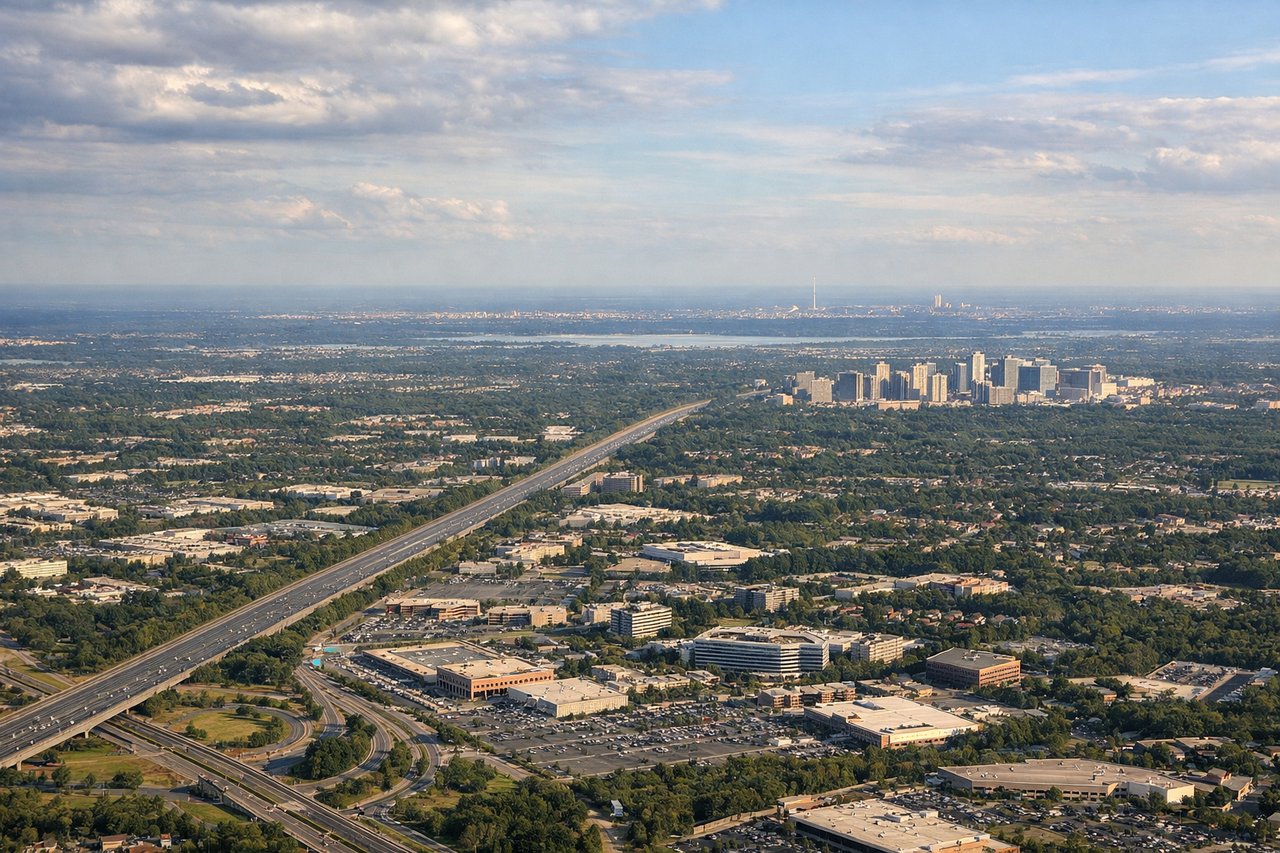
Landing at IAD
RIGHTRight side offers superior approach scenery into IAD. The descent path typically brings aircraft over the Piedmont region and Potomac River valley, with views of the Shenandoah Valley foothills to the west and the Potomac River itself as a defining geographic feature during final approach. Left side shows the flat Coastal Plain and Chesapeake Bay region—less dramatic terrain.
Will your flight be in sunlight?
Pick a date and time in the Sun Map to watch the sun move across your whole flight.
About This Route
Which side of the plane should I sit on flying from Rocky Mountain Metropolitan Airport (BJC) to Washington Dulles International (IAD)?
Sit on the Left side of the plane for the best views on flights from Denver to Washington. Left side scores higher due to the exceptional scenic value of the Rocky Mountain Front during departure—a dramatic, recognizable, and visually striking feature that dominates the early flight phase. While the landing approach favors the right side with Potomac River views, the takeoff experience from BJC is more memorable and geographically distinctive. The cruise phase over the Great Plains and Appalachian foothills is relatively similar on both sides, but the departure advantage tips the overall score leftward.
What can I see during takeoff from Rocky Mountain Metropolitan Airport in Denver?
During takeoff from Rocky Mountain Metropolitan Airport (BJC), sit on the Left side for the best views. Left side captures the dramatic Rocky Mountain Front during climb-out from BJC. The Front Range rises immediately west and northwest of the airport, creating a striking vertical relief that dominates the early departure phase. Right side shows the Denver metro sprawl and flat plains extending eastward—visually monotonous. Notable sights include: Front Range peaks (Mount Evans, Mount Bierstadt visible on clear days), South Platte River valley, Denver downtown skyline to the southeast.
What can I see when landing at Washington Dulles International in Washington?
When landing at Washington Dulles International (IAD), sit on the Right side for the best views. Right side offers superior approach scenery into IAD. The descent path typically brings aircraft over the Piedmont region and Potomac River valley, with views of the Shenandoah Valley foothills to the west and the Potomac River itself as a defining geographic feature during final approach. Left side shows the flat Coastal Plain and Chesapeake Bay region—less dramatic terrain. Notable sights include: Potomac River (clearly visible during descent and approach), Blue Ridge Mountains on the distant western horizon, Shenandoah Valley foothills, IAD airport complex and surrounding Loudoun County landscape.
How long is the flight from Denver to Washington?
The flight from Rocky Mountain Metropolitan Airport (BJC) to Washington Dulles International (IAD) takes about 3 hours 15 minutes. The shortest flight path between them is 1,472 miles (2,369 km); winds and air traffic control usually add a few percent.
What does the Denver to Washington flight path pass over?
Great Plains extending from Colorado into Kansas and Missouri (relatively flat, sparse landmarks); Mississippi River valley near St. Louis area; Ozark Plateau in southern Missouri and northern Arkansas (low, forested hills); Appalachian foothills in eastern Tennessee and western Virginia (increasing elevation and ridge-and-valley topography); Shenandoah Valley in Virginia (north-south trending valley visible during descent phase)