The left side wins on both ends of the flight — Mount Kinabalu and Sabah's coastline at departure, and Singapore's skyline and busy strait at arrival — while the right side is dominated by featureless open ocean for nearly the entire route.
Flown BKI to SIN? Did we get it right?
Flight Path
Kota Kinabalu to Singapore is 889 miles (1,431 km), a flight of about 2 hours 15 minutes.
Mid-flight the route crosses open South China Sea with no landmarks visible; the Sarawak/Brunei coastline fades behind on the left shortly after departure, and Singapore's Johor Strait approach comes into view only near descent.
Great circle distance and headings ›Phase by phase
Takeoff from BKI
LEFTClimbing out of Kota Kinabalu, the left side offers views back toward Mount Kinabalu's granite massif rising over the Crocker Range, plus the winding river deltas and mangrove coastline of Sabah as the aircraft turns southwest. The right side only shows the open, featureless South China Sea.
Landing at SIN
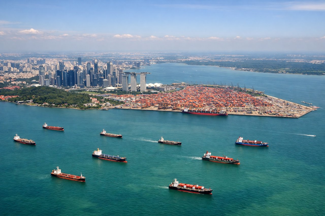
LEFTOn approach into Changi, the left side gives passengers a sweeping view of Singapore's skyline, Marina Bay, and the container ships lined up in the Singapore Strait, while the right side mostly faces the flatter Johor coastline with less visual interest.
Will your flight be in sunlight?
Pick a date and time in the Sun Map to watch the sun move across your whole flight.
About This Route
Which side of the plane should I sit on flying from Kota Kinabalu International (BKI) to Singapore Changi (SIN)?
Sit on the Left side of the plane for the best views on flights from Kota Kinabalu to Singapore. The left side wins on both ends of the flight — Mount Kinabalu and Sabah's coastline at departure, and Singapore's skyline and busy strait at arrival — while the right side is dominated by featureless open ocean for nearly the entire route.
What can I see during takeoff from Kota Kinabalu International in Kota Kinabalu?
During takeoff from Kota Kinabalu International (BKI), sit on the Left side for the best views. Climbing out of Kota Kinabalu, the left side offers views back toward Mount Kinabalu's granite massif rising over the Crocker Range, plus the winding river deltas and mangrove coastline of Sabah as the aircraft turns southwest. The right side only shows the open, featureless South China Sea. Notable sights include: Mount Kinabalu, Crocker Range, Sabah river deltas, Brunei Bay coastline.
What can I see when landing at Singapore Changi in Singapore?
When landing at Singapore Changi (SIN), sit on the Left side for the best views. On approach into Changi, the left side gives passengers a sweeping view of Singapore's skyline, Marina Bay, and the container ships lined up in the Singapore Strait, while the right side mostly faces the flatter Johor coastline with less visual interest. Notable sights include: Marina Bay skyline, Singapore Strait shipping lanes, Sentosa Island, Johor Strait.
How long is the flight from Kota Kinabalu to Singapore?
The flight from Kota Kinabalu International (BKI) to Singapore Changi (SIN) takes about 2 hours 15 minutes. The shortest flight path between them is 889 miles (1,431 km); winds and air traffic control usually add a few percent.
What does the Kota Kinabalu to Singapore flight path pass over?
Mid-flight the route crosses open South China Sea with no landmarks visible; the Sarawak/Brunei coastline fades behind on the left shortly after departure, and Singapore's Johor Strait approach comes into view only near descent.