While most of the flight crosses open South China Sea with little to see on either side, the right side provides both a glimpse of Singapore's coastline at departure and, more importantly, a clear view of Mount Kinabalu during arrival, making it the more scenic choice overall.
Flown SIN to BKI? Did we get it right?
Flight Path
Singapore to Kota Kinabalu is 889 miles (1,431 km), a flight of about 2 hours 15 minutes.
Open South China Sea with no significant landmarks; occasional distant cargo ship traffic near shipping lanes north of Borneo.
Great circle distance and headings ›

Phase by phase
Takeoff from SIN
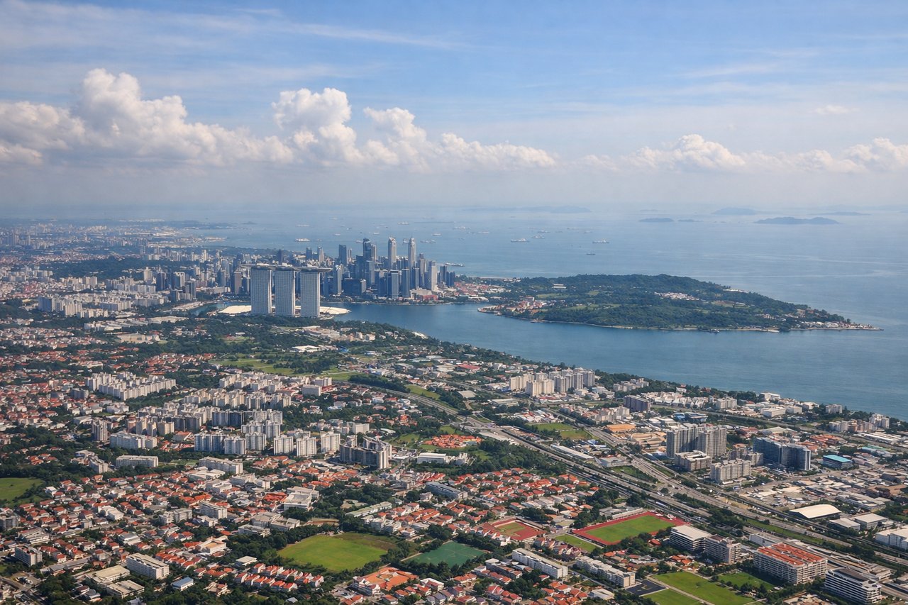
RIGHTDeparting Changi toward the northeast, the right side offers a brief view of Singapore's eastern coastline, the Changi port area, and the Strait's shipping lanes before the aircraft turns out over open water. The left side mostly shows Singapore's interior and quickly fades into featureless ocean.
Landing at BKI
RIGHTOn the final approach into Kota Kinabalu, the right side typically faces inland toward Mount Kinabalu's granite massif rising above the coastal plain, a dramatic contrast to the flat South China Sea view on the left. This is the single standout landmark of the entire route.
Will your flight be in sunlight?
Pick a date and time in the Sun Map to watch the sun move across your whole flight.
About This Route
Which side of the plane should I sit on flying from Singapore Changi (SIN) to Kota Kinabalu International (BKI)?
Sit on the Right side of the plane for the best views on flights from Singapore to Kota Kinabalu. While most of the flight crosses open South China Sea with little to see on either side, the right side provides both a glimpse of Singapore's coastline at departure and, more importantly, a clear view of Mount Kinabalu during arrival, making it the more scenic choice overall.
What can I see during takeoff from Singapore Changi in Singapore?
During takeoff from Singapore Changi (SIN), sit on the Right side for the best views. Departing Changi toward the northeast, the right side offers a brief view of Singapore's eastern coastline, the Changi port area, and the Strait's shipping lanes before the aircraft turns out over open water. The left side mostly shows Singapore's interior and quickly fades into featureless ocean. Notable sights include: Changi Airport coastline, Singapore Strait shipping lanes, Pulau Ubin island silhouette.
What can I see when landing at Kota Kinabalu International in Kota Kinabalu?
When landing at Kota Kinabalu International (BKI), sit on the Right side for the best views. On the final approach into Kota Kinabalu, the right side typically faces inland toward Mount Kinabalu's granite massif rising above the coastal plain, a dramatic contrast to the flat South China Sea view on the left. This is the single standout landmark of the entire route. Notable sights include: Mount Kinabalu massif, Crocker Range foothills, Kota Kinabalu coastal city, Likas Bay.
How long is the flight from Singapore to Kota Kinabalu?
The flight from Singapore Changi (SIN) to Kota Kinabalu International (BKI) takes about 2 hours 15 minutes. The shortest flight path between them is 889 miles (1,431 km); winds and air traffic control usually add a few percent.
What does the Singapore to Kota Kinabalu flight path pass over?
Open South China Sea with no significant landmarks; occasional distant cargo ship traffic near shipping lanes north of Borneo.