Bangkok to Islamabad is 2,225 miles (3,580 km), a flight of about 4 hours 30 minutes.
For most of the cruise across Myanmar and northern India, the right side faces the Himalayan chain, offering distant but genuine views of snow-capped peaks along the horizon, culminating in the dramatic Margalla Hills approach into Islamabad.
Flight Path
Myanmar's Shan Hills, the Bay of Bengal coastline near Chittagong, the Gangetic plain of northern India, and the distant Himalayan foothills visible to the north as the route crosses into Pakistan
Great circle distance and headings ›.jpg?width=600)

.jpg?width=600)
Phase by phase
Takeoff from BKK
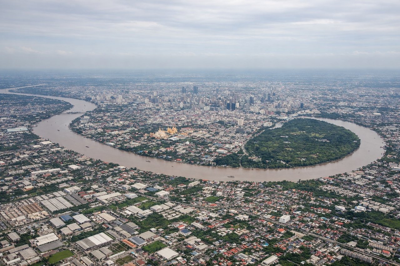
LEFTSuvarnabhumi's runways run north-south, and the initial turn toward the northwest gives passengers on the left a brief look back at Bangkok's skyline and the Chao Phraya River delta before the aircraft settles onto its cruise heading.
Landing at ISB
RIGHTApproaching Islamabad from the east on a westerly approach, the Margalla Hills and the first Himalayan foothills rise dramatically to the north, filling the right-side view just before touchdown.
Landmarks on this routeAll landmarks →
Will your flight be in sunlight?
Pick a date and time in the Sun Map to watch the sun move across your whole flight.
About This Route
Which side of the plane should I sit on flying from Suvarnabhumi Airport (BKK) to Islamabad International Airport (ISB)?
Sit on the Right side of the plane for the best views on flights from Bangkok to Islamabad. For most of the cruise across Myanmar and northern India, the right side faces the Himalayan chain, offering distant but genuine views of snow-capped peaks along the horizon, culminating in the dramatic Margalla Hills approach into Islamabad.
What can I see during takeoff from Suvarnabhumi Airport in Bangkok?
During takeoff from Suvarnabhumi Airport (BKK), sit on the Left side for the best views. Suvarnabhumi's runways run north-south, and the initial turn toward the northwest gives passengers on the left a brief look back at Bangkok's skyline and the Chao Phraya River delta before the aircraft settles onto its cruise heading. Notable sights include: Bangkok skyline, Chao Phraya River, Gulf of Thailand coastline.
What can I see when landing at Islamabad International Airport in Islamabad?
When landing at Islamabad International Airport (ISB), sit on the Right side for the best views. Approaching Islamabad from the east on a westerly approach, the Margalla Hills and the first Himalayan foothills rise dramatically to the north, filling the right-side view just before touchdown. Notable sights include: Margalla Hills, Himalayan foothills, Rawalpindi urban sprawl, Islamabad's grid layout.
How long is the flight from Bangkok to Islamabad?
The flight from Suvarnabhumi Airport (BKK) to Islamabad International Airport (ISB) takes about 4 hours 30 minutes. The shortest flight path between them is 2,225 miles (3,580 km); winds and air traffic control usually add a few percent.
What does the Bangkok to Islamabad flight path pass over?
Myanmar's Shan Hills, the Bay of Bengal coastline near Chittagong, the Gangetic plain of northern India, and the distant Himalayan foothills visible to the north as the route crosses into Pakistan